
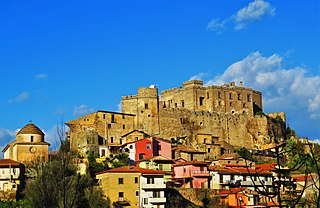
Greci is an Arbëreshë town and comune in the province of Avellino, Campania, Italy, located about 100 km northeast of Naples and about 50 km southwest of Foggia. It is a mountain agricultural village lying astride the Apennines and represents the only existing linguistic minority in Campania; Arbereshe people have settled in Greci since the 15th century.
Airola is a comune (municipality) in the Province of Benevento in the Italian region Campania, located about 35 km northeast of Naples and about 20 km southwest of Benevento in the Valle Caudina, facing the Monte Taburno. Nearby is the confluence of the Tesa and Faenza streams into the Isclero River. Airola's territory is also crossed by the Acquedotto Carolino, carrying waters to the Caserta Palace.

Apollosa is a comune (municipality) in the Province of Benevento in the Italian region Campania, located about 50 km northeast of Naples and about 8 km southwest of Benevento.

Bucciano is a comune (municipality) in the Province of Benevento in the Italian region of Campania, located about 40 km northeast of Naples and about 20 km southwest of Benevento on the southern slopes of the Monte Taburno.

Campoli del Monte Taburno is a comune (municipality) in the Province of Benevento in the Italian region Campania, located about 45 km northeast of Naples and about 11 km west of Benevento.
Casalduni is a comune (municipality) in the Province of Benevento in the Italian region Campania, located about 60 km northeast of Naples and about 15 km northwest of Benevento, on the slopes of Monte Cicco on the right of the Tammaro river.

Castelpoto is a comune (municipality) in the Province of Benevento in the Italian region Campania, located about 50 km northeast of Naples and about 7 km west of Benevento.
Cautano is a comune (municipality) constituted from two countries, Cautano and Cacciano, in the Province of Benevento( until 1861 Province of Avellino) in the Italian region Campania, located about 75 km northeast of Naples and about 13 km west of Benevento and about 13 km north of Montesarchio..

Cerreto Sannita is a comune (municipality) in the Province of Benevento in the Italian region Campania, located about 60 km northeast of Naples and about 25 km northwest of Benevento.

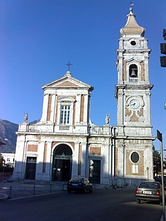
Foglianise is a comune (municipality) in the Province of Benevento in the Italian region Campania, located about 50 kilometres (31 mi) northeast of Naples and about 10 kilometres (6.2 mi) northwest of Benevento. Foglianise borders the following municipalities: Benevento, Castelpoto, Cautano, Torrecuso, and Vitulano.
Frasso Telesino is a comune (municipality) in the Province of Benevento in the Italian region Campania, located about 40 km northeast of Naples and about 20 km west of Benevento.
Limatola is a comune (municipality) in the Province of Benevento in the Italian region Campania, located about 35 km northeast of Naples and about 30 km west of Benevento.

Moiano is a comune (municipality) in the Province of Benevento in the Italian region Campania, located about 40 kilometres (25 mi) northeast of Naples and about 20 kilometres (12 mi) southwest of Benevento on the western slope of the Monte Taburno, on the river Isclero.
Paupisi is a comune (municipality) in the Province of Benevento in the Italian region Campania, located about 50 kilometres (31 mi) northeast of Naples and about 12 kilometres (7.5 mi) northwest of Benevento. As of 31 December 2004, it had a population of 1,500 and an area of 9.0 square kilometres (3.5 sq mi).
San Nicola Manfredi is a comune (municipality) in the Province of Benevento in the Italian region Campania, located about 50 km northeast of Naples and about 8 km southeast of Benevento.

Sant'Agata de' Goti is a comune (municipality) and former Catholic bishopric in the Province of Benevento in the Italian region Campania, located about 35 km northeast of Naples and about 25 km west of Benevento near the Monte Taburno.

Torrecuso is a comune (municipality) in the Province of Benevento in the Italian region Campania, located about 50 km northeast of Naples and about 10 km northwest of Benevento.
Sant'Arcangelo Trimonte is a comune (municipality) in the Province of Benevento in the Italian region Campania, located about 70 km northeast of Naples and about 13 km east of Benevento.

Taburno Camposauro is a massif located in the Apennines, to the west of Benevento, in the Campania region of Southern Italy. Its highest peak is the Taburno, at 1,393 m. It is composed of two groups of calcareous mountains separated by a plain. The fauna is affected by human activities, but the birdlife is very diverse. Several historical structures, mainly religious, are located on the massif. A DOC wine is produced in the area.

Santa Maria in Gruptis is a former abbey located in the comune of Vitulano, in the Campania region of Southern Italy. Founded in the 10th century and used by several monastic orders, it was deconsecrated in 1705, and is currently in ruins.


