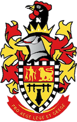
Emalahleni, previously named Witbank, is a city situated on the Highveld of Mpumalanga, South Africa, within the Emalahleni Local Municipality. The name Witbank is Afrikaans for "white ridge", and is named after a white sandstone outcrop where wagon transport drivers rested. The city is known for its coal-mining in the surrounding region.

Matatiele is a town located in the northern part of the Eastern Cape Province of South Africa. According to the South African National Census of 2011, its 12,466 residents and 4,107 households make Matatiele the largest populated town in the Matatiele Local Municipality.

Witzenberg Municipality is a local municipality located within the Cape Winelands District Municipality, in the Western Cape province of South Africa. As of 2011 it had a population of 115,946.

Matzikama Local Municipality is a local municipality which governs the northernmost part of the Western Cape province of South Africa, including the towns of Vredendal, Vanrhynsdorp, Klawer and Lutzville, and the surrounding villages and rural areas. As of 2011 it had a population of 67,147. It forms part of the West Coast District Municipality, and has municipality code WC011.

Riverbend is a suburb of Johannesburg, South Africa. It is located in Region B of the City of Johannesburg Metropolitan Municipality.

Mayfair is a suburb of Johannesburg, South Africa. The suburb is west of the Johannesburg CBD and is adjacent to Fordsburg. It is located in Region F of the City of Johannesburg Metropolitan Municipality.

Mier was a local municipality within the ZF Mgcawu District Municipality in the Northern Cape province of South Africa. Its area includes the South African portion of one of the world's largest conservation areas, the Kgalagadi Transfrontier Park. The main settlement in the municipality is the town of Rietfontein.

Matatiele Local Municipality is a Category B municipality located in the Alfred Nzo District of Eastern Cape in South Africa. It adjoins Lesotho to the north, Elundini to the south-west, and Greater Kokstad to the east and its 4,352 km² makes the Matatiele Local Municipality largest of four municipalities in the district at almost half of its geographical area. [1]

Greater Kokstad Local Municipality is an administrative area in the Harry Gwala District of KwaZulu-Natal in South Africa. Kokstad is derived from Dutch, and it means "town of Kok". It was named after Adam Kok III.

Ntabankulu Local Municipality is a local municipality in Alfred Nzo District Municipality in the Wild Coast Region of the Eastern Cape Province in South Africa.

Zwelisha is a rural settlement in Mbombela Local Municipality in Ehlanzeni District of the Mpumalanga province, South Africa. How populated it is and racial it is
Islington is a settlement in the Ehlanzeni District Municipality in the Mpumalanga Province of South Africa. It is located east of Acornhoek.
Coronation is a populated place in the Emalahleni Local Municipality, Nkangala District Municipality in the Mpumalanga Province of South Africa.
Ikageng is a populated place in the Emalahleni Local Municipality of the Nkangala District Municipality in the Mpumalanga Province of South Africa.
Landau Colliery is a populated place in the Emalahleni Local Municipality of the Nkangala District Municipality in the Mpumalanga Province of South Africa.
Rethabile is a populated place in the Emalahleni Local Municipality of the Nkangala District Municipality in the Mpumalanga Province of South Africa.
Phola is a populated place in the Emalahleni Local Municipality, Nkangala District Municipality in the Mpumalanga Province of South Africa.
Wolwekrans is a populated place in the Emalahleni Local Municipality of the Nkangala District Municipality in the Mpumalanga Province of South Africa.
Springbok is a populated place in the Emalahleni Local Municipality of the Nkangala District Municipality in the Mpumalanga Province of South Africa.
Reedstream Park is a populated place in the Emalahleni Local Municipality, Nkangala District Municipality in the Mpumalanga Province of South Africa.


