North Brabant, also unofficially called Brabant, is a province in the south of the Netherlands. It borders the provinces of South Holland and Gelderland to the north, Limburg to the east, Zeeland to the west, and the Flemish provinces of Antwerp and Limburg to the south. The northern border follows the Meuse westward to its mouth in the Hollands Diep strait, part of the Rhine–Meuse–Scheldt delta. North Brabant had a population of about 2,626,000 as of January 2023. Major cities in North Brabant are Eindhoven, Tilburg, Breda, its provincial capital 's-Hertogenbosch, and Helmond

The Meierij van 's-Hertogenbosch was one of the four parts of the Duchy of Brabant, the others being the Margraviate of Antwerp, the County of Brussels and the County of Leuven/Louvain. Located in the current-day Netherlands, it acquired its name from the bailiff of 's-Hertogenbosch, who administered the area in the name of the Dukes of Brabant. The Meierij roughly corresponds to the larger province of North Brabant.

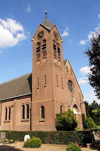
Sint-Oedenrode is a town in the Dutch province of North Brabant.

The peat therapy resortMoorbad Gmös in the vicinity of the town of Laakirchen is one of the few bogs in the Alpine foothills of Upper Austria. The bog dates back to the Mindel glaciation and was created by a "dead-ice hole". In 1987 the local authorities of Upper Austria declared the area of 3.4 ha of the Gmöser Moor a natural preserve. A path around the area has since then given the visitor the opportunity of observing rare flora and fauna. In 2002 the spa was chosen as background scenery for the TV-production Schlosshotel Orth.

The fauna of Europe is all the animals living in Europe and its surrounding seas and islands. Europe is the western part of the Palearctic realm. Lying within the temperate region, the wildlife is not as rich as in the hottest regions, but is nevertheless diverse due to the variety of habitats and the faunal richness of Eurasia as a whole.
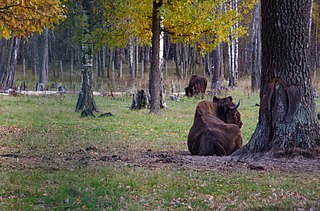
Prioksko-Terrasny Nature Biosphere Reserve is one of Russia's smallest zapovedniks, sprawling over an area of 5,000 hectares along the left bank of the Oka River in the Serpukhov District of Moskva Oblast. It was established in 1945 as part of the Moscow Nature Reserve and is home to 900 plant species, 130 bird species, and 54 mammal species. A wisent nursery was established in 1948 to populate the region with European bison from the Belovezhskaya Pushcha and Western Caucasus. There is also a small herd of American bison.
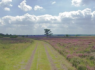
The Strabrechtse Heide is a natural heathland area about 1500 ha in size, located in the municipalities of Heeze-Leende, Someren and Geldrop-Mierlo, in North Brabant, the Netherlands. It is largely under the care of Staatsbosbeheer. In July 2010, around 200 hectares of the area were damaged or destroyed in a wildfire that took over a week to put out.

De Maasduinen National Park(duinen = dunes) is a national park in the Dutch province of Limburg, founded in 1996 and covering approximately 4500 ha. The landscape consists of forests and heathlands on a sandy plateau along the river Meuse close to the German border. The estate 'de Hamert' is the heart of the park. Until 1998 the national park was called 'De Hamert' after this estate. The present name is derived from the parabolic dunes which date from the last glaciation.

Utrechtse Heuvelrug National Park is a national park in the Dutch province of Utrecht. It covers the southern part of the Utrecht Hill Ridge. When it was founded in 2003 the park covered 6,000 ha of heathlands, shifting sands, forests, grass lands and floodplains. In 2013 the park was extended to 10,000 ha, adding the area north of highway A12 when the ecoduct Mollebos was realized. The most striking landscape feature is the glacial ridge after which the park is named.

The Natural Regional Park of Serre is a protected natural area of Calabria, Italy created in 2004.
Nijnsel is a village in the province of North Brabant, located in the Meierij of 's-Hertogenbosch. Nijnsel is a parish of the municipality of Meierijstad.

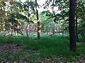
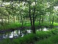
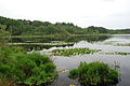
The Moerkuilen are, along with the Dommelbeemden a forestry area in a bend of the Dommel river north east of Nijnsel in Meierijstad. It is located at the Lieshoutse Dijk, not far from the A50 motorway. The protected area measures over 100 acres and connects with the Vresselse Bossen in the south. The Moerkuilen are part of the larger area Het Groene Woud.
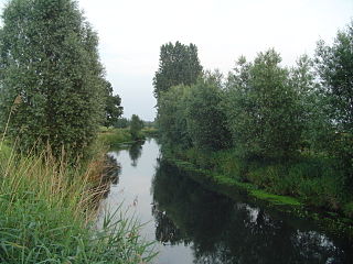
The Dommelbeemden are, along with the Moerkuilen a forestry area in a bend of the Dommel river northeast of Nijnsel in Meierijstad. It is located at the Lieshoutse Dijk, not far from the A50 motorway. The protected area measures over 100 acres. The Dommelbeemden are part of the larger area Het Groene Woud.
The forest and nature area the Geelders is located at the western side of the village of Olland in Meierijstad, North Brabant and covers almost 300 hectares. The Geelders are part of the larger area Het Groene Woud.

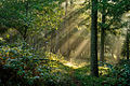
Het Groene Woud is a special area of the Netherlands which is located in North Brabant between the cities of Tilburg, Eindhoven and 's-Hertogenbosch. It includes nature reserves such as the Kampina, the Oisterwijk forests and fens, Velderbos and the Dommel.

Sint-Oedenrode is a moderately urbanized city and capital of the former municipality of the same name in the province of North Brabant. The city is located in the Meierij of 's-Hertogenbosch. Sint-Oedenrode counts 17,928 inhabitants and has an area of 64.25 km². The municipality has traditionally city rights since 1232, and was known as a "Vlek" in the past. Today it is still a large town. From southeast to northwest, the city is split by the river the Dommel.

The Dolomiti Bellunesi National Park is a national park in the province of Belluno, Veneto, in the northern Italy.

Lavells Lake is a 12.5-hectare (31-acre) Local Nature Reserve on the outskirts of Woodley, a suburb of Reading in Berkshire. It is owned by Wokingham District Council and managed by the council and The Friends of Lavell's Lake. The nature reserve is part of Dinton Pastures Country Park.

The Atlantic mixed forests is a terrestrial ecoregion in western Europe. It extends along the western edge of continental Europe, from southwestern France through northern France, Belgium, the Netherlands, northwestern Germany, and western Denmark. Most of the region's forests and dunes have been converted to fields, pastures, and forest plantations, and its once-extensive wetlands have mostly been drained and filled.