Eindhoven is the fifth-largest city and a municipality of the Netherlands, located in the south of the country. It had a population of 235,923 in 2021, making it the largest city in the province of North Brabant. Eindhoven was originally located at the confluence of the Dommel and Gender.

North Brabant, also unofficially called Brabant, is a province in the south of the Netherlands. It borders the provinces of South Holland and Gelderland to the north, Limburg to the east, Zeeland to the west, and the Flemish provinces of Antwerp and Limburg to the south. The northern border follows the Meuse westward to its mouth in the Hollands Diep strait, part of the Rhine–Meuse–Scheldt delta. North Brabant has a population of 2,562,566 as of November 2019. Major cities in North Brabant are Eindhoven, Tilburg, Breda and its provincial capital 's-Hertogenbosch.

The Meierij van 's-Hertogenbosch was one of the four parts of the duchy of Brabant, the others being the margraviate of Antwerp, the county of Brussels, and the county of Leuven/Louvain. It got its name from the Bailiff of 's-Hertogenbosch, which administered the area in the name of the Dukes of Brabant. The Meierij roughly corresponds to the somewhat larger Dutch province of North Brabant.
Deurne is a rural municipality and eponymous village in the province of North Brabant in the Netherlands. Including the villages of Liessel, Vlierden, Neerkant, and Helenaveen, Deurne had a population of 32,362 in 2019 and covers an area of 118.36 km2 (45.70 sq mi).

Mierlo is a town in the southern Netherlands, in the municipality of Geldrop-Mierlo, North Brabant. Until 2004, it was a separate municipality with an area of 18.09 km2 (7 sq mi).

Sint-Michielsgestel is a municipality in the southern part of the Netherlands. It is named for the village of Sint-Michielsgestel located within its boundaries.

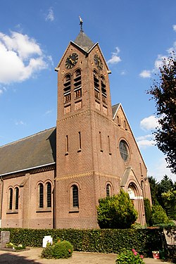
Sint-Oedenrode is a town in the province of North Brabant.

Son en Breugel is a municipality in the southern Netherlands just outside Eindhoven. The municipality covers an area of 26.51 km2 (10.24 sq mi) of which 0.56 km2 (0.22 sq mi) is water. It had a population of 16,904 in 2019. Son en Breugel used to be two different villages: 'Son' and 'Breugel', with the stream the Dommel separating the two villages. Son en Breugel also borders the following larger municipalities: Eindhoven, Meierijstad, Nuenen, Gerwen en Nederwetten, and Best. The spoken language is North Meierijs.

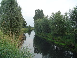
The Dommel is a small river in Belgium and the Netherlands, left tributary of the Dieze. It is 120 km long, of which 85 km in the Netherlands. The Dommel takes in water from the Keersop, Tongelreep, Run, Gender and Kleine Dommel streams and merges at 's-Hertogenbosch with the Aa stream to form the river Dieze, which subsequently flows towards the Meuse. The main cities and towns along the Dommel's course are Peer, Neerpelt, Valkenswaard, Dommelen, Eindhoven, Son en Breugel, Sint-Oedenrode, Boxtel, Sint-Michielsgestel and 's-Hertogenbosch.

Beek en Donk is a town in the province North Brabant, Netherlands. There are 10,028 inhabitants. The spoken language is Peellands.

The Tongelreep is a small tributary of the Dommel that flows through Belgium and the Netherlands. It begins in Belgium near Neerpelt and runs into the Dommel in Eindhoven by way of Valkenswaard and Aalst. The stream runs near the Achel Abbey, the Leenderbos, the Valkenhorst estates and the Genneper Parken park area.

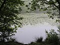
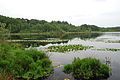
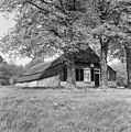
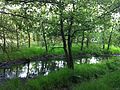
The Moerkuilen are, along with the Dommelbeemden a forestry area in a bend of the Dommel river north east of Nijnsel in Meierijstad. It is located at the Lieshoutse Dijk, not far from the A50 motorway. The protected area measures over 100 acres and connects with the Vresselse Bossen in the south. The Moerkuilen are part of the larger area Het Groene Woud.
The Dommelbeemden are, along with the Moerkuilen a forestry area in a bend of the Dommel river northeast of Nijnsel in Meierijstad. It is located at the Lieshoutse Dijk, not far from the A50 motorway. The protected area measures over 100 acres. The Dommelbeemden are part of the larger area Het Groene Woud.
East of the village of Nijnsel and the hamlet of Vressel, both in Meierijstad, North Brabant, Netherlands, is the location of the Vresselse bossen or Vresselsche Bosch . The Vresselse Bossen is a forest area of 241 ha. It is owned and managed by the National Forest Service (Staatsbosbeheer). The forest is named after the nearby hamlet of Vressel.

Het Groene Woud is a special area of the Netherlands which is located in North Brabant between the cities of Tilburg, Eindhoven and 's-Hertogenbosch. It includes nature reserves such as the Kampina, the Oisterwijk forests and fens, Velderbos and the Dommel.

Sint-Oedenrode is a moderately urbanized city and capital of the former municipality of the same name in the province of North Brabant. The city is located in the Meierij of 's-Hertogenbosch. Sint-Oedenrode counts 17,928 inhabitants and has an area of 64.25 km². The municipality has traditionally city rights since 1232, and was known as a "Vlek" in the past. Today it is still a large town. From southeast to northwest, the city is split by the river the Dommel.
The forest and nature areas De Rooise Broek and De Scheeken borders on the outskirts of the village of Boskant, Meierijstad, North Brabant. Both De Rooise Broek and De Scheeken are part of the larger area Het Groene Woud.
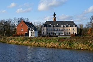
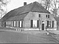
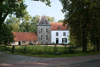
Nieuw-Herlaer Castle is a manor in Sint-Michielsgestel, the Netherlands. It contains a tower which was part of the preceding castle.

Haanwijk is an estate and nature reserve with a manor house near Sint-Michielsgestel in North-Brabant, Netherlands.

Sint-Michielsgestel is a village in the municipality of Sint-Michielsgestel, Netherlands.