Vuhokesa

Last updated
Vuhokesa
Suburb
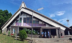
Holy Cross Cathedral, St Mary Catholic. Front view.jpg
Holy Cross Catholic Cathedral, St Mary.
1024px Honiara suburban map of Solomon Islands.png
Red pog.svg
Vuhokesa
Location in Honiara (Council boundary-red box)
Coordinates: 9°26′S159°57′E / 9.433°S 159.950°E / -9.433; 159.950
CountryFlag of the Solomon Islands.svg  Solomon Islands
Province Honiara Town
Island Guadalcanal
Elevation
29 - 100 m (−299 ft)
Time zone UTC+11 (UTC)

Vuhokesa is a suburb in Honiara located in the main center on the Tandai Highway [1] and includes the City Council roundabout. Vuhokesa is in the Honiara City Council ward of Vavaea. [2] and is East of Point Cruz and West of Lord Howe Settlement. The Vuhokesa border is the West bank of the Mataniko River which runs into Kua Bay.

Contents

Mamana Water Settlement

The Mamana Water Settlement as well as the Lord Howe Settlement are squeezed in between the main road and the shore line, a distance of 30–100 metres. The land is not suitable for agriculture except for small garden beds. However, brick-making using sand is practised at Mamana while at Lord Howe, the sand beach is used for beach soccer tournaments. [3]

In 2012 the Mamana Water Community were the first group of women to graduate from Sistas Savve and participated in a fundraiser to build a permanent leaf hut where they can organize, meet and create their products. [4] Clean-up Honiara campaigns often focus around the Mamana Water Settlement. [5]

The Mamana Water Settlement as well as the Lord Howe Settlement is often inundated with tidal surges, especially during the wet season. [6]

Settlements including Lord Howe, Mamana Water and Fishing Village (Fishery) are the most vulnerable for inundation in the city as they are situated right on the coastline. Extreme high tide coupled with storm can inundate these settlements as they are only 5 meters away from the high tide water line. [7]

Honiara Central Magistrate's Court

The Magistrate's Court has civil jurisdiction and can hear claims in contract or tort where the amount does not exceed SBC 2000 (principal Magistrate SBC 6000). The criminal jurisdiction of the magistrate's courts varies according to the class of magistrate. All classes of magistrates have jurisdiction to try criminal matters summarily while the Principal Magistrate has jurisdiction in relation to offences that carry punishment up to 14 years and may only impose a term of imprisonment of five years or a fine of $1,000 or both. [8]

Bridge over Mataniko River facing Vuhokesa.jpg
Bridge over Mataniko River facing Vuhokesa. Guadalcanal American Memorial to left. Kua Bay to right. Honiara

Honiara City Council buildings

The Honiara Town Council (HTC) was created between 1956 and 1958. The Town Council was constituted under the 1957 Town Council Ordinance by a warrant issued by the High Commissioner on 1 March 1958, although the first full elections were not held until 1969. [9]

The Honiara City Council was established under section four (4) of the Honiara City Act 1999 to make provision for the establishment of a City Council for the Honiara City; to prescribe its functions and powers and for matters connected therewith. [10] The council services include Health, City Growth, Education and Recreation Services and the Environment [11] and the nine divisions of the council include, Finance, Law Enforcement, Physical Planning, Administration, Works, Market, Education, Youth, Sports & Women's Affairs and Health and Medical Services. [12]

Library

The Solomon Islands Public Library, situated near the Mataniko River just outside Chinatown in Honiara, was opened by Rev. Charles Fox (q.v.) in August 1968. [13] The National Library of Solomon Islands was then established in 1974 with the aim of reorganising existing library services and extending reading services to the entire nation. [13]

In 2003 during the civil war, the library was mostly destroyed and in 2005 the Australian Capital Territory (ACT) government donated a large quantity of books to the library. [14]

Ita Hardware

The Dettke family of German origin was said to own the ITA hardware, a very large building in Vuhokesa. [15] Bodo Dettke was a prominent politician in Solomon Islands. [16] [17]

Hyundai Mall building

The Hyundai mall building is Honiara's newest shopping center and houses several medical facilities, embassies and commercial businesses and banking facilities. The developer, Korean Enterprises Ltd., at the time of planning, promised "the largest retail and commercial building in Solomon Islands". Designed by Pacific Architect Limited, the three-storey building covers 10,000 square meters. [18]

Alvaro building

A professional services building located in Mendana Ave. Possibly named after Alvaro Mendana.

Central Market

The Honiara Central Market is managed by the Honiara Central Market Vendor's Association [19] [20] [21] whose aim is to ensure Honiara Central Market is safe, healthy and economically conducive workplace for all by strengthening communication with Market Management, representing market vendors' needs and interests and identifying opportunities for market vendors to learn and develop new skills. [22] The association was formed in 2014 to promote the rights and interests of stallholders and to help improve conditions at the Solomon Islands biggest market. [23]

The market is regulated by the Honiara City Council, and specific items are permitted to be sold providing the stallholder pay the appropriate fees. [24]

In 1976, the Chief Minister,(later Prime Minister), Solomon Mamaloni addressed strikers at the Central Market who were protesting about the introduction of self-government. Protesters were later dispersed with tear gas. [25]

In 1989, riots broke out in Honiara over a sign displayed at the Central Market purportedly by the Bellonese that was designed to insult the majority Malaitan population. The Prime Minister, Solomon Mamaloni, warned that the troubles had the potential to develop into a lethal cancer. [26] Several years later, ethnic violence increased and resulted in civil war.

Tourism

Churches

South Seas Evangelical Church

United Church

Holy Cross Cathedral St Marys

Laracy (1976, 11) [27] [28] states that the Spanish expeditions to the Solomons in 1568, 1595 and 1605 were for exploration, colonisation and spreading the gospel. The French Marists first reached the Solomon Islands on 2 December 1845, led by Bishop Epalle and later formed the Melanesia and Micronesia district of Marists under Bishop Epalle with headquarters at Makira until the death of Bishop Epalle where attempts were abandoned. Catholic missionaries returned to the Solomons in 1898 when Bishop Julian Vidal landed at Tulagi settling on small Rua Sura Island off Aola Bay, Guadalcanal. Land was purchased at Tangarare in South Guadalcanal in May 1898 and two priests were installed in June 1900.

The Visale (NW Guadalcanal) Cathedral was destroyed in a severe earthquake on 25 January 1925 and later rebuilt in 1930. By 1918 there were 3000 Catholic conversions on Guadalcanal. As a result of World War 2 the missions from Visale moved back to Tangarare due to safety reasons and then were evacuated by the Americans to Caledonia as the Japanese believed Marists were collaborating with the Allies. After World War 2 Bishop Epalle relocated to Kakabona using a small leaf chapel and later a Quonset hut and the Tanagai Mission Station was established. The remains of the Visale printing press were brought to Kakabona, where the Bishop made his headquarters at Tanagai. In 1946 twenty Marist students were sent to Fiji to study to become Marist brothers. [27] [28]

Bishop Aubin (1934–1949) at Tanagai Mission Station purchased the hill of Vatuliva from the Town Council in 1947. The hill located in Vuhokesa is the site of the Holy Cross Cathedral St Marys. It was written that Mendana erected a cross and a chapel on the hill. [29]

In December 1966, Pope Paul VI established a new ecclesiastical hierarchy for Papua New Guinea and the Solomon Islands. The Vicar Apostolic of the South Solomons, Daniel W. Stuyvenberg (q.v.), was styled Bishop of Honiara, and Gizo Diocese was under Irishman Bishop Eusebius Crawford. Both were to be suffragans of the Metropolitan See of Rabaul. Dominicans ran the Gizo-based diocese, and Marists the Honiara-based diocese. In recognition that the Marists lacked the capacity to serve all of the Solomons, but the war halted progress and it was not until January 1956 that Dominican priests, friars and sisters set out from Australia to Gizo. They purchased Loga, an old Lever Brothers plantation a short canoe trip from Gizo, and set to work. They also purchased a Mission ship, the Salve Regina. In 1959, the Western District became an apostolic vicariate in its own right under Bishop Crawford. (O'Brien 1995, 157–170) [30]

Solomon Islands Water Authority

The head office for SIWA is located in Vuhokesa on the highway near the Mataniko River [31]

The Solomon Islands Water Authority is a state-owned enterprise wholly owned by the Government of Solomon Islands. It is mandated to operate as the provider of municipal water and wastewater services in Solomon Islands by the SIWA Act of 1992. As a state-owned enterprise it is also subject to the State-Owned Enterprise Act of 2007 modified in 2010. The Authority is governed by an independent Board of Directors, appointed by the responsible Ministers in accordance with the State Owned Enterprises Act, 2007. The Board is responsible for the prudent and transparent governance of the organisation. It reports to Minister of Mines, Energy and Rural Electrification and to the Minister of Finance. [32]

Related Research Articles

<span class="mw-page-title-main">History of Solomon Islands</span>

Solomon Islands is a sovereign state in the Melanesia subregion of Oceania in the western Pacific Ocean. This page is about the history of the nation state rather than the broader geographical area of the Solomon Islands archipelago, which covers both Solomon Islands and Bougainville Island, a province of Papua New Guinea. For the history of the archipelago not covered here refer to the former administration of the British Solomon Islands Protectorate, the North Solomon Islands and the History of Bougainville.

<span class="mw-page-title-main">Guadalcanal</span> Principal island of Solomon Islands

Guadalcanal is the principal island in Guadalcanal Province of Solomon Islands, located in the southwestern Pacific Ocean, northeast of Australia. It is the largest island in the Solomons by area and the second-largest by population. The island is mainly covered in dense tropical rainforest and has a mountainous hinterland.

<span class="mw-page-title-main">Solomon Islands</span> Country in the southwestern Pacific

Solomon Islands, also known simply as the Solomons, is a country consisting of 21 major islands Guadalcanal, Malaita, Makira, Santa Isabel, Choiseul, New Georgia, Kolombangara, Rennell, Vella Lavella, Vangunu, Nendo, Maramasike, Rendova, Shortland, San Jorge, Banie, Ranongga, Pavuvu, Nggela Pile and Nggela Sule, Tetepare, and over 900 smaller islands in Melanesia, part of Oceania, to the northeast of Australia. It is directly adjacent to Papua New Guinea to the west, Australia to the southwest, New Caledonia and Vanuatu to the southeast, Fiji, Wallis and Futuna, and Tuvalu to the east, and Nauru and the Federated States of Micronesia to the north. It has a total area of 28,896 square kilometres, and a population of 734,887 according to the official estimates for mid 2023. Its capital and largest city, Honiara, is located on the largest island, Guadalcanal. The country takes its name from the wider area of the Solomon Islands archipelago, which is a collection of Melanesian islands that also includes the Autonomous Region of Bougainville, but excludes the Santa Cruz Islands.
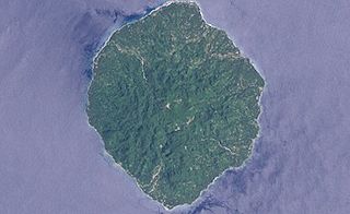
<span class="mw-page-title-main">Savo Island</span> Island in Solomon Islands

Savo Island is an island in Solomon Islands in the South Pacific ocean. Administratively, Savo Island is a part of the Central Province of Solomon Islands. It is about 35 kilometres (22 mi) from the national capital of Honiara. The principal village is Alialia, in the north of the island.

Solomon Islands is divided into nine provinces. The national capital, Honiara, on the island of Guadalcanal, is separately governed as the country's Capital Territory.

<span class="mw-page-title-main">Solomon Islands Football Federation</span>

The Solomon Islands Football Federation is a member of the Oceania Football Confederation. The Solomon Islands national football team made history when they made it to the final Oceania stages of the 2006 World Cup Qualification against Australia. Before the tournament began it was almost presumed this place would go to New Zealand.

<span class="mw-page-title-main">Catholic Church in Solomon Islands</span>

The Catholic Church in Solomon Islands is part of the worldwide Catholic Church, under the spiritual leadership of the Pope in Rome.

<span class="mw-page-title-main">Roman Catholic Archdiocese of Honiara</span> Latin Catholic jurisdiction in the Solomon Islands

The Archdiocese of Honiara is a Latin Church ecclesiastical territory or archdiocese of the Catholic Church in the Solomon Islands. It is the successor of the apostolic prefecture of the British Solomon Islands, which was erected in 1897. The ecclesiastical province of Honiara was created in 1978, the first such creation of Pope John Paul II, and contains two suffragan sees: Gizo and Auki (1982).

<span class="mw-page-title-main">White River, Honiara</span> Suburb in Guadalcanal, Honiara Town, Solomon Islands

White River is a suburb on the fringe of Honiara, Solomon Islands and is located 3 kilometres (1.9 mi) west of the main center on the Tandai Highway. White River is in the Honiara City Council ward of Nggosi. A water spring supplies water to the community.

<span class="mw-page-title-main">Honiara</span> Capital city in Honiara City, Solomon Islands

Honiara is the capital and largest city of Solomon Islands, situated on the northwestern coast of Guadalcanal. As of 2021, it had a population of 92,344 people. The city is served by Honiara International Airport and the seaport of Point Cruz, and lies along the Kukum Highway. In 1983, a Capital Territory – comprising the 22 square-kilometre metropolitan area of Honiara – was proclaimed, with a self-governing status akin to a province, although the city also retained an older role as capital of Guadalcanal Province.

<span class="mw-page-title-main">Point Cruz</span> Suburb in Guadalcanal, Honiara Town, Solomon Islands

Point Cruz is a peninsula in the center of Honiara, on Guadalcanal Island. Honiara is the capital city of the Solomon Islands. Point Cruz is located on the Tandai Highway, and is ¼ mile north of the Solomon Islands Parliament Building. Point Cruz is in the Honiara City Council ward of Cruz, and is East of Town Ground and West of Tuvaruhu.
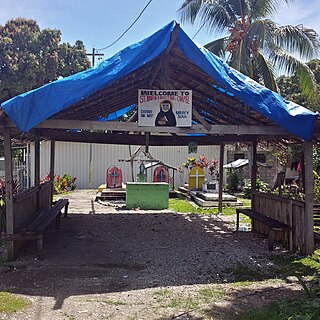
<span class="mw-page-title-main">Tandai, Honiara</span> Suburb in Guadalcanal, Honiara Town, Solomon Islands

Tandai is a suburb of Honiara, in the Solomon Islands, located 2 kilometres (1.2 mi) west of the main center on the Tandai Highway. Tandai is in the Honiara City Council ward of Nggosi.

<span class="mw-page-title-main">Rove, Honiara</span> Suburb in Guadalcanal, Honiara Town, Solomon Islands

Rove is a suburb in Honiara located 2 kilometres (1.2 mi) west of the main center on the Tandai Highway. Rove borders the Honiara City Council ward of Nggosi and Rove-Lengakiki.

Town Ground is a suburb in Honiara, Solomon Islands, located in the main center on the Tandai Highway. Town Ground is in the Honiara City Council ward of Nggosi and Rove-Lengakiki.

Kakabona (Kakambona) is a peri-urban suburb on the fringe of Honiara, Solomon Islands and is located 4 kilometres (2.5 mi) west of the main center and west of White River on the Tandai Highway. Kakabona borders the Honiara City Council ward of Nggosi. Refugees from Bouganville settled following the conflict.

The 2009–10 Solomon Islands National Club Championship was the 7th season of the National Club Championship in the Solomon Islands. Koloale won the league for the third time and also qualified as the Solomon Islands representative for the 2010–11 OFC Champions League through the 2011 Solomon Islands Champions League Playoff against Solomon Warriors. All matches were played at the hillside ground called Lawson Tama Stadium, with an approximate capacity of 20,000.

<span class="mw-page-title-main">Honiara Central Market</span>

The Honiara Central Market is a fish, flower, clothing, fruit and vegetable market, which also sells shell money, and other local crafts such as palm-frond broomsticks, jewellery, coconut oil and hair tonics in Honiara, the capital of Solomon Islands; offering the largest fresh produce and fish outlets of the country. The market "dominates" the national internal trade, starting from early after its creation in the 1950s, and up until today.

<span class="mw-page-title-main">Holy Cross Cathedral, Honiara</span> Church in Honiara, Solomon Islands

The Holy Cross Cathedral, also referred to as the Catholic Cathedral of Honiara, is the cathedral church and seat of the Metropolitan Archdiocese of Honiara. It is located in the city of Honiara, which is on Guadalcanal Island and is the capital of the Solomon Islands, a country in the southwest Pacific Ocean.

<span class="mw-page-title-main">2000 Solomon Islands coup d'état</span>

On 5 June 2000, a coup d'état occurred in Solomon Islands, in the capital of Honiara, in which the prime minister, Bartholomew Ulufa’alu, was taken hostage by militants of the Malaita Eagle Force. The event came as a result of longstanding ethnic tensions between the province that saw a rise in armed political groups from the late 1990s.

The Honiara City Council is an organisation that looks after the municipal affairs of Honiara, the capital city of the Solomon Islands on Guadalcanal Honiara is divided into twelve wards, each of which elect one councillor. There are eight extra councillors. Four are appointed by the Solomon Islands Minister of Home Affairs, and members of parliament representing the city are included, along with the premier of Guadalcanal province. The assembled council selects a mayor from one of the elected twelve.
References

  1. Geographic Information Unit (June 2004). HONIARA LOCATION GUIDE. Department of Lands and Survey. p. 205.
  2. Honiara City Council. "Ward Map". Archived from the original on 19 April 2015. Retrieved 19 April 2015.
  3. "Stayin' Alive Social research on livelihoods in Honiara 2009" (PDF). Retrieved 8 June 2015.
  4. Sistas Savve (12 July 2012). "Delicious Cassava Pudding and Fried Fish: A Fundraiser at Mamana Water Community" . Retrieved 8 June 2015.
  5. Solomon Times Online (1 June 2015). "Cleaner Shorelines Aimed for Environment Day" . Retrieved 8 June 2015.
  6. "Climate Change: Impacts in the Caribbean Region with contribution from the Pacific Islands" (PDF). Retrieved 8 June 2015.
  7. Reginald Reuben (19 July 2013). "Spatial Analysis of Informal Settlement Growth and Disaster Management Preparedness: A Case Study in Honiara City, Solomon Islands" (PDF). Thesis. Retrieved 8 June 2015.
  8. "PACLII - Solomon Islands" . Retrieved 8 June 2015.
  9. "Honiara Town Council". solomonencyclopaedia.net. Retrieved 8 June 2015.
  10. "Honiara City Council History" . Retrieved 8 June 2015.
  11. "Honiara City Council Services" . Retrieved 8 June 2015.
  12. "Honiara City Council - How it is organised" . Retrieved 8 June 2015.
  13. 1 2 "National Library of Solomon Islands" . Retrieved 8 June 2015.
  14. Jon Stanhope (18 July 2005). "ACT GIVES BOOKS TO SOLOMONS" . Retrieved 12 June 2015.
  15. Dinnen, Sinclair; (eds.), Stewart Firth (2008). Politics and state building in Solomon Islands. Canberra, ACT, Australia.: ANU E Press. ISBN   978-1-921313-66-0 . Retrieved 8 June 2015.{{cite book}}: |last2= has generic name (help)
  16. PACIFIC ISLANDS REPORT (2008). "HONIARA AIRPORT SLOW TO PAY FURNITURE SUPPLIER" . Retrieved 8 June 2015.
  17. "Hon. Heinz Horst Bodo Dettke". Solomon Islands Parliament. Retrieved 8 June 2015.
  18. Solomon Times Online (24 January 2008). "New Honiara Shopping Mall to Boost Economy" . Retrieved 9 June 2015.
  19. frank Short. "Honiara Central Market".
  20. "Central Market". Lonely Planet. Retrieved 8 June 2015.
  21. "Honiara Central Market" . Retrieved 8 June 2015.
  22. "Press Release: Market vendors working collectively to bring about positive change at Honiara Central Market". UN WOMEN -21 April 2015. Retrieved 9 June 2015.
  23. "Central Market Registers Association". Solomon Times Online. 13 August 2014. Retrieved 9 June 2015.
  24. "Council Markets". Honiara City Council. Archived from the original on 19 April 2015. Retrieved 9 June 2015.
  25. AAP (3 January 1976). "Solomons protest leads to riot". National Library of Australia. Canberra Times (ACT : 1926 - 1995). Retrieved 9 June 2015.
  26. "Tensions remain after Solomon Islands unrest". National Library of Australia. The Canberra Times (ACT : 1926 - 1995). 13 November 1989. Retrieved 9 June 2015.
  27. 1 2 Laracy, Hugh (1975). Marists and Melanesians : a history of Catholic missions in the Solomon Islands . Honolulu: University Press of Hawaii. ISBN   978-0-8248-0361-2 . Retrieved 26 April 2015.
  28. 1 2 "Catholic Church". Solomon Islands Historical Encyclopaedia. Retrieved 26 April 2015.
  29. "Holy Cross Cathedral Parish Church and Metropolitan See Archdiocese of Honiara" (PDF). Retrieved 12 June 2015.
  30. Claire O'Brien (1995). A greater than Solomon here: a story of Catholic Church in Solomon Islands 1567-1967. Catholic Church Solomon Islands Inc. ISBN   9789823370019 . Retrieved 26 April 2015.
  31. "Solomon Islands Water Authority" . Retrieved 9 June 2015.
  32. "Solomon Water History". Solomon Islands Water Authority. Retrieved 9 June 2015.