
Solomon Islands is a sovereign state in the Melanesia subregion of Oceania in the western Pacific Ocean. This page is about the history of the nation state rather than the broader geographical area of the Solomon Islands archipelago, which covers both Solomon Islands and Bougainville Island, a province of Papua New Guinea. For the history of the archipelago not covered here refer to the former administration of the British Solomon Islands Protectorate, the North Solomon Islands and the History of Bougainville.

Politics of Solomon Islands takes place within the framework of a parliamentary representative democratic, constitutional monarchy. Solomon Islands is an independent Commonwealth realm, where executive power is exercised by the government. Legislative power is vested in both the government and a multi-party parliament.

Solomon Islands, also known simply as the Solomons, is an island country consisting of six major islands and over 900 smaller islands in Melanesia, part of Oceania, to the northeast of Australia. It is directly adjacent to Papua New Guinea to the west, Australia to the southwest, New Caledonia and Vanuatu to the southeast, Fiji, Wallis and Futuna, and Tuvalu to the east, and Nauru and the Federated States of Micronesia to the north. It has a total area of 28,896 square kilometres, and a population of 734,887 according to the official estimates for mid-2023. Its capital and largest city, Honiara, is located on the largest island, Guadalcanal. The country takes its name from the wider area of the Solomon Islands archipelago, which is a collection of Melanesian islands that also includes the Autonomous Region of Bougainville, but excludes the Santa Cruz Islands.

Auki is the provincial capital of Malaita Province, Solomon Islands. It is situated on the northern end of Langa Langa Lagoon on the north-west coast of Malaita. It is one of the largest provincial towns in Solomon Islands. It was established as the administrative center for Malaita Province in 1909.
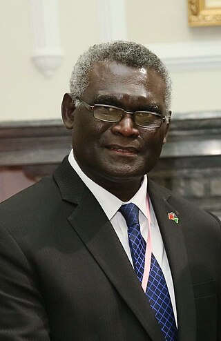
Manasseh Damukana Sogavare is a Solomon Islander politician serving as Minister of Finance since 2024. He served as the prime minister of Solomon Islands for a total of nine years from 2000–2001, 2006–2007, 2014–2017, and 2019–2024. Sogavare has served in the National Parliament representing East Choiseul since 1997.
General elections were held in the Solomon Islands on 5 April 2006. No party won more than four of the fifty seats, while thirty seats went to independent candidates. A number of those subsequently formed an Association of Independent Members of Parliament, with Snyder Rini as their leader. Rini was elected prime minister by Parliament on 18 April, amidst "widespread street protests" in Honiara, which caused particular damage in the city's Chinatown. Rioters "alleged corruption and insisted that Mr. Rini had been unfairly favouring Chinese businessmen". While the riots ceased with the arrival of Australian and New Zealand peacekeeping troops the next day, the opposition soon lodged a motion of no confidence in Rini's premiership. Rini resigned on 26 April, having been Prime Minister for just eight days. Opposition parties united in a coalition and succeeded in having Manasseh Sogavare, of the Solomon Islands Social Credit Party, elected Prime Minister on 4 May.

Honiara is the capital and largest city of Solomon Islands, situated on the northwestern coast of Guadalcanal. As of 2021, it had a population of 92,344 people. The city is served by Honiara International Airport and the seaport of Point Cruz, and lies along the Kukum Highway. In 1983, a capital territory – comprising the 22 square-kilometre metropolitan area of Honiara – was proclaimed, with a self-governing status akin to a province, although the city also retained an older role as capital of Guadalcanal Province.
Burns Creek is a suburb of Honiara, Solomon Islands located to the east of the main center, south of Lungga Point and west of Henderson. It was formed following the tensions over land when displaced Malaitans founded a squatted informal settlement in the late 1990s and early 2000s. The area became known for high levels of unemployment and crime.
Sun Valley is a suburb of Honiara, Solomon Islands located east of the main center and next to Honiara International Airport. There are Seventy-two households in Sun Valley community.
Bloody Ridge is a suburb of Honiara, Solomon Islands and the location of a World War II battle.
Nggosi is a suburb of Honiara, Solomon Islands and is located West of the main center and South East of White River.
Namoliki is a suburb of Honiara, Solomon Islands and is located South of Chinatown.
East Kola'a Ridge is a suburb of Honiara, Solomon Islands and is located east of Chinatown.
Ferakusia is a suburb of Honiara, Solomon Islands, south of Chinatown.
Lungga Point is a suburb of Honiara, Solomon Islands and is located East of the main center and North-West of Honiara International Airport.
NZ Camp is a suburb of Honiara, Solomon Islands and is located South-East of Honiara International Airport.
Henderson West is a suburb of Honiara, Solomon Islands and is located West Honiara International Airport.
Henderson Central is a suburb of Honiara, Solomon Islands and is located near the Honiara International Airport.
Henderson East is a suburb of Honiara, Solomon Islands and is located East of Honiara International Airport.
The 2021 Solomon Islands unrest was a series of demonstrations and violent riots in Solomon Islands from 24 to 27 November 2021.

