Related Research Articles

Perth is the capital city of Western Australia. It is the fourth most populous city in Australia, with a population of over 2.3 million within Greater Perth as of 2023. It is part of the South West Land Division of Western Australia, with most of Perth's metropolitan area on the Swan Coastal Plain between the Indian Ocean and the Darling Scarp. The city has expanded outward from the original British settlements on the Swan River, upon which its central business district and port of Fremantle are situated.

Toodyay, known as Newcastle between 1860 and 1910, is a town on the Avon River in the Wheatbelt region of Western Australia, 85 kilometres (53 mi) north-east of Perth. The first European settlement occurred in the area in 1836. After flooding in the 1850s, the townsite was moved to its current location in the 1860s. It is connected by railway and road to Perth. During the 1860s, it was home to bushranger Moondyne Joe.

Subiaco is an inner-western suburb of Perth, the capital of Western Australia. It is approximately 3 km (1.9 mi) west of Perth's central business district, in the City of Subiaco local government area. Historically a working-class suburb containing a mixture of industrial and commercial land uses, since the 1990s the area has been one of Australia's most celebrated urban redevelopment projects. It remains a predominantly low-rise, urban village neighbourhood centred around Subiaco train station and Rokeby Road.

New Norcia is a town in Western Australia, 132 km (82 mi) north of Perth, near the Great Northern Highway. It is situated next to the banks of the Moore River, in the Shire of Victoria Plains. New Norcia is the only monastic town in Australia, with its Benedictine abbey founded in 1848. The monks later founded a mission and schools for Aboriginal children. A series of Catholic colleges were created, with the school that became St Benedict's College in 1965 later gaining notoriety for being the site of sexual abuse that took place in the late 1960s and 1970s.

Busselton is a city in the South West region of the state of Western Australia approximately 220 km (140 mi) south-west of Perth. Busselton has a long history as a popular holiday destination for Western Australians; however, the closure of the Busselton Port in 1972 and the contemporaneous establishment of the nearby Margaret River wine region have seen tourism become the dominant source of investment and development, supplemented by services and retail. The city is best known for the Busselton Jetty, the longest wooden jetty in the Southern Hemisphere.
Captain John Molloy was an early Irish settler in Western Australia. He was one of the original settlers of Augusta and an early settler of Busselton.
Walkaway is a small town in the City of Greater Geraldton local government area of Western Australia. At the 2016 census, Walkaway had a population of 270.
Wembley is a western suburb of Perth, Western Australia, located within the Town of Cambridge. Its postcode is 6014.

Eglinton is a locality in the Western Australian capital city of Perth, approximately 44 kilometres (27 mi) north of Perth's central business district on the Indian Ocean. For the most part, the suburb is covered in native banksia woodland, scrubland and heath typical of the Swan Coastal Plain. However, in recent years, there has been growth in residential estates, with a town centre to be built in the near future.

Daglish is a small western suburb of Perth, the capital of Western Australia. It is approximately 4 kilometres (2.5 mi) west of the Perth central business district, and within the City of Subiaco local government area. It was named after Henry Daglish, who was the mayor of Subiaco, member for the electoral district of Subiaco and premier of Western Australia from 1904 to 1905. The Daglish railway station opened in 1924 in response to population growth in the neighbouring suburb of Subiaco. The following year, the Municipality of Subiaco bought the land west of the railway station to sell for housing. Development occurred over the following 20 years. The initial development next to the railway station used the garden suburb principles, with large lots and gardens, curved streets, and lots of green space. Today, the suburb has significant heritage value due to its uniform streetscape, with most original homes still standing. It has a population of 1,419 as of the 2016 Australian census.
The Flinders Bay branch railway, also known as the Boyanup to Flinders Bay section ran between Boyanup and Flinders Bay, in South Western Western Australia. The section from Flinders Bay to Busselton has now been converted into a rail trail for bushwalkers and cyclists, called the Wadandi Trail.

The bicentenary of Australia was celebrated in 1988. It marked 200 years since the arrival of the First Fleet of British convict ships at Sydney in 1788.

The City of Perth is a local government area and body, within the Perth metropolitan area, which is the capital of Western Australia. The local government is commonly known as Perth City Council. The City covers the Perth city centre and surrounding suburbs. The City covers an area of 20.01 square kilometres (8 sq mi) and had an estimated population of 21,092 as at 30 June 2015. On 1 July 2016 the City expanded, absorbing 1,247 residents from the City of Subiaco.
James Drummond was an early settler in Western Australia, and a member of the Western Australian Legislative Council from 1870 to 1873.
Mgr Anselm Bourke, born Nicholas Bourke, was a Roman Catholic priest of Irish origins. He was prominent in Catholic education for several decades, and also founded the West Perth parish of the Church in 1901. He made his profession as a Benedictine monk in 1858, but got dispensation from his monastic vows from the Vatican in 1871; therefore, he cannot be called a Benedictine.

Clackline is a locality in the Wheatbelt region of Western Australia, about 80 kilometres (50 mi) east-north-east of Perth.

The Toodyay Post Office and residence is located in Toodyay, Western Australia on the corner of Stirling Terrace and Duke Street North.
Joseph Strelley Harris (1811–1889) was a pastoralist in Western Australia. Between 1840 and 1888, he was a resident magistrate, serving in the towns of Williams, Toodyay, Busselton and Kojonup.
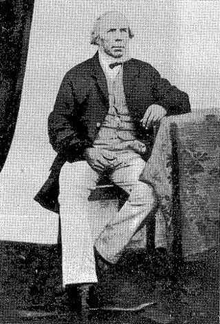
Charles Harper was Toodyay's first Anglican minister, and the first ordinand from Western Australia. While being a minister of the church was probably far from his intentions when he set sail for the Swan River Colony in 1837, his family's clerical background and his own disposition suited him well for this vocation. Harper served the Toodyay district for over 30 years, first as registrar of births, deaths and marriages, then from 1849 as an ordained minister.
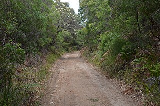
Toodyay pioneer heritage trail was a trail created by the Toodyay Bicentennial Community Committee in 1988 for the Australian Bicentenary as part of the W.A. Heritage Trails Network.
References
- ↑ Markwell, Kevin; Stevenson, Deborah; Rowe, David (2004), Footsteps and memories: interpreting an Australian urban landscape through thematic walking tours, Routledge, retrieved 6 November 2016 a later publication on the subject of heritage walking tours
- ↑ Western Australian Heritage Committee (1988), A guide to the W. A. Heritage Trails Network, Western Australian Heritage Commission, retrieved 16 October 2016
- ↑ Western Australian Heritage Committee (1985), Report on the activities of the Western Australian Heritage Committee, The Committee, retrieved 16 October 2016
- ↑ Western Australian Heritage Committee (1987), Annual report, Western Australian Heritage Committee, ISSN 1031-2102
- ↑ De Vos, Ainslie (1986), "Bicentennial brief. -New walks and drives through Western Australia's past-", This Australia, 5 (4): 54–56, retrieved 16 October 2016
- ↑ Western Australian Heritage Committee (1988), First settlement heritage trail : settlement and development of the Albany district, W.A. Heritage Committee, retrieved 16 October 2016
- ↑ Heritage Trails Network (W.A.); South Fremantle Senior High School; Heritage Trails Schools Program (W.A.) (1986), The Arthur Head Heritage Trail, W.A. Heritage Trails Network, retrieved 16 October 2016
- ↑ Western Australian Heritage Committee (1988), Augusta-Busselton Heritage Trail : retracing the pioneer route from Augusta to the Vasse : a Commonwealth, W.A. Heritage Committee, retrieved 17 October 2016
- ↑ Heritage Trails Network (W.A.); Heritage Council of Western Australia (1999), Heritage Trail, Augusta-Busselton : retracing the pioneer route from Augusta to the Vasse, Heritage Council of Western Australia, retrieved 17 October 2016
- ↑ Heritage Trails Network (W.A.); Heritage Council of Western Australia; Western Australian Heritage Committee (1988), Broome Heritage Trail : settlement and development of the North West's major pearling port, Heritage Council of W.A, retrieved 16 October 2016
- ↑ "Western Australian Heritage Trails Network" (PDF). State Library of Western Australia . J S Battye Library of West Australian History Collection PR12454. Perth. 2023. Retrieved 19 January 2025.
- ↑ National Trust of Australia (W.A.); Heritage Trails Network (W.A.); Heritage Council of Western Australia (1988), Guildford to York Heritage Trail, Heritage Council of W.A, retrieved 17 October 2016
- ↑ Western Australian Heritage Committee (1988), Moora Heritage Trail : a Commonwealth/State Bicentennial Project, Western Australian Heritage Committee, retrieved 17 October 2016
- ↑ Western Australia. Heritage Trails Secretariat (1986), New Norcia Heritage Trail : the development of the Benedictine settlement at New Norcia, Western Australia, Heritage Trails Secretariat, Western Australian Heritage Committee, retrieved 17 October 2016
- ↑ Heritage Trails Network (W.A.); Heritage Council of Western Australia (1999), Heritage Trail, New Norcia : the development of the Benedictine settlement at New Norcia, Western Australia, Heritage Council of Western Australia, retrieved 17 October 2016
- 1 2 Heritage Council of Western Australia (1988), Perth heritage trails : settlement and development of the City of Perth. 1., Central Perth Heritage Trail; 2. East Perth Heritage Trail, Western Australian Heritage Committee], retrieved 16 October 2016
- 1 2 Heritage Council of Western Australia (1988), Perth heritage trails : settlement and development of the City of Perth. 1., Northbridge Heritage Trail; 2. West Perth Heritage Trail, Western Australian Heritage Committee], retrieved 16 October 2016
- ↑ two titles: Rugged mountains, jewelled sea : the south coast heritage trail networkExplore the living history of the south coast from Eucla to AlbanySandiford, Libby; Western Australia. Department of Conservation and Land Management; Western Australian Heritage Committee; Sandiford, Libby; Western Australia. Dept. of Conservation and Land Management (1988), Rugged mountains, jewelled sea : the south coast heritage trail network, Dept. of Conservation and Land Management, ISBN 978-0-7309-2510-1
- ↑ Western Australian Heritage Committee (1988), Subiaco heritage trails, Western Australian Heritage Commission, retrieved 17 October 2016
- ↑ Western Australian Heritage Committee (1988), Subiaco Heritage Trails : development of an early inner city municipality. 1. Subiaco Heritage Trail. 2. Jolimont Heritage Trail : a Commonwealth/State Bicentennial Project, W.A. Heritage Committee, retrieved 17 October 2016
- ↑ Heritage Council of Western Australia; Heritage Trails Network (W.A.) (1988), Subiaco heritage trails : development of an early inner city municipality - 1. Shenton Park Heritage Trail. 2. Foreshore Heritage Trail, Heritage Council of WA, retrieved 17 October 2016
- ↑ Swan River Heritage Trail in PDF format
- ↑ Western Australian Heritage Committee (1988), Swan Valley Heritage Trail : settlement of the Swan River Valley, Western Australia :Commonwealth/State Bicentennial Project, W.A. Heritage Committee, retrieved 16 October 2016
- ↑ Heritage Council of Western Australia (1988), Toodyay Pioneer Heritage Trail : early settlement of Toodyay in the Avon Valley, Western Australia : a Commonwealth/State Bicentennial Project, Heritage Council of W.A, retrieved 17 October 2016
- ↑ Western Australian Heritage Committee; Heritage Trails Network (W.A.) (1988), Yarloop Heritage Trail : a Commonwealth/State bicentennial project, Western Australian Heritage Committee, retrieved 16 October 2016
- ↑ Heritage Council of Western Australia; Heritage Trails Network (W.A.); National Trust of Australia (W.A.); Western Australian Heritage Committee (1988), York Heritage Trail : settlement and development of Western Australia's oldest inland town, Heritage Council of W.A, retrieved 16 October 2016
- ↑ Western Australian Heritage Committee (1988), York to goldfields heritage trail : retracing the original route to the, Western Australian Heritage Commission, retrieved 17 October 2016