Related Research Articles

Unorganized Centre Parry Sound District is an unorganized area in central Ontario, Canada, between Georgian Bay and Lake Nipissing in the District of Parry Sound. It is made up of geographic townships which have no governing bodies and which are not incorporated as municipalities. The territory consists of two non-contiguous areas, with the main part located directly south of the French River and Lake Nipissing, and east of Georgian Bay. Shawanaga Township is a small exclave south of it along Highway 69.

The Magnetawan River is a long river in Parry Sound District, Ontario, Canada. The river flows 175 km from its source of Magnetawan Lake inside Algonquin Provincial Park to empty into Georgian Bay at the community of Britt on Byng Inlet.
King's Highway 69, commonly referred to as Highway 69, is a provincially maintained north–south highway in the central portion of the Canadian province of Ontario. In conjunction with Highway 400, it links Toronto with the city of Greater Sudbury at Highway 17, via Parry Sound. It is part of the Trans-Canada Highway and the National Highway System. From its southern terminus of Highway 559 at Carling, Highway 69 begins as Highway 400 narrows from a four-laned freeway to a two lane highway. It travels northerly for approximately 68 kilometres (42 mi) to south of the French River before widening back to a divided four lane freeway for approximately 64 kilometres (40 mi) into Sudbury. The final 6 kilometres (3.7 mi) of the route, connecting to Highway 17, is a five lane arterial road that will be converted to freeway as the final phase of the four-laning.
Byng Inlet is a ghost town and community in Unorganized Centre Parry Sound District, Ontario, Canada. For a period in the nineteenth century it was home to one of the largest sawmill operations in Canada. The name of the town came from that of the English Admiral John Byng. It is also the name of the body of water, on which the village is situated, on the south shore of the Byng Inlet a widening of the Magnetawan River, near its mouth on Georgian Bay.

Nipissing is an incorporated (political) township in Parry Sound District in Central Ontario, Canada. It is on Lake Nipissing and is part of the Almaguin Highlands region. Nipissing was surveyed between 1874 and 1881, and was incorporated in 1888. Among the first settlers in the area were the Chapman and Beatty families. Nipissing Township annexed Gurd Township in 1970. The township also contains a community named Nipissing, which is located on the South River near Chapman's Landing, on the South Bay of Lake Nipissing. The township administrative offices are located in Nipissing.
King's Highway 124, commonly known as Highway 124, is a provincially maintained highway in the Canadian province of Ontario. The highway connects Highway 400 in Parry Sound with Highway 11 in Sundridge, a distance of 91.2 km (56.7 mi), including a 15.4 km (9.6 mi) concurrency with Highway 520. It is one of several highways in Central Ontario to provide this connection through the Muskoka and Parry Sound region, and the northernmost provincial highway to do so south of Highway 17.

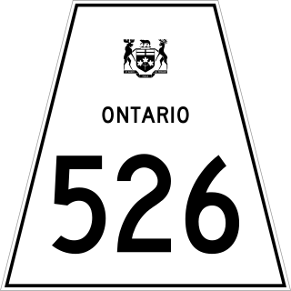
Secondary Highway 526, commonly referred to as Highway 526, is a provincially maintained secondary highway in the Canadian province of Ontario. It is a short and lightly travelled route that connects Highway 69 with the community of Britt.

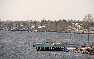
Britt is a community in the Canadian province of Ontario, located in the unincorporated township of Wallbridge in the Parry Sound District.

Magnetawan is a township in the Almaguin Highlands region of the Parry Sound District in the Canadian province of Ontario, as well as the name of the primary population centre in the township.

Whitestone is a municipality in the Canadian province of Ontario, as well as the name of a community within the municipality.

Byng Inlet is a body of water on the eastern shore of Georgian Bay, between Parry Sound and the mouth of the French River. It is a widening of the Magnetawan River, near its mouth. The name of the river "Magnetawan", meaning "long open channel" in the Ojibwe language, refers to this section of the river.

Dunchurch is a compact rural community in the Canadian province of Ontario, located in the municipality of Whitestone in Parry Sound District.

The Almaguin Highlands Region in Ontario, Canada, covers approximately 5,200 km2 (2,000 sq mi) comprising the eastern half of Parry Sound District. It is bounded by Muskoka in the south, and by Lake Nipissing and Nipissing District in the north. The eastern edge abuts the western boundary of Algonquin Provincial Park, whereas the western boundary of the Almaguin Highlands is generally regarded to be the mid east-west point of Parry Sound District. Originally derived from the words Algonquin, Magnetawan, and Seguin. the name Almaguin is now used to describe the marketing region of East Parry Sound.

Secondary Highway 529, commonly referred to as Highway 529, is a provincially maintained secondary highway in the Canadian province of Ontario. Located within Parry Sound District, the highway follows a 25.7-kilometre (16.0 mi) route, from its southern terminus at Highway 69 near Pointe au Baril to its northern terminus at the Highway 69 crossing of the Magnetawan River near Byng Inlet. Two spur routes, Highway 529A and Highway 645, branch off the highway to serve the communities of Bayfield Inlet and Byng Inlet, respectively. The route was established along the present alignment of Highway 529A in 1956. It was relocated in 1961 along the former routing of Highway 69 when a bypass opened through the area, with the former alignment being renumbered as Highway 529A.
Shawanaga is an unincorporated geographic township in the Unorganized Centre Part of Parry Sound District in central Ontario, Canada.
Bob's Lake is a lake in geographic Patterson Township in the Unorganized Centre Part of Parry Sound District in Central Ontario, Canada. It is in the Great Lakes Basin, and the nearest community is Restoule, 6 kilometres (4 mi) to the east. It is located in the Almaguin Highlands.
Mowat is an unorganized geographic township in the Canadian province of Ontario, located within the Parry Sound District. Part of the census subdivision of Unorganized Centre Parry Sound District, the township includes the communities of Bon Air, Cranberry and Key River, the ghost towns of Ludgate and Pakesley and the rail sidings of Mowat and Wanikewin.
Henvey is an unorganized geographic township in the Canadian province of Ontario, located within the Parry Sound District. Part of the census subdivision of Unorganized Centre Parry Sound District, the township includes the communities of Britt Station and Still River. It formerly had larger boundaries, also including the ghost town of Key Harbour, although the more northerly section was transferred to the municipality of Killarney in the 1990s. Britt Station is part of the local services board of Britt and Byng Inlet.
Rabbit Lake is a small lake in Parry Sound District in Central Ontario, Canada. It is part of the Great Lakes Basin, lies in geographic Wilson Township, and is within Island Lake Forest and Barrens Conservation Reserve. The lake exits at the southwest via an unnamed creek, then flows via the Still River to Byng Inlet on Georgian Bay, Lake Huron.
References
- ↑ "Wallbridge". Geographical Names Data Base . Natural Resources Canada . Retrieved 2013-02-19.
- 1 2 "Wallbridge" (PDF). Geology Ontario - Historic Claim Maps. Ontario Ministry of Northern Development, Mines and Forestry . Retrieved 2013-02-19.
- ↑ "Britt". Ontario Northland. Retrieved July 29, 2022.
- ↑ "Byng Inlet". Ontario Northland. Retrieved July 29, 2022.
- ↑ "Ontario Northland 201 and 202" (PDF). Ontario Northland. Retrieved July 29, 2022.
Other map sources:
- Map 8 (PDF) (Map). 1 : 700,000. Official road map of Ontario. Ministry of Transportation of Ontario. 2012-01-01. Retrieved 2013-02-19.
- Restructured municipalities - Ontario map #4 (Map). Restructuring Maps of Ontario. Ontario Ministry of Municipal Affairs and Housing. 2006. Retrieved 2013-02-19.