Walnut Islands, California | |
---|---|
![]() | |
Coordinates: 34°3′55″N117°50′24″W / 34.06528°N 117.84000°W | |
Country | ![]() |
State | ![]() |
County | ![]() |
Area | |
• Total | 3.8 sq mi (10 km2) |
Population (2000) | |
• Total | 4,053 |
• Density | 1,122/sq mi (433/km2) |
Time zone | UTC-8 (PST) |
• Summer (DST) | UTC-7 (PDT) |
ZIP code | 91724, 91768, 91789 |
Area codes | 626, 909 |
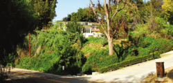
Walnut Islands [1] [2] [3] or Ramona [4] [5] is an unincorporated area [1] in the eastern part of Los Angeles County in the U.S. state of California. The former is the technical term used by the county government, [1] while the latter was used by the Los Angeles Times in 2008 [4] and the LA Metro. [5] One news report referred to the area as Covina Hills. [6] Walnut Islands is surrounded by the cities of Covina and San Dimas to the north, Walnut to the south, West Covina to the west, and Pomona to the east. [4] The population of Ramona was 4,053 according to the 2000 census. [4]
The land in Walnut Islands was historically used for agriculture. [1]
Walnut Islands has a total area of 3.8 square miles (2,400 acres). [1] It is situated in a low point in the San Jose Hills.
![]() | This section needs to be updated.(April 2023) |
There were 4,053 people living in Walnut Islands, according to the US Census. [4] The population density was 1,122 inhabitants per square mile. The racial makeup of the area was 35.0% Asian, 32.3% White, 26.3% Latino, 3.0% African American, and 3.4% from other races. The average household size was 3.1. The age distribution was 15.4% 10 and under, 11.5% from 11 to 18, 18.5% from 19 to 34, 24.6% from 35 to 49, 15.9% from 50 to 64, and 14.1% 65 or older. The median age was 37 years. The median household income was $86,325. (in 2008 dollars)
There is no commercial land in Walnut Islands, California. [1] However, there are institutions in the area, such as Forest Lawn – Covina Hills [7] and Cal Poly Pomona, that employ people.
In the California State Legislature, Walnut Islands is in the 29th senatorial district , represented by Democrat Eloise Reyes, and in the 55th Assembly district , represented by Democrat Isaac Bryan. In the United States House of Representatives, it is split between California's 32nd congressional district , represented by Democrat Brad Sherman, and California's 39th congressional district , represented by Democrat Mark Takano.
The area is bounded by Interstate 10 to its south.
The area is mostly served by the Covina-Valley Unified School District, with students attending schools in the southeastern corner of the district, such as South Hills High School.[ citation needed ]
Firefighters were called just before 9 a.m. to the 19800 block of Florencita Drive December 12 in an unincorporated area identified as Walnut Islands.