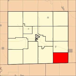
Tyrone is a town in Schuyler County, New York, United States. The population was 1,714 at the 2000 census.

Wayne is a town located in the northeast corner of Steuben County, New York, United States. As of the 2000 census, the township population was 1,165.

The Regional District of Kootenay Boundary (RDKB) is one of 29 regional districts in the province of British Columbia, Canada. As of the 2016 census, the population was 31,447. The area is 8,095.62 km². The RDKB was incorporated in 1966 and consists of eight incorporated municipalities and five unincorporated electoral areas. The regional district's offices are in the City of Trail, with secondary offices in the City of Grand Forks. Other major population centres include the cities of Rossland and Greenwood, and the villages of Fruitvale, Warfield, and Montrose. The region also encompasses electoral areas A, B/Lower Columbia-Old Glory, C/Christina Lake, D/Rural Grand Forks and E/West Boundary including Rock Creek, Bridesville, Beaverdell and Big White Ski Resort.
Highway 3B, opened in 1967, is an alternate loop to the Crowsnest Highway between Nancy Greene Lake and an area called Meadows, just west of Erie on the Crowsnest. Originally, Highway 3B went between Nancy Greene Lake to Trail, where the Crowsnest picked up the route to the Meadows area. Highway 3 was re-routed off the present-day Highway 3B alignment east of Trail in 1979.
Highway 22A is a cross-border spur in the West Kootenay region of the province. The highway was opened in 1967, and its number is derived from former Secondary State Highway 22A, with which the highway connected at the Canada–US border. Highway 22A connects Highway 3B east of Montrose to the border town of Waneta, 11 km (7 mi) south of the 3B junction.
Waneta Ethel (Nixon) Hoyt was an American serial killer who was convicted of killing all five of her biological children.

Wa-na-ta or Waneta was a chief of the Yanktonai, a tribe of the Dakota. Chief Wa-na-ta, also known as Wanata and Wanataan I, was born around 1795. The Yanktonai were located near the St. Peter River, which is today known as the Minnesota River, in present day Minnesota. The Yanktonai were said to have a population between five and six thousand individuals with 1,300 warriors. Wanata was a very influential chief, as evidenced by his ability to lead his tribes' 1,300 warriors into battle.
Lamoka Lake, previously known as Mud Lake, is a small crescent-shaped lake in the western part of New York state. The lake is located at the border of Schuyler County and Steuben County. Most of the lake is in Schuyler County with only a small part, called "Mill Pond," at the southwest corner in Steuben County.
Waneta Storms is a Canadian dramatic actor. She is best known for her portrayal of Isobel Lambert in the CTV series The Eleventh Hour (2003–2005).
Waneta and Wahneta may refer to:

Roscoe Township is a township in Davis County, Iowa, USA. As of the 2000 census, its population was 233.
Waneta Lake is a small lake in the Finger Lakes region of the state of New York in the United States. The lake straddles the border of Schuyler County and Steuben County, and is within the towns of Tyrone and Wayne. Waneta Lake is 3.5 miles long (north-to-south) and half a mile wide (east-to-west), and lies just east of the southern branch of Keuka Lake. The lake is at 42°27′56″N77°06′17″W.
The Waneta Dam is a concrete gravity-type hydroelectric dam on the Pend d'Oreille River in the Canadian province of British Columbia. It lies 9.5 kilometres (6 mi) downstream of Seven Mile Dam at the Pend d'Oreille's confluence with the Columbia River. It is located about 12.5 kilometres (8 mi) southeast of Trail and 0.35 kilometres (0.2 mi) north of the U.S. border at Washington.
Seven Mile Dam is a concrete gravity-type hydroelectric dam on the Pend d'Oreille River 15 km SE of Trail, 18 km downstream from Boundary Dam and 9 km upstream from Waneta Dam in the Canadian province of British Columbia. The powerplant has a capacity of 848 MW and generates 3200 GWh per year. The May, June and early July flow of the river in most years, is greater than the plants capacity. During these times water is spilled, not used to generate power. The reservoir is 420 ha, which includes 170 ha of flooded river channel. Under the Canal Plant Agreement operations are coordinated with Waneta Dam.
USS Waneta (YT-384), later YTB-384, later YTM-384, was a United States Navy harbor tug in commission from 1944 to 1946 and from 1953 to 1974.
Columbia Gardens is a ghost town located in the West Kootenay region of British Columbia. The town is situated near Trail, British Columbia. Columbia Gardens is near the Waneta border crossing.

Waneta is an unincorporated community located in Jackson County, Kentucky, United States.

The Boundary-Waneta Border Crossing connects the town of Northport, Washington with Trail, British Columbia on the Canada–US border. It can be reached from Waneta Road on the American side and British Columbia Highway 22A on the Canadian side. Canada has had a customs office at or near this crossing since 1865, initially to inspect vessels arriving via the Columbia River, then to inspect trains with the completion of the Nelson and Fort Sheppard Railway in 1893.
Waneta Dam Expansion is a two-unit powerplant which started construction in winter of 2010/11 just downstream of the existing Waneta Dam on the Pend d'Oreille River. The dam generates power from water that would otherwise be spilled from the existing project, and is delivered to the BC Hydro grid via a separate 10km long 230kV transmission line. The expansion project is a partnership, with Fortis Inc. holding a 51% share in the project and the two Crown agencies Columbia Power Corporation and Columbia Basin Trust holding a 32.5% and 16.5% share, respectively. SNC-Lavalin designed and built the project.


