Warnock, Ohio

Last updated

Location of Warnock, Ohio OHMap-doton-Warnock.png
Location of Warnock, Ohio

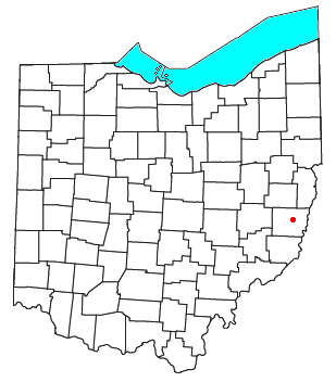
Warnock is an unincorporated community in northern Smith Township, Belmont County, Ohio, United States. [1] It has a post office with the ZIP code 43967. [2] It lies along State Route 9.

Warnock is part of the Wheeling, WV-OH Metropolitan Statistical Area.

History

A former variant name was Warnocks Station. [1] A post office called Warnock has been in operation since 1857. [3] The community was named for the Warnock family, the original owners of the town site. [4]

Related Research Articles

<span class="mw-page-title-main">Pemberton, Ohio</span> Unincorporated community in Ohio, U.S.

Pemberton is an unincorporated community in eastern Perry Township, Shelby County, Ohio, United States. It has a post office with the ZIP code 45353.

<span class="mw-page-title-main">Maynard, Ohio</span> Unincorporated community in Ohio, U.S.

Maynard is an unincorporated community located in western Colerain Township, Belmont County, Ohio, United States, along Wheeling Creek. It has a post office with the ZIP code 43937.

<span class="mw-page-title-main">Jacobsburg, Ohio</span> Human settlement in Ohio, United States

Jacobsburg is an unincorporated community in southeastern Smith Township, Belmont County, Ohio, United States. It has a post office with the ZIP code 43933. It lies along State Route 147.

<span class="mw-page-title-main">Fairpoint, Ohio</span> Unincorporated community in Ohio, U.S.

Fairpoint is an unincorporated community in eastern Wheeling Township, Belmont County, Ohio, United States, along Wheeling Creek. Although it is unincorporated, and at one point had a post office which was closed in recent years, with the ZIP code 43927. It lies along State Route 9.

<span class="mw-page-title-main">Colerain, Ohio</span> Unincorporated community in Ohio, U.S.

Colerain is an unincorporated community in eastern Colerain Township, Belmont County, Ohio, United States. It has a post office with the ZIP code 43916. It lies along U.S. Route 250.

<span class="mw-page-title-main">Blaine, Ohio</span> U.S. city in Ohio

Blaine is an unincorporated community in northern Pease Township, Belmont County, Ohio, United States. It is located along Wheeling Creek. It has a post office with the ZIP code 43909.

<span class="mw-page-title-main">Barton, Ohio</span> Unincorporated community in Ohio, U.S.

Barton is an unincorporated community in southern Colerain Township, Belmont County, Ohio, United States, along Wheeling Creek. It has a post office with the ZIP code 43905.

<span class="mw-page-title-main">Alledonia, Ohio</span> Unincorporated community in Ohio, U.S.

Alledonia is an unincorporated community in central Washington Township, Belmont County, Ohio, United States. It has a post office with the ZIP code 43902. It lies along State Route 148.

<span class="mw-page-title-main">Mount Liberty, Ohio</span> Unincorporated community in Ohio, U.S.

Mount Liberty is an unincorporated community on the border between the Milford and Liberty Townships of Knox County, Ohio, United States. It has a post office with the ZIP code 43048. It lies along the concurrent U.S. Route 36 and State Route 3.

<span class="mw-page-title-main">Wolf Run, Ohio</span> Unincorporated community in Ohio, U.S.

Wolf Run is an unincorporated community in eastern Springfield Township, Jefferson County, Ohio, United States. It has a post office with the ZIP code 43970. The stream of Wolf Run, which flows northward past the community, is a tributary of Goose Creek, which in turn flows southward to meet Cross Creek in Harrison County's German Township, which in turn flows eastward to meet the Ohio River at Mingo Junction.

<span class="mw-page-title-main">North Georgetown, Ohio</span> Unincorporated community in Ohio, U.S.

North Georgetown is an unincorporated community in western Knox Township, Columbiana County, Ohio, United States. Although unincorporated, it has a post office, with the ZIP code of 44665. The town itself is located at the intersection of Georgetown Road and Rochester Road.

<span class="mw-page-title-main">Paris, Stark County, Ohio</span> Unincorporated community in Ohio, U.S.

Paris is an unincorporated community in northwestern Paris Township, Stark County, Ohio. It has a post office with the ZIP code 44669. It lies along State Route 172 between East Canton and Lisbon. The community is part of the Canton–Massillon Metropolitan Statistical Area.

<span class="mw-page-title-main">Fowler, Ohio</span> Unincorporated community in Ohio, U.S.

Fowler is an unincorporated community in central Fowler Township, Trumbull County, Ohio, United States. It has a post office with the ZIP code 44418. It lies at the intersection of State Routes 193 and 305.

<span class="mw-page-title-main">Scroggsfield, Ohio</span> Unincorporated community in Ohio, U.S.

Scroggsfield is an unincorporated community in Fox Township, Carroll County, Ohio, United States. The community is part of the Canton–Massillon Metropolitan Statistical Area. The community is served by the Carrollton, Ohio post office, ZIP code 44615. It is located near the source of Strawcamp Run, a tributary to Yellow Creek.

<span class="mw-page-title-main">Wattsville, Ohio</span> Unincorporated community in Ohio, U.S.

Wattsville is an unincorporated community in Fox Township, Carroll County, Ohio, United States. The community is part of the Canton–Massillon Metropolitan Statistical Area. It is serviced by the Carrollton, Ohio, post office, ZIP code 44615. It is located on the Upper North Fork of Yellow Creek, State Route 524, and the Ohi-Rail Corporation (OHIC) railroad.

Crescent is an unincorporated community in Belmont County, in the U.S. state of Ohio.

Stewartsville is an unincorporated community in Belmont County, in the U.S. state of Ohio.

McClainville is an unincorporated community in Belmont County, in the U.S. state of Ohio.

Pleasant Grove is an unincorporated community in Belmont County, in the U.S. state of Ohio.

Uniontown is an unincorporated community in Belmont County, in the U.S. state of Ohio.

References

  1. 1 2 U.S. Geological Survey Geographic Names Information System: Warnock, Ohio
  2. Zip Code Lookup
  3. "Belmont County". Jim Forte Postal History. Retrieved January 2, 2016.
  4. McKelvey, A. T. (1903). Centennial History of Belmont County, Ohio, and Representative Citizens. Biographical Publishing Company. pp.  287.

40°01′21″N80°56′14″W / 40.02250°N 80.93722°W / 40.02250; -80.93722