Lansing, Ohio

Last updated
Lansing, Ohio
OHMap-doton-Lansing.png
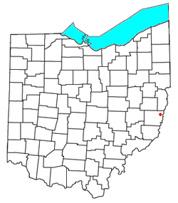
Location of Lansing, Ohio
Coordinates: 40°04′33″N80°47′31″W / 40.07583°N 80.79194°W / 40.07583; -80.79194
Country United States
State Ohio
County Belmont
Township Pease
Elevation
[1]
705 ft (215 m)
Population
 (2020)
  Total596
Time zone UTC-5 (Eastern (EST))
  Summer (DST) UTC-4 (EDT)
ZIP code
43934
Area code 740
GNIS feature ID2628924 [1]

Lansing is a census-designated place in northern Pease Township, Belmont County, Ohio, United States, along Wheeling Creek. [1] [2] As of the 2020 census it had a population of 596. [3] It has a post office with the ZIP code 43934. [4]

Lansing is part of the Wheeling, WV-OH Metropolitan Statistical Area.

A post office called Lansing has been in operation since 1898. [5] Besides the post office, Lansing had a church, built there in 1834. [6] Lansing was once known as Soaptown.[ citation needed ]

Related Research Articles

<span class="mw-page-title-main">Belmont County, Ohio</span> County in Ohio, United States

Belmont County is a county in the U.S. state of Ohio. As of the 2020 United States census, the population was 66,497. Its county seat is St. Clairsville, while its largest city is Martins Ferry. The county was created on September 7, 1801, and organized on November 7, 1801. It takes its name from the French for "beautiful mountain".

<span class="mw-page-title-main">Neffs, Ohio</span> Census-designated place in Ohio, United States

Neffs is an unincorporated community and census-designated place in northwestern Pultney Township, Belmont County, Ohio, United States. The population was 878 at the 2020 census. It is part of the Wheeling metropolitan area.

<span class="mw-page-title-main">Powhatan Point, Ohio</span> Village in Ohio, United States

Powhatan Point is a village in southeastern Belmont County, Ohio, United States, along the Ohio River. The population was 1,461 at the 2020 census. It is part of the Wheeling metropolitan area.

<span class="mw-page-title-main">Colerain Township, Belmont County, Ohio</span> Township in Ohio, United States

Colerain Township is one of the sixteen townships of Belmont County, Ohio, United States. As of the 2020 census the population was 4,174.

<span class="mw-page-title-main">Stony Ridge, Ohio</span> CDP in Ohio, United States

Stony Ridge is a census-designated place (CDP) in northwestern Troy Township, Wood County, Ohio, United States. As of the 2020 census, it had a population of 434. It has a post office with the ZIP code 43463.

<span class="mw-page-title-main">Warnock, Ohio</span> Unincorporated community in Ohio, U.S.

Warnock is an unincorporated community in northern Smith Township, Belmont County, Ohio, United States. It has a post office with the ZIP code 43967. It lies along State Route 9.

<span class="mw-page-title-main">Maynard, Ohio</span> Unincorporated community in Ohio, U.S.

Maynard is an unincorporated community located in western Colerain Township, Belmont County, Ohio, United States, along Wheeling Creek. It has a post office with the ZIP code 43937. Maynard is part of the Wheeling, WV-OH Metropolitan Statistical Area. The community is near Wheeling Township and its sister community of Blainesville. Maynard is a part of the St. Clairsville-Richland City School District.

<span class="mw-page-title-main">Lafferty, Ohio</span> Unincorporated community in Ohio, United States

Lafferty is a census-designated place in northeastern Union Township, Belmont County, Ohio, United States, along Wheeling Creek. As of the 2020 census it had a population of 255. It has a post office with the ZIP code 43951.

<span class="mw-page-title-main">Jacobsburg, Ohio</span> Human settlement in Ohio, United States

Jacobsburg is an unincorporated community in southeastern Smith Township, Belmont County, Ohio, United States. It has a post office with the ZIP code 43933. It lies along State Route 147.

<span class="mw-page-title-main">Glencoe, Ohio</span> Unincorporated community in Ohio, United States

Glencoe is a census-designated place in southern Richland Township, Belmont County, Ohio, United States. As of the 2020 census it had a population of 264. It has a post office with the ZIP code 43928.

<span class="mw-page-title-main">Fairpoint, Ohio</span> Unincorporated community in Ohio, U.S.

Fairpoint is an unincorporated community in eastern Wheeling Township, Belmont County, Ohio, United States, along Wheeling Creek. Although it is unincorporated, and at one point had a post office which was closed in recent years, with the ZIP code 43927. It lies along State Route 9.

<span class="mw-page-title-main">Colerain, Ohio</span> Unincorporated community in Ohio, U.S.

Colerain is an unincorporated community in eastern Colerain Township, Belmont County, Ohio, United States. It has a post office with the ZIP code 43916. It lies along U.S. Route 250.

<span class="mw-page-title-main">Blaine, Ohio</span> U.S. city in Ohio

Blaine is an unincorporated community in northern Pease Township, Belmont County, Ohio, United States. It is located along Wheeling Creek. It has a post office with the ZIP code 43909.

<span class="mw-page-title-main">Barton, Ohio</span> Unincorporated community in Ohio, U.S.

Barton is an unincorporated community in southern Colerain Township, Belmont County, Ohio, United States, along Wheeling Creek. It has a post office with the ZIP code 43905.

<span class="mw-page-title-main">Bannock, Ohio</span> Unincorporated community in Ohio, United States

Bannock is a census-designated place in northwestern Richland Township, Belmont County, Ohio, United States, along Wheeling Creek. As of the 2020 census it had a population of 159. It has a post office with the ZIP code 43972. It lies along State Route 331.

<span class="mw-page-title-main">Sardis, Ohio</span> Census-designated place in Ohio, United States

Sardis is a census-designated place (CDP) in southeastern Lee Township, Monroe County, Ohio, United States. It is unincorporated, but has a post office with the ZIP code of 43946. As of the 2020 census, it had a population of 522.

<span class="mw-page-title-main">Middlebranch, Ohio</span> CDP in Ohio, United States

Middlebranch is a census-designated place in northeastern Plain Township, Stark County, Ohio, United States. It is located about 7 miles Northeast of Canton. It has a post office with the ZIP code 44652. The community is part of the Canton–Massillon Metropolitan Statistical Area. The population was 2,117 at the 2020 census. Trains from the Wheeling and Lake Erie Railway often run through the area carrying loads of scrap metal bound for other Ohio cities.

<span class="mw-page-title-main">McDermott, Ohio</span> CDP in Ohio, United States

McDermott is a census-designated place in western Rush Township, Scioto County, Ohio, United States. As of the 2020 census it had a population of 308. It has a post office with the ZIP code 45652.

The Wheeling, WV–OH Metropolitan Statistical Area, as defined by the United States Census Bureau, is an area consisting of two counties in the Northern Panhandle of West Virginia and one in eastern Ohio, anchored by the city of Wheeling. As of the 2010 census, the MSA had a population of 147,950. This represents a decline of 3.4% from the 2000 census population of 153,172.

Wolfhurst is a census-designated place (CDP) in Belmont County, Ohio, United States. It is part of the Wheeling, West Virginia Metropolitan Statistical Area. The population was 1,119 at the 2020 census.

References

  1. 1 2 3 U.S. Geological Survey Geographic Names Information System: Lansing, Ohio
  2. Ohio Atlas & Gazetteer. Yarmouth, Me.: DeLorme. 1991. pp. 62–63. ISBN   0-89933-233-1.
  3. "Lansing CPD, Ohio - Census Bureau Profile". United States Census Bureau. Retrieved 24 May 2023.
  4. "Free ZIP Code Lookup with area code, county, geocode, MSA/PMSA, population". zipinfo.com. Retrieved December 1, 2015.
  5. "Belmont County". Jim Forte Postal History. Retrieved 2 January 2016.
  6. McKelvey, A. T. (1903). Centennial History of Belmont County, Ohio, and Representative Citizens. Biographical Publishing Company. p.  210.