Riverview, Belmont County, Ohio

Last updated
Location of Riverview, Ohio OHMap-doton-Riverview.png
Location of Riverview, Ohio

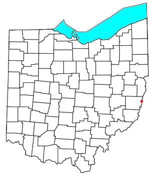
Riverview is an unincorporated community [1] along State Route 7 in northeastern Pultney Township, Belmont County, Ohio, United States, between Bridgeport and Bellaire. At one time, Riverview was a small unincorporated village, but it was demolished over time to make way for Interstate 470 near its crossing of the Ohio River. Its remains are still visible from Route 7 during late fall, winter and early spring.

Unincorporated area Region of land not governed by own local government

In law, an unincorporated area is a region of land that is not governed by a local municipal corporation; similarly an unincorporated community is a settlement that is not governed by its own local municipal corporation, but rather is administered as part of larger administrative divisions, such as a township, parish, borough, county, city, canton, state, province or country. Occasionally, municipalities dissolve or disincorporate, which may happen if they become fiscally insolvent, and services become the responsibility of a higher administration. Widespread unincorporated communities and areas are a distinguishing feature of the United States and Canada. In most other countries of the world, there are either no unincorporated areas at all, or these are very rare; typically remote, outlying, sparsely populated or uninhabited areas.

State Route 7 (SR 7), formerly known as Inter-county Highway 7 until 1921 and State Highway 7 in 1922, is a north–south state highway in the southern and eastern portions of the U.S. state of Ohio. At just over 292 miles (470 km) in length, it is the longest state route in Ohio. Its southern terminus is an interchange with U.S. Route 52 (US 52) just west of Chesapeake. Its northern terminus also serves as the eastern terminus of SR 531 in Conneaut. The path of SR 7 stays within five miles (8.0 km) of the Ohio River for the southern portion, with the river being visible from much of the route. The road also remains within 10 miles (16 km) of the Pennsylvania state line for the northern portion.

Pultney Township, Belmont County, Ohio Township in Ohio, United States

Pultney Township is one of the sixteen townships of Belmont County, Ohio, United States. The 2010 census found 8,795 people in the township.

Related Research Articles

Belmont County, Ohio county in Ohio, United States

Belmont County is a county located in the U.S. state of Ohio. As of the 2010 census, the population was 70,400. Its county seat is St. Clairsville. The county was created in 1801 and later organized in 1815. It takes its name from the French for "beautiful mountain".

Riverview, Florida Census-designated place in Florida, United States

Riverview is an unincorporated census-designated place in Hillsborough County, Florida, United States. It is located south of Brandon. The population was 71,050 in the 2010 census, up from 12,035 in the 2000 census.

Riverview may refer to communities, historic houses or other places:

Riverview, Ohio may refer to:

Western Avenue (Chicago) major north-south thoroughfare in Chicago, Illinois, United States

Western Avenue is the longest continuous street within the city of Chicago at 23.5 miles (37.82 km) in length. Western Avenue extends south as a continuous road to the Dixie Highway at Sibley Boulevard in Dixmoor, giving the road a total length of 27.38 miles (44.06 km). Western Avenue, after turning into Asbury Ave, runs out on the north side at Green Bay Road in Evanston and on the south side at Crete-Monee Road in Crete. However, Western Avenue extends intermittently through the Southland to the Will / Kankakee county border in unincorporated Will Township. Within Chicago's grid street system, Western Avenue is 2400 West.

Belmont Avenue (Chicago) street in Chicago, Illinois and west suburbs

Belmont Avenue is a major east-west street in Chicago and some suburbs. Belmont starts at the Belmont harbor area and is a central commercial street in Lakeview and, west of the North Branch of the Chicago River, Avondale. Further west, it anchors the Belmont-Central shopping district straddling the Belmont Cragin and Portage Park communities. The road enters western suburbs River Grove and Franklin Park before the main segment ends with other parts of Belmont still going west. Then west of the Cook County line parts of Belmont enter DuPage County, specifically in Bensenville and Addison, ending.

Ohio State Route 149 highway in Ohio

State Route 149 is an L-shaped state highway in eastern Ohio. Though the east–west leg of the route is longer than the north–south portion, the entire route is signed as north–south. The route starts at an interchange with SR 7 in Bellaire. The route heads west to Belmont where it turns north at an intersection with SR 147. After spending most of the time in Belmont County, SR 149's northern terminus is at SR 9 near New Athens, Harrison County.

Pease Township, Belmont County, Ohio Township in Ohio, United States

Pease Township is one of sixteen townships of Belmont County, Ohio, United States. The 2010 census counted 14,309 people living in the township.

Warnock, Ohio human settlement in United States of America

Warnock is an unincorporated community in northern Smith Township, Belmont County, Ohio, United States. Although it is unincorporated, it has a post office, with the ZIP code of 43967. It lies along State Route 9.

Maynard, Ohio human settlement in United States of America

Maynard is an unincorporated community located in western Colerain Township, Belmont County, Ohio, United States, along Wheeling Creek. Although it is unincorporated, it has a post office, with the ZIP code of 43937. Maynard is part of the Wheeling, WV-OH Metropolitan Statistical Area. The community is near the border with Wheeling Township and its sister community of Blainesville. Maynard is a part of the St. Clairsville-Richland City School District.

Jacobsburg, Ohio human settlement in United States of America

Jacobsburg is an unincorporated community in southeastern Smith Township, Belmont County, Ohio, United States. Although it is unincorporated, it has a post office, with the ZIP code of 43933. It lies along State Route 147.

Fairpoint, Ohio human settlement in United States of America

Fairpoint is an unincorporated community in eastern Wheeling Township, Belmont County, Ohio, United States, along Wheeling Creek. Although it is unincorporated, and at one point had a post office which was closed in recent years, with the ZIP code of 43927. It lies along State Route 9.

Colerain, Ohio human settlement in United States of America

Colerain is an unincorporated community in eastern Colerain Township, Belmont County, Ohio, United States. Although it is unincorporated, it has a post office, with the ZIP code of 43916. It lies along U.S. Route 250.

Bannock, Ohio human settlement in United States of America

Bannock is a census-designated place in northwestern Richland Township, Belmont County, Ohio, United States, along Wheeling Creek. As of the 2010 census it had a population of 211. Although it is unincorporated, it has a post office, with the ZIP code of 43972. It lies along State Route 331.

Alledonia, Ohio human settlement in United States of America

Alledonia is an unincorporated community in central Washington Township, Belmont County, Ohio, United States. Although it is unincorporated, it has a post office, with the ZIP code of 43902. It lies along State Route 148.

Captina is an unincorporated community in Belmont County, in the U.S. state of Ohio.

Centerville is an unincorporated community in Belmont County, in the U.S. state of Ohio.

Lamira is an unincorporated community in Belmont County, in the U.S. state of Ohio.

Temperanceville is an unincorporated community in Belmont County, in the U.S. state of Ohio.

References