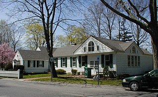
Washakie Ten, Wyoming

Last updated
Ten Sleep, Wyoming
USA Wyoming location map.svg
Red pog.svg
Ten Sleep, Wyoming
Location within the state of Wyoming
Usa edcp location map.svg
Red pog.svg
Ten Sleep, Wyoming
Ten Sleep, Wyoming (the United States)
Coordinates: 44°4′24″N107°55′4″W / 44.07333°N 107.91778°W / 44.07333; -107.91778 Coordinates: 44°4′24″N107°55′4″W / 44.07333°N 107.91778°W / 44.07333; -107.91778
Country United States
State Wyoming
County Washakie
Area
  Total25.6 sq mi (66.2 km2)
  Land25.1 sq mi (65.0 km2)
  Water0.4 sq mi (1.1 km2)
Elevation
4,026 ft (1,227 m)
Population
  Total604
  Density24.1/sq mi (9.3/km2)
Time zone UTC-7 (Mountain (MST))
  Summer (DST) UTC-6 (MDT)
Area code(s) 307
FIPS code 56-81671 [1]
GNIS feature ID1853216 [2]

Washakie is an unincorporated community in Washakie County, Wyoming, United States. The population was 604 at the 2000 census, when it was a census-designated place (CDP).

Unincorporated area Region of land not governed by own local government

In law, an unincorporated area is a region of land that is not governed by a local municipal corporation; similarly an unincorporated community is a settlement that is not governed by its own local municipal corporation, but rather is administered as part of larger administrative divisions, such as a township, parish, borough, county, city, canton, state, province or country. Occasionally, municipalities dissolve or disincorporate, which may happen if they become fiscally insolvent, and services become the responsibility of a higher administration. Widespread unincorporated communities and areas are a distinguishing feature of the United States and Canada. In most other countries of the world, there are either no unincorporated areas at all, or these are very rare; typically remote, outlying, sparsely populated or uninhabited areas.

Washakie County, Wyoming County in the United States

Washakie County is a county in the U.S. state of Wyoming. As of the 2010 United States Census, the population was 8,533. Its county seat is Worland.

Wyoming State of the United States of America

Wyoming is a state in the mountain region of the western United States. The state is the 10th largest by area, the least populous, and the second most sparsely populated state in the country. Wyoming is bordered on the north by Montana, on the east by South Dakota and Nebraska, on the south by Colorado, on the southwest by Utah, and on the west by Idaho and Montana. The state population was estimated at 577,737 in 2018, which is less than 31 of the most populous U.S. cities including Denver in neighboring Colorado. Cheyenne is the state capital and the most populous city, with an estimated population of 63,624 in 2017.

Contents

Geography

Washakie Ten is located at 44°4′24″N107°55′4″W / 44.07333°N 107.91778°W / 44.07333; -107.91778 (44.073398, -107.917650). [3]

According to the United States Census Bureau, in 2000 the CDP has a total area of 25.5 square miles (66.2 km²), of which, 25.1 square miles (65.0 km²) of it is land and 0.4 square miles (1.1 km²) of it (1.72%) is water.

United States Census Bureau Bureau of the United States responsible for the census and related statistics

The United States Census Bureau is a principal agency of the U.S. Federal Statistical System, responsible for producing data about the American people and economy. The Census Bureau is part of the U.S. Department of Commerce and its director is appointed by the President of the United States.

Demographics

As of the census [1] of 2000, there were 604 people, 235 households, and 169 families residing in the CDP. The population density was 24.1 people per square mile (9.3/km²). There were 262 housing units at an average density of 10.4/sq mi (4.0/km²). The racial makeup of the CDP was 91.56% White, 0.17% Native American, 1.49% Asian, 5.13% from other races, and 1.66% from two or more races. Hispanic or Latino of any race were 7.95% of the population.

Census Acquiring and recording information about the members of a given population

A census is the procedure of systematically acquiring and recording information about the members of a given population. The term is used mostly in connection with national population and housing censuses; other common censuses include agriculture, business, and traffic censuses. The United Nations defines the essential features of population and housing censuses as "individual enumeration, universality within a defined territory, simultaneity and defined periodicity", and recommends that population censuses be taken at least every 10 years. United Nations recommendations also cover census topics to be collected, official definitions, classifications and other useful information to co-ordinate international practice.

Population density A measurement of population numbers per unit area or volume

Population density is a measurement of population per unit area or unit volume; it is a quantity of type number density. It is frequently applied to living organisms, and most of the time to humans. It is a key geographical term. In simple terms population density refers to the number of people living in an area per kilometer square.

There were 235 households out of which 37.4% had children under the age of 18 living with them, 63.0% were married couples living together, 4.3% had a female householder with no husband present, and 27.7% were non-families. 26.4% of all households were made up of individuals and 8.5% had someone living alone who was 65 years of age or older. The average household size was 2.57 and the average family size was 3.12.

Marriage social union or legal contract between people called spouses that creates kinship

Marriage, also called matrimony or wedlock, is a socially or ritually recognised union between spouses that establishes rights and obligations between those spouses, as well as between them and any resulting biological or adopted children and affinity. The definition of marriage varies around the world not only between cultures and between religions, but also throughout the history of any given culture and religion, evolving to both expand and constrict in who and what is encompassed, but typically it is principally an institution in which interpersonal relationships, usually sexual, are acknowledged or sanctioned. In some cultures, marriage is recommended or considered to be compulsory before pursuing any sexual activity. When defined broadly, marriage is considered a cultural universal. A marriage ceremony is known as a wedding.

In the CDP the population was spread out with 29.8% under the age of 18, 5.0% from 18 to 24, 29.6% from 25 to 44, 25.2% from 45 to 64, and 10.4% who were 65 years of age or older. The median age was 38 years. For every 100 females, there were 109.0 males. For every 100 females age 18 and over, there were 102.9 males.

The median income for a household in the CDP was $29,313, and the median income for a family was $46,591. Males had a median income of $40,761 versus $25,714 for females. The per capita income for the CDP was $22,384. About 16.1% of families and 17.8% of the population were below the poverty line, including 41.5% of those under age 18 and none of those age 65 or over.

Per capita income mean income of the people in an economic unit such as a country or city

Per capita income (PCI) or average income measures the average income earned per person in a given area in a specified year. It is calculated by dividing the area's total income by its total population.

Education

Public education in the community of Washakie is provided by Washakie County School District #1. The district operates five campuses – East Side Elementary, South Side Elementary, West Side Elementary, Worland Middle School, and Worland High School .

Related Research Articles

References

  1. 1 2 "American FactFinder". United States Census Bureau . Retrieved 2008-01-31.
  2. "US Board on Geographic Names". United States Geological Survey. 2007-10-25. Retrieved 2008-01-31.
  3. "US Gazetteer files: 2010, 2000, and 1990". United States Census Bureau. 2011-02-12. Retrieved 2011-04-23.