
Langdon Place is a home rule-class city in Jefferson County, Kentucky, United States. The population was 936 as of the 2010 census.

Mornington Meadows is a residential area in the town of Caerphilly, south Wales. The name comes from the pastoral land and hay meadows which once covered this area. It borders Porset Park to the south, with pastoral land to the north-east. It is within the community council of Van, Caerphilly and the electoral ward of St. James. The estate was constructed in the 1970s. All residential roads within the estate are linked into a circular internal ring road - Pen Y Cae. The estate only has one exit road for vehicles, but has a considerable number of pedestrian paths in to and out of the estate. Despite Mornington Meadows having an English name all of the roads in the estate have Welsh names.

Area codes 740 and 220 are telephone area codes in the North American Numbering Plan (NANP) for the southeastern and central parts of Ohio. The numbering plan area (NPA) includes the cities of Athens, Belpre, Cadiz, Chillicothe, Circleville, Coshocton, Delaware, Gallipolis, Heath, Ironton, Jackson, Lancaster, Laurelville, Logan, Marietta, Marion, Mount Vernon, Nelsonville, Newark, Newcomerstown, Pataskala, Portsmouth, Rockbridge, Steubenville, Washington Court House, and Zanesville, Shadyside and the surrounding areas. It does not include the city of Columbus and rate centers in Franklin County which primarily use area code 614. Although it is Ohio's largest area code by geographic size, Southeastern Ohio is largely rural and has fewer residents overall than the rest of the state except in the areas near Columbus.
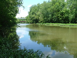
Paint Creek is a tributary of the Scioto River, 94.7 miles (152.4 km) long, in south-central Ohio in the United States. Via the Scioto and Ohio Rivers, it is part of the watershed of the Mississippi River. It drains an area of 1,143 square miles (2,960 km2).

Moxahala Creek is a tributary of the Muskingum River, 29.2 miles (47.0 km) long, in southeastern Ohio in the United States. Via the Muskingum and Ohio Rivers, it is part of the watershed of the Mississippi River, draining an area of 301 square miles (780 km2)

Byer is an unincorporated community in northwestern Washington Township, Jackson County, Ohio, United States. It lies along State Route 327 between Wellston and Londonderry, at 39°10′53″N82°37′53″W.

Clear Creek is a tributary of the Hocking River. It starts in western Fairfield County and flows southwest into northern Hocking County. In the upper half of the creek's watershed was glaciated and currently has a large amount of agricultural land use. The lower half is part of the unglaciated Allegheny Plateau and is much more forested. The creek's mouth is found at 39°35′49″N82°32′46″W
Ilesboro is an unincorporated community in Washington Township, Hocking County, Ohio, United States.
Ewing is an unincorporated community in Washington Township, Hocking County, Ohio, United States.
Greencastle is an unincorporated community in Fairfield County, in the U.S. state of Ohio.
Beckett is an unincorporated community in Washington County, in the U.S. state of Ohio.
Meadow Farm is an unincorporated community in Muskingum County, in the U.S. state of Ohio.
McDonaldsville is an unincorporated community in Stark County, in the U.S. state of Ohio.
Zoarville is an unincorporated community in Tuscarawas County, in the U.S. state of Ohio.
Nemah is an unincorporated community in Pacific County, in the U.S. state of Washington, lying on the mainland bordering Willapa Bay.
Hughes Creek is a stream in Cape Girardeau County in the U.S. state of Missouri. It is a tributary of Apple Creek.
Lost Creek is a stream in DeKalb and Gentry counties in the U.S. state of Missouri.It is a tributary of Grindstone Creek.
Comet is an unincorporated community in Washington Township, Jackson County, Ohio, United States. It is located at 39°06′57″N82°33′04″W, on the western edge of Wellston.
Lesmil is an unincorporated community in Washington Township, Jackson County, Ohio, United States. It is located about 2.2 miles (3.5 km) west of Hamden along Les Mil Road, at 39°09′30″N82°34′15″W.
Glen Nell is an unincorporated community in Washington Township, Jackson County, Ohio, United States. It is located west of Wellston at the intersection of Glen Nell Road and Von-Glen Nell Road, at 39°08′51″N82°37′17″W.
