Logan Elm Village, Ohio

Last updated
Logan Elm Village, Ohio
CDP
OHMap-doton-Logan Elm Village.png
Location of Logan Elm Village, Ohio
Detailed map of Logan Elm Village, Ohio.png
Detailed map of Logan Elm Village
Coordinates: 39°34′13″N82°56′50″W / 39.57028°N 82.94722°W / 39.57028; -82.94722
Country United States
State Ohio
County Pickaway
Township Circleville
Area
[1]
  Total0.36 sq mi (0.94 km2)
  Land0.36 sq mi (0.94 km2)
  Water0.00 sq mi (0.00 km2)
Elevation
[2]
692 ft (211 m)
Population
 (2020)
  Total1,045
  Density2,878.79/sq mi (1,111.17/km2)
Time zone UTC-5 (Eastern (EST))
  Summer (DST) UTC-4 (EDT)
FIPS code 39-44636 [3]
GNIS feature ID2393106 [2]

Logan Elm Village is a census-designated place (CDP) in Pickaway County, Ohio, United States, near the site of the Logan Elm. The population was 1,062 at the 2000 census.

Contents

"Logan elm" originally referred to a large individual elm tree where Logan the Orator gave a speech. [4]

Geography

According to the United States Census Bureau, the CDP has a total area of 0.5 square miles (1.3 km2), all of it land.

Demographics

Historical population
CensusPop.Note
2020 1,045
U.S. Decennial Census [5]

As of the census [3] of 2000, there were 1,062 people, 425 households, and 295 families residing in the CDP. The population density was 2,073.2 inhabitants per square mile (800.5/km2). There were 438 housing units at an average density of 855.0 per square mile (330.1/km2). The racial makeup of the CDP was 96.70% White, 1.79% African American, 0.09% Native American, 0.75% Asian, 0.09% from other races, and 0.56% from two or more races. Hispanic or Latino people of any race were 0.75% of the population.

There were 425 households, out of which 27.1% had children under the age of 18 living with them, 56.2% were married couples living together, 10.6% had a female householder with no husband present, and 30.4% were non-families. 28.2% of all households were made up of individuals, and 17.6% had someone living alone who was 65 years of age or older. The average household size was 2.32 and the average family size was 2.79.

In the CDP the population was spread out, with 21.6% under the age of 18, 5.6% from 18 to 24, 23.3% from 25 to 44, 28.0% from 45 to 64, and 21.6% who were 65 years of age or older. The median age was 44 years. For every 100 females there were 82.5 males. For every 100 females age 18 and over, there were 74.3 males.

The median income for a household in the CDP was $39,250, and the median income for a family was $48,558. Males had a median income of $39,911 versus $25,208 for females. The per capita income for the CDP was $17,584. About 7.4% of families and 10.6% of the population were below the poverty line, including 20.0% of those under the age of 18 and 11.0% of those 65 and older.

Related Research Articles

<span class="mw-page-title-main">Pickaway County, Ohio</span> County in Ohio, United States

Pickaway County is a county in the U.S. state of Ohio. As of the 2020 census, the population was 58,539. Its county seat is Circleville. Its name derives from the Pekowi band of Shawnee Indians, who inhabited the area.

<span class="mw-page-title-main">Bright, Indiana</span> Census-designated place in Indiana, United States

Bright is an unincorporated community and census-designated place (CDP) in Dearborn County, Indiana, United States. The population was 5,814 at the 2020 census.

<span class="mw-page-title-main">Silver Ridge, New Jersey</span> Populated place in Ocean County, New Jersey, US

Silver Ridge is an unincorporated community and census-designated place (CDP) located within Berkeley Township, in Ocean County, in the U.S. state of New Jersey. As of the 2010 United States Census, the CDP's population was 1,133.

<span class="mw-page-title-main">Park Layne, Ohio</span> Census-designated place in Ohio, United States

Park Layne is a census-designated place (CDP) in Bethel Township, Clark County, Ohio, United States. The population of the CDP was 4,248 at the 2020 census. It is part of the Springfield, Ohio Metropolitan Statistical Area. Park Layne became a CDP in the 1980 United States Census.

<span class="mw-page-title-main">Covedale, Ohio</span> Census-designated place in Ohio, United States

Covedale is a census-designated place (CDP) in Green Township, Hamilton County, Ohio, United States. The population was 6,472 at the 2020 census. The CDP represents the part of the former village of Covedale that was not annexed by the city of Cincinnati in the 1890s.

<span class="mw-page-title-main">Dillonvale, Hamilton County, Ohio</span> Census-designated place in Ohio, United States

Dillonvale is a census-designated place (CDP) in Sycamore Township, Hamilton County, Ohio, United States. The population was 3,436 at the 2020 census.

<span class="mw-page-title-main">Evendale, Ohio</span> Village in Ohio, United States

Evendale is a village in Hamilton County, Ohio, United States, within the Cincinnati metropolitan area. The population was 2,669 at the 2020 census.

<span class="mw-page-title-main">Grandview, Hamilton County, Ohio</span> Census-designated place in Ohio, United States

Grandview is a census-designated place (CDP) in Hamilton County, Ohio, United States. The population was 1,312 at the 2020 census.

<span class="mw-page-title-main">Kenwood, Ohio</span> Census-designated place in Ohio, United States

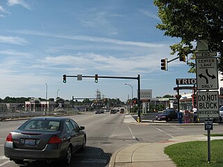
Kenwood is a census-designated place (CDP) in Sycamore Township, Hamilton County, Ohio, United States. The population was 7,570 at the 2020 census. It is a major shopping destination for the Cincinnati area, featuring properties such as Kenwood Towne Centre and The Kenwood Collection.

<span class="mw-page-title-main">Northbrook, Ohio</span> Census-designated place in Ohio, United States

Northbrook is a census-designated place (CDP) in Hamilton County, Ohio, United States. The population was 10,912 at the 2020 census.

<span class="mw-page-title-main">Northgate, Ohio</span> Census-designated place in Ohio, United States

Northgate is a census-designated place (CDP) in Colerain Township, Hamilton County, Ohio, United States. The population was 7,277 at the 2020 census.

<span class="mw-page-title-main">Sherwood, Hamilton County, Ohio</span> Census-designated place in Ohio, United States

Sherwood is a census-designated place (CDP) in Hamilton County, Ohio, United States. The population was 3,633 at the 2020 census.

<span class="mw-page-title-main">Turpin Hills, Ohio</span> Census-designated place in Ohio, United States

Turpin Hills is a census-designated place (CDP) in Anderson Township, Hamilton County, Ohio, United States. The population was 5,162 at the 2020 census.

<span class="mw-page-title-main">Laurelville, Ohio</span> Village in Ohio, United States

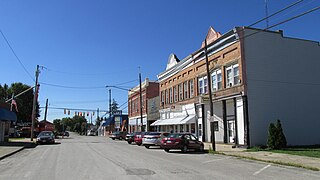
Laurelville is a village in Hocking County, Ohio, United States. The population was 512 at the 2020 census.

<span class="mw-page-title-main">Orient, Ohio</span> Census-designated place in Ohio, United States

Orient is a census-designated place and former village in Pickaway County, Ohio, United States. The population was 246 at the 2020 census.

<span class="mw-page-title-main">Mallory, West Virginia</span> Census-designated place in West Virginia, United States

Mallory is a census-designated place (CDP) in Logan County, West Virginia, United States. The population was 1,654 at the 2010 census. The CDP contains the unincorporated communities, from west to east, of Huff Junction, Mallory, Davin, Mineral City, Claypool, Combs Addition, and Gillman Bottom.

<span class="mw-page-title-main">Mount Gay-Shamrock, West Virginia</span> Census-designated place in West Virginia, United States

Mount Gay-Shamrock is a census-designated place (CDP) in Logan County, West Virginia, United States.

<span class="mw-page-title-main">Switzer, West Virginia</span> Census-designated place in West Virginia, United States

Switzer is an unincorporated community and census-designated place (CDP) in Logan County, West Virginia, United States. The CDP includes the neighboring unincorporated community of Micco. The total CDP population was 595 at the 2010 census.

<span class="mw-page-title-main">New Holland, Ohio</span> Village in Ohio, United States

New Holland is a village in Fayette and Pickaway counties in Ohio, United States. The population was 804 at the 2020 census.

<span class="mw-page-title-main">Loveland Park, Ohio</span> Census-designated place in Ohio, United States

Loveland Park is a census-designated place (CDP) located in Symmes Township, Hamilton County and Deerfield Township, Warren County, in the southwestern part of the U.S. state of Ohio. The CDP is named after the city of Loveland. The population was 1,737 at the 2020 census.

References

  1. "ArcGIS REST Services Directory". United States Census Bureau. Retrieved September 20, 2022.
  2. 1 2 U.S. Geological Survey Geographic Names Information System: Logan Elm Village, Ohio
  3. 1 2 "U.S. Census website". United States Census Bureau . Retrieved 2008-01-31.
  4. History of Franklin and Pickaway Counties, Ohio. Williams bros. 1880. p. 265.
  5. "Census of Population and Housing". Census.gov. Retrieved June 4, 2016.