Washington Prairie, Iowa | |
|---|---|
 Washington Prairie Location in Iowa | |
| Coordinates: 43°16′13″N91°36′50″W / 43.27028°N 91.61389°W | |
| Country | |
| State | |
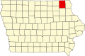
| County | Winneshiek County |
| Elevation | 1,217 ft (371 m) |
| Time zone | UTC-6 (CST) |
| • Summer (DST) | UTC-5 (CDT) |
| GNIS feature ID | 464056 [1] |
Washington Prairie is an unincorporated community in Winneshiek County, Iowa, in the United States.