Coordinates: 41°31′03″N124°01′01″W / 41.51750°N 124.01694°W

A geographic coordinate system is a coordinate system that enables every location on Earth to be specified by a set of numbers, letters or symbols. The coordinates are often chosen such that one of the numbers represents a vertical position and two or three of the numbers represent a horizontal position; alternatively, a geographic position may be expressed in a combined three-dimensional Cartesian vector. A common choice of coordinates is latitude, longitude and elevation. To specify a location on a plane requires a map projection.
| Waukell Flat | |
|---|---|
| Former settlement | |
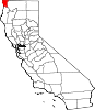
 Waukell Flat Location in California | |
| Coordinates: 41°31′03″N124°01′01″W / 41.51750°N 124.01694°W | |
| Country | United States |
| State | California |
| County | Del Norte County |
| Elevation [1] | 23 ft (7 m) |
Waukell Flat (formerly, Wakell Flat) [2] is a former settlement in Del Norte County, California. It was located on the south bank of the Klamath River 4.25 miles (6.8 km) from its mouth, [2] at an elevation of 23 feet (7 m). It still appeared on maps as of 1952.
Del Norte County is a county at the far northwest corner of the U.S. state of California, along the Pacific Ocean adjacent to the Oregon border. As of the 2010 census, the population was 28,610. The county seat and only incorporated city is Crescent City. Del Norte was pioneered and settled by Azorean Portuguese explorers and dairy farmers, which may account for the local pronunciation of the county name. Residents pronounce the county name as Del Nort, not Del Nor-teh as would be expected in Spanish.

California is a state in the Pacific Region of the United States. With 39.6 million residents, California is the most populous U.S. state and the third-largest by area. The state capital is Sacramento. The Greater Los Angeles Area and the San Francisco Bay Area are the nation's second- and fifth-most populous urban regions, with 18.7 million and 9.7 million residents respectively. Los Angeles is California's most populous city, and the country's second-most populous, after New York City. California also has the nation's most populous county, Los Angeles County, and its largest county by area, San Bernardino County. The City and County of San Francisco is both the country's second-most densely populated major city after New York City and the fifth-most densely populated county, behind only four of the five New York City boroughs.

The Klamath River flows 257 miles (414 km) through Oregon and northern California in the United States, emptying into the Pacific Ocean. By average discharge, the Klamath is the second largest river in California after the Sacramento River. It drains an extensive watershed of almost 16,000 square miles (41,000 km2) that stretches from the arid country of south-central Oregon to the temperate rainforest of the Pacific coast. Unlike most rivers, the Klamath begins in the high desert and flows toward the mountains – carving its way through the rugged Cascade Range and Klamath Mountains before reaching the sea. The upper basin, today used for farming and ranching, once contained vast freshwater marshes that provided habitat for abundant wildlife, including millions of migratory birds. Most of the lower basin remains wild, with much of it designated wilderness. The watershed is known for this peculiar geography, and the Klamath has been called "a river upside down" by National Geographic magazine.