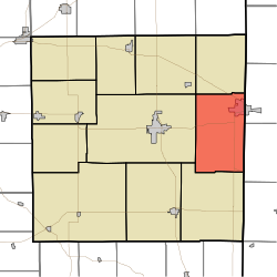
Wayne Township, Randolph County, Indiana

Last updated

Wayne Township
Map highlighting Wayne Township, Randolph County, Indiana.svg
Coordinates: 40°09′52″N84°51′22″W / 40.16444°N 84.85611°W / 40.16444; -84.85611
Country United States
State Indiana
County Randolph
Government
  Type Indiana township
Area
  Total
39.74 sq mi (102.9 km2)
  Land39.7 sq mi (103 km2)
  Water0.04 sq mi (0.10 km2)
Elevation
[1]
1,112 ft (339 m)
Population
 (2020) [2]
  Total
4,317
  Density109/sq mi (42.0/km2)
Time zone UTC-5 (Eastern (EST))
  Summer (DST) UTC-4 (EDT)
Area code 765
FIPS code 18-81890 [3]
GNIS feature ID 454039

Wayne Township is one of eleven townships in Randolph County, Indiana. As of the 2020 census, its population was 4,317 (down from 4,611 at 2010 [4] ) and it contained 2,109 housing units. [2]

Contents

History

Wayne Township was established in 1838. [5]

Geography

According to the 2010 census, the township has a total area of 39.74 square miles (102.9 km2), of which 39.7 square miles (103 km2) (or 99.90%) is land and 0.04 square miles (0.10 km2) (or 0.10%) is water. [4]

Cities and towns

Unincorporated towns

(This list is based on USGS data and may include former settlements.)

References

  1. "US Board on Geographic Names". United States Geological Survey. October 25, 2007. Retrieved January 31, 2008.
  2. 1 2 "Census Bureau profile: Wayne Township, Randolph County, Indiana". United States Census Bureau. May 2023. Retrieved April 6, 2024.
  3. "U.S. Census website". United States Census Bureau . Retrieved January 31, 2008.
  4. 1 2 "Population, Housing Units, Area, and Density: 2010 - County -- County Subdivision and Place -- 2010 Census Summary File 1". United States Census. Archived from the original on February 12, 2020. Retrieved May 10, 2013.
  5. Tucker, E. (1882). History of Randolph County, Indiana: With Illustrations and Biographical Sketches of Some of Its Prominent Men and Pioneers : to which are Appended Maps of Its Several Townships. A.L. Klingman. p.  49.