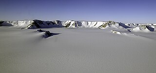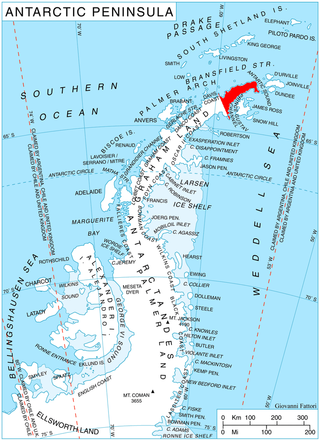
The Shackleton Range is a mountain range in Antarctica that rises to 1,875 metres (6,152 ft) and extends in an east–west direction for about 100 miles (160 km) between the Slessor and Recovery Glaciers.

The Byrd Glacier is a major glacier in Antarctica, about 136 km (85 mi) long and 24 km (15 mi) wide. It drains an extensive area of the Antarctic plateau, and flows eastward to discharge into the Ross Ice Shelf.
The Commonwealth Range is a north-south trending range of rugged mountains, 60 nautical miles long, located within the Queen Maud Mountains on the Dufek Coast of the continent of Antarctica. The range borders the eastern side of Beardmore Glacier from Keltie Glacier to the Ross Ice Shelf.

The Darwin Glacier is a large glacier in Antarctica. It flows from the polar plateau eastward between the Darwin Mountains and the Cook Mountains to the Ross Ice Shelf. The Darwin and its major tributary the Hatherton are often treated as one system, the Darwin–Hatherton.

Shackleton Glacier is a major Antarctic glacier, over 60 nautical miles long and from 5 to 10 nautical miles wide, descending from the Antarctic Plateau from the vicinity of Roberts Massif and flowing north through the Queen Maud Mountains to enter the Ross Ice Shelf between Mount Speed and Waldron Spurs. Discovered by the United States Antarctic Service (USAS) (1939–41) and named by the Advisory Committee on Antarctic Names (US-ACAN) for Sir Ernest Shackleton, British Antarctic explorer.
The Trojan Range is a mountain range rising to 2,760 metres (9,055 ft), extending northward from Mount Francais along the east side of Iliad Glacier, Anvers Island, in the Palmer Archipelago of the British Antarctic Territory. It was surveyed by the Falkland Islands Dependencies Survey (FIDS) in 1955 and named by the UK Antarctic Place-Names Committee (UK-APC) for the Trojans, one of the opposing sides in the Trojan War in Homer's Iliad.
On the continent of Antarctica, the Aramis Range is the third range south in the Prince Charles Mountains, situated 11 miles southeast of the Porthos Range and extending for about 30 miles in a southwest–northeast direction. It was first visited in January 1957 by Australian National Antarctic Research Expeditions (ANARE) southern party led by W.G. Bewsher, who named it for a character in Alexandre Dumas' novel The Three Musketeers, the most popular book read on the southern journey.
Beaufoy Ridge is a conspicuous black ridge, rising to 650 metres (2,130 ft) at its northwest end, standing at the west side of Sunshine Glacier and close north of Iceberg Bay on the south coast of Coronation Island, in the South Orkney Islands. It was named by the Falkland Islands Dependencies Survey, following their survey in 1948–49, after the cutter Beaufoy which, on 12 December 1821, under Michael McLeod, sailed to a position at least 60 nautical miles (110 km) west of the South Orkney Islands, where a chart annotation indicates that land was sighted, possibly Coronation Island.

Otter Highlands is a group of peaks and ridges extending northwest-southeast for 17 nautical miles from Mount Lowe to Wyeth Heights, located west of Blaiklock Glacier and forming the west end of the Shackleton Range. Surveyed by the Commonwealth Trans-Antarctic Expedition in 1957. Named by the United Kingdom Antarctic Place-Names Committee (UK-APC) in 1972 after the De Havilland Otter aircraft which supported the CTAE.
The Stratton Glacier is a glacier 20 nautical miles (37 km) long, flowing north from Pointer Nunatak and then northwest to the north of Mount Weston, in the Shackleton Range of Antarctica.
Guyatt Ridge is a ridge southwest of Wedge Ridge in the southern part of the Haskard Highlands, in the Shackleton Range, Antarctica. It was surveyed by the Commonwealth Trans-Antarctic Expedition, 1957, photographed from the air by the U.S. Navy, 1967, and further surveyed by the British Antarctic Survey (BAS), 1968–71. It was named by the UK Antarctic Place-Names Committee after Malcolm J. Guyatt, a BAS general assistant at Halley Station, 1969–71, who worked in the Shackleton Range, 1969–70.
Pointer Nunatak is a conspicuous nunatak, 1,245 m, immediately east of Wedge Ridge in the west part of the Shackleton Range. First mapped in 1957 by the Commonwealth Trans-Antarctic Expedition and so named because it is an important landmark on the route from Blaiklock Glacier to Stratton Glacier which provides access from the west to the east part of the Shackleton Range.
Moider Glacier is a glacier flowing west into the east side of Dalgliesh Bay, Pourquoi Pas Island, in Marguerite Bay, Antarctica. It was named by the UK Antarctic Place-Names Committee in 1979 in association with nearby Perplex Ridge; the word "moider" can be a synonym for "perplex".

The Haskard Highlands are a range of peaks and ridges between Blaiklock Glacier and Stratton Glacier in the northwest of the Shackleton Range, Antarctica, rising to 1,210 metres (3,970 ft) at Mount Weston and including features between Mount Provender and Pointer Nunatak. The highlands were first mapped in 1957 by the Commonwealth Trans-Antarctic Expedition, and photographed from the air by the U.S. Navy in 1967. They were surveyed by the British Antarctic Survey between 1968 and 1971, and named by the UK Antarctic Place-Names Committee in 1971 after Sir Cosmo Haskard, Governor of the Falkland Islands 1964–70.
The Knappane Peaks are a string of separated rock peaks just west of Nålegga Ridge, on the west side of Borg Massif in Queen Maud Land, Antarctica. They were mapped by Norwegian cartographers from surveys and air photos by the Norwegian–British–Swedish Antarctic Expedition (1949–52) and named Knappane.

Sjogren Glacier is a glacier 12.5 miles (20 km) long in the south part of Trinity Peninsula, flowing southeast from Detroit Plateau in between Aldomir Ridge and Hazarbasanov Ridge to enter Prince Gustav Channel at the head of Sjögren Inlet, west of Royak Point. Discovered in 1903 by the Swedish Antarctic Expedition under Nordenskjold. He named it Sjogren Fiord after a patron of the expedition. The true nature of the feature was determined by the Falkland Islands Dependencies Survey (FIDS) in 1945.

The Kent Plateau is an ice-covered plateau in the northern extreme of the Churchill Mountains of Antarctica.

Read Mountains is a group of rocky summits, the highest being Holmes Summit at 1,875 metres (6,152 ft), lying east of Glen Glacier in the south-central part of the Shackleton Range.
Robb Glacier is a glacier about 40 nautical miles (70 km) long that flows through the Ross Dependency to enter the west coast of the Ross Ice Shelf in Antarctica.

Ramorino Glacier is the 4.5 nautical miles long glacier situated northwest of upper Crosswell Glacier and southeast of Cervellati Glacier on the east slope of Sentinel Range in the Ellsworth Mountains, Antarctica. It flows northeastwards between Epperly Ridge and Shinn Ridge, and enters Crosswell Glacier northwest of Mount Segers. The feature was named by US-ACAN in 2006 after Maria Chiara Ramorino, manager of the Italian team that compiled and promulgated the SCAR Composite Gazetteer of Antarctica, 1998–2006.


