Weißdorf | |
|---|---|
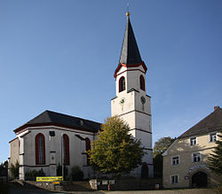 Lutheran Church of Saint Mary | |
 Coat of arms | |
Location of Weißdorf within Hof district  | |
 Weißdorf  Weißdorf | |
| Coordinates: 50°10′N11°50′E / 50.167°N 11.833°E | |
| Country | Germany |
| State | Bavaria |
| Admin. region | Oberfranken |
| District | Hof |
| Municipal assoc. | Sparneck |
| Subdivisions | 7 Ortsteile |
| Government | |
| • Mayor (2020–26) | Heiko Hain [1] |
| Area | |
• Total | 21.90 km2 (8.46 sq mi) |
| Elevation | 532 m (1,745 ft) |
| Population (2023-12-31) [2] | |
• Total | 1,216 |
| • Density | 56/km2 (140/sq mi) |
| Time zone | UTC+01:00 (CET) |
| • Summer (DST) | UTC+02:00 (CEST) |
| Postal codes | 95237 |
| Dialling codes | 09251 |
| Vehicle registration | HO |
| Website | www.weissdorf.de |
Weißdorf is a municipality in Upper Franconia in the district of Hof in Bavaria in Germany. It lies on the Saale River.
