Welty | |
|---|---|
 Welty Fire Dept, July 2025 | |
 Welty Location within the state of Oklahoma  Welty Welty (the United States) | |
| Coordinates: 35°37′09″N96°24′47″W / 35.61917°N 96.41306°W | |
| Country | United States |
| State | Oklahoma |
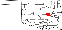
| County | Okfuskee |
| Area | |
• Total | 2.39 sq mi (6.19 km2) |
| • Land | 2.37 sq mi (6.14 km2) |
| • Water | 0.019 sq mi (0.05 km2) |
| Elevation | 715 ft (218 m) |
| Population (2020) | |
• Total | 131 |
| • Density | 55.3/sq mi (21.34/km2) |
| Time zone | UTC-6 (Central (CST)) |
| • Summer (DST) | UTC-5 (CDT) |
| FIPS code | 40-80000 |
| GNIS feature ID | 2805361 [2] |
Welty is an unincorporated community in Okfuskee County, Oklahoma, United States. [2] Named for the town developer, Edwin A. Welty, its post office was established October 12, 1905, with Jerimiah D. Wilson as the first postmaster.[ citation needed ]
Welty is south of Bristow and north of Castle on the west side of Oklahoma State Highway 48 off E 960 Rd. [3]
Okemah Lake, southeast of town, [3] features swimming, boating, hunting, fishing, and camping. [4]