West Augusta, Virginia

Last updated

West Augusta, Virginia
Unincorporated community
2016-05-19 16 52 52 View east along Shenandoah Mountain Road (U.S. Route 250) in West Augusta, Augusta County, Virginia.jpg
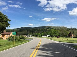
View east along US 250 entering West Augusta
USA Virginia location map.svg
Red pog.svg
West Augusta, Virginia
Usa edcp location map.svg
Red pog.svg
West Augusta, Virginia
Coordinates: 38°16′12″N79°18′28″W / 38.27000°N 79.30778°W / 38.27000; -79.30778
CountryUnited States
State Virginia
County Augusta
Elevation
1,890 ft (580 m)
Time zone UTC−5 (Eastern (EST))
  Summer (DST) UTC−4 (EDT)
ZIP code
24485
Area code 540
GNIS feature ID1500293 [1]

West Augusta is an unincorporated community in Augusta County, Virginia, United States. West Augusta is located at the intersection of U.S. Route 250 and Virginia State Route 629. [2] The source of the Calfpasture River, which flows through West Augusta, is located near the community to the north. [3]

Climate

The climate in this area is characterized by hot, humid summers and generally mild to cool winters. According to the Köppen Climate Classification system, West Augusta has a humid subtropical climate, abbreviated "Cfa" on climate maps. [4]

References

  1. "West Augusta". Geographic Names Information System . United States Geological Survey, United States Department of the Interior.
  2. "West Augusta, Virginia" (Map). Google Maps . Retrieved December 15, 2012.
  3. "Calfpasture River". Geographic Names Information System . United States Geological Survey, United States Department of the Interior.
  4. Climate Summary for West Augusta, Virginia