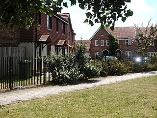
Kidbrooke is an area of south-east London, England, in the Royal Borough of Greenwich 7+1⁄2 miles (12 km) south-east of Charing Cross and north west of Eltham.
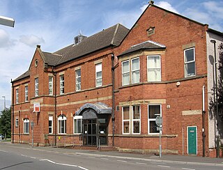
Staveley is a town and civil parish in the Borough of Chesterfield, Derbyshire, England. Located along the banks of the River Rother. It is northeast of Chesterfield, west of Clowne, northwest of Bolsover, southwest of Worksop and southeast of Sheffield.
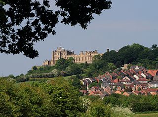
Bolsover is a market town and the administrative centre of the Bolsover District, Derbyshire, England. It is 18 miles (29 km) from Sheffield, 26 miles (42 km) from Nottingham and 27 miles (43 km) from Derby. It is the main town in the Bolsover district.

Pleasley is a village and civil parish with parts in both Derbyshire and Nottinghamshire. It lies between Chesterfield and Mansfield, 5 miles (8 km) south east of Bolsover, Derbyshire, England and 2.5 miles (4 km) north west of Mansfield, Nottinghamshire. The River Meden, which forms the county boundary in this area, runs through the village.
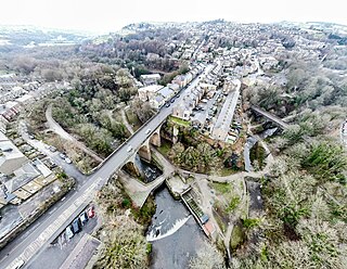
New Mills is a town in the Borough of High Peak, Derbyshire, England, 8 miles (13 km) south-east of Stockport and 13 miles (21 km) from Manchester at the confluence of the River Goyt and Sett. It is close to the border with Cheshire and above the Torrs, a 70 feet (21 m) deep gorge cut through carboniferous sandstone, on the north-western edge of the Peak District National Park.

Bolsover District is a local government district in Derbyshire, England. It is named after the town of Bolsover, which is near the geographic centre of the district, but the council is based in the large village of Clowne to the north. The district also includes the town of Shirebrook and several villages and surrounding rural areas.

Whaley Bridge is a town and civil parish in the High Peak district of Derbyshire, England. It is situated on the River Goyt, 16 miles (26 km) south-east of Manchester, 7 miles (11 km) north of Buxton, 9 miles (14 km) north-east of Macclesfield and 28 miles (45 km) west of Sheffield. It had a population of 6,455 at the 2011 census, including Furness Vale, Horwich End, Bridgemont, Fernilee, Stoneheads and Taxal.

Shirebrook is a town and civil parish in the Bolsover District of Derbyshire, England. It had a population of 13,300 at the 2021 Census. The town is on the B6407 road and close to the A632 road which runs between the towns of Mansfield, Worksop and Bolsover. The town is close to the Bassetlaw and Mansfield Districts of Nottinghamshire.
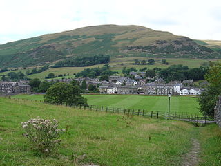
Sedbergh is a town and civil parish in the ceremonial county of Cumbria. It falls within the historic boundaries of the West Riding of Yorkshire. Since April 2023, it has been administered by Westmorland and Furness local authority. The 2001 census gave the parish a population of 2,705, increasing at the 2011 census to 2,765. It lies about 10 miles (16 km) east of Kendal, 28 miles (45 km) north of Lancaster and about 10 miles (16 km) north of Kirkby Lonsdale, within the Yorkshire Dales National Park. It stands at the foot of Howgill Fells, on the north bank of the River Rawthey, which joins the River Lune 2 miles (3 km) below the town.

South Normanton is a village and civil parish in the Bolsover District of Derbyshire, England. The population at the 2011 Census was 9,445. An ex-mining village, it is two miles east of Alfreton. The historic industries of the village were agriculture, stocking, spinning and mining. Normanton means 'the farm of the north men' or 'Northwegans'.

Clowne is a town and civil parish in the Bolsover district of Derbyshire, England. The population was 7,590 at the 2011 Census and 7,755 at the 2021 Census. It lies 9 miles (14 km) north east of Chesterfield and 7 miles (11 km) south west of Worksop and is mentioned in the Domesday Book as Clune. The name is derived from the Celtic Clun for a river.

The Buxton line is a railway line in Northern England, connecting Manchester with Buxton in Derbyshire. Passenger services on the line are currently operated by Northern Trains.

Glapwell is a rural village and civil parish on the A617 road in the Bolsover District of north-east Derbyshire, The village is at the top of a steep hill at an elevation of 176m, on the western edge of the Southern Magnesian Limestone] overlooking the valley of the River Doe Lea. It lies between Chesterfield, Mansfield, and Bolsover, and had a population of 1,503 at the 2011 Census.

Darley Abbey is a former historic mill village, now a suburb of the city of Derby, in the ceremonial county of Derbyshire, England. It is located approximately 1.4 miles (2.3 km) north of the city centre, on the west bank of the River Derwent, and forms part of the Darley ward along with Little Chester and the West End. The settlement dates back to the medieval era, when it was the site of an Augustinian monastery. In the 18th century, the Evans family developed their planned industrial mill village in the area; Darley Abbey is now part of the Derwent Valley Mills World Heritage Site.

Newton is a village in the civil parish of Blackwell, in the Bolsover district of Derbyshire, England, about a mile south of Tibshelf.

Astwith is a village in Derbyshire, England. Astwith is in the parish of Ault Hucknall. For many decades it was a part of the manor of Stainsby, which was known as Steinesbei in the Domesday survey (1087).

Nether Langwith is a village and civil parish, in the Bassetlaw district of Nottinghamshire, England. It is located 9 miles (14 km) east of Chesterfield and 8 miles (13 km) south west of Worksop. Nether Langwith lies east of the adjoining village, Langwith, which is in the district of Bolsover in Derbyshire, England. It is 527 hectares in size and lies on the banks of the River Poulter. The population at the 2011 census was 526, decreasing to 478 in 2021.

Langwith is a close group of six villages crossing the Derbyshire-Nottinghamshire border, on the River Poulter about 2 miles (3.2 km) from Warsop, and about 4 miles (6.4 km) from Bolsover on the A632 road, south of Whaley Thorns. The population is listed under the Derbyshire civil parish of Langwith and the Nottinghamshire civil parish of Nether Langwith.

Whaley Thorns is a former colliery village in the Bolsover district of Derbyshire, England, close to the Nottinghamshire border. Whaley Thorns lies just north of Nether Langwith and Langwith, 1.5 miles (2.4 km) south-east of Creswell, and west of Cuckney. It is in the civil parish of Langwith.

Old Bolsover is a civil parish in Bolsover District, Derbyshire, England. It includes the town of Bolsover and the villages of Carr Vale, Shuttlewood, Stanfree, Bentinck and Whaley.


