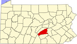
Wheatfield Township, Pennsylvania | |
---|---|
Country | United States |
State | Pennsylvania |
County | Perry |
Settled | 1760 |
Incorporated | 1826 |
Area | |
• Total | 20.98 sq mi (54.33 km2) |
• Land | 20.80 sq mi (53.88 km2) |
• Water | 0.17 sq mi (0.45 km2) |
Population | |
• Total | 3,194 |
• Estimate (2021) [2] | 3,195 |
• Density | 158.91/sq mi (61.36/km2) |
Time zone | UTC-5 (Eastern (EST)) |
• Summer (DST) | UTC-4 (EDT) |
Area code | 717 |
FIPS code | 42-099-84368 |
Wheatfield Township is a township in Perry County, Pennsylvania, United States. The population was 3,194 at the 2020 census. [2]
The Dellville Covered Bridge was added to the National Register of Historic Places in 1980. [3]
According to the United States Census Bureau, the township has a total area of 21.1 square miles (54.6 km2), of which, 20.9 square miles (54.2 km2) is land and 0.2 square mile (0.4 km2) (0.76%) is water.
Census | Pop. | Note | %± |
---|---|---|---|
2010 | 3,334 | — | |
2020 | 3,194 | −4.2% | |
2021 (est.) | 3,195 | [2] | 0.0% |
U.S. Decennial Census [4] |
As of the census [5] of 2000, there were 3,329 people, 1,206 households, and 943 families residing in the township. The population density was 159.2 inhabitants per square mile (61.5/km2). There were 1,283 housing units at an average density of 61.4 per square mile (23.7/km2). The racial makeup of the township was 99.16% White, 0.12% African American, 0.03% Native American, 0.21% Asian, 0.06% from other races, and 0.42% from two or more races. Hispanic or Latino of any race were 0.72% of the population.
There were 1,206 households, out of which 36.9% had children under the age of 18 living with them, 67.3% were married couples living together, 6.8% had a female householder with no husband present, and 21.8% were non-families. 17.9% of all households were made up of individuals, and 5.1% had someone living alone who was 65 years of age or older. The average household size was 2.75 and the average family size was 3.11.
In the township the population was spread out, with 27.5% under the age of 18, 7.0% from 18 to 24, 32.5% from 25 to 44, 25.3% from 45 to 64, and 7.8% who were 65 years of age or older. The median age was 36 years. For every 100 females there were 102.1 males. For every 100 females age 18 and over, there were 102.4 males.
The median income for a household in the township was $44,010, and the median income for a family was $53,661. Males had a median income of $35,811 versus $26,500 for females. The per capita income for the township was $18,639. About 5.4% of families and 7.7% of the population were below the poverty line, including 9.5% of those under age 18 and 12.5% of those age 65 or over.
Huntington Township is a rural township which is located in Adams County, Pennsylvania, United States. The population was 2,369 at the time of the 2010 census.
Latimore Township is a township in Adams County, Pennsylvania, United States. The population was 2,580 at the 2010 census.
Mount Pleasant Township is a township that is located in Adams County, Pennsylvania, United States. As of the 2010 census, the township population was 4,693.
Gibson Township is a township in Cameron County, Pennsylvania, United States. The population was 178 at the 2020 census, up from 164 in 2010, which in turn was a decline from the figure of 222 in 2000.
Middlesex Township is a township located in Cumberland County, Pennsylvania, United States. As of the 2010 census, the township had a total population of 7,040.
Barnett Township is a township in Forest County, Pennsylvania, United States. The population was 308 at the 2020 census, down from 361 in 2010.
East Wheatfield Township is a township in Indiana County, Pennsylvania, United States. East Wheatfield Township was created when the original Wheatfield Township was divided in 1859 into East and West Wheatfield. It was named for the large unforested areas naturally occurring there which were ideal for growing wheat. The population was 2,161 at the 2020 census, a decline from the figure of 2,366 tabulated in 2010. It includes the communities of Boltz, Cramer, Gas Center, Ninevah, Robindale, Shoupstown, Virginia, and Wheatfield. It surrounds, but does not include, the borough of Armagh.
Barnett Township is a township in Jefferson County, Pennsylvania, United States. The population was 231 at the 2020 census down from 254 at the 2010 census. It was named for Jefferson County pioneer Joseph Barnett.
Greenwood Township is a township in Juniata County, Pennsylvania, United States. The population was 533 at the 2020 census, an increase over the figure of 617 tabulated in 2010.
Deer Creek Township is a township in Mercer County, Pennsylvania, United States. The population was 456 at the 2020 census, a decline from the figure of 502 in 2010.
Lake Township is a township in Mercer County, Pennsylvania, United States. The population was 702 at the 2020 census, a decline from the figure of 780 in 2010.
New Vernon Township is a township in Mercer County, Pennsylvania, United States. The population was 492 at the 2020 census, down from 504 in 2010.
Greenwood Township is a township in Perry County, Pennsylvania, United States. The population was 1,032 at the 2020 census.
Howe Township is a township in Perry County, Pennsylvania, United States. The population was 375 at the 2020 census.
Oliver Township is a township in Perry County, Pennsylvania, United States. The population was 2,046 at the 2020 census.
Penn Township is a township in Perry County, Pennsylvania, United States. The population was 3,112 at the 2020 census.
Beaver Township is a township in Snyder County, Pennsylvania, United States. The population was 508 at the 2020 census.
Bloss Township is a township in Tioga County, Pennsylvania, United States. The population was 344 at the 2020 census.
Covington Township is a township in Tioga County, Pennsylvania, United States. The population was 1,031 at the 2020 census.
Pine Grove Township is a township in Warren County, Pennsylvania, United States. As of the 2020 census, the township population was 2,603, down from 2,965 at the 2010 census.