Wheatland Township | |
|---|---|
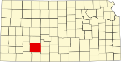
 Location in Ford County | |
| Coordinates: 37°49′00″N099°37′29″W / 37.81667°N 99.62472°W | |
| Country | United States |
| State | Kansas |
| County | Ford |
| Area | |
• Total | 74.39 sq mi (192.68 km2) |
| • Land | 74.39 sq mi (192.68 km2) |
| • Water | 0 sq mi (0 km2) 0% |
| Elevation | 2,316 ft (706 m) |
| Population (2000) | |
• Total | 170 |
| • Density | 2.3/sq mi (0.9/km2) |
| GNIS feature ID | 0473534 |
Wheatland Township is a township in Ford County, Kansas, United States. As of the 2000 census, its population was 170.