Bellefont, Kansas | |
|---|---|
 | |
 Bellefont  Bellefont | |
| Coordinates: 37°52′21″N99°39′28″W / 37.87250°N 99.65778°W [1] | |
| Country | United States |
| State | Kansas |
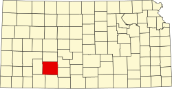
| County | Ford |
| Founded | 1870s |
| Elevation | 2,356 ft (718 m) |
| Time zone | UTC-6 (CST) |
| • Summer (DST) | UTC-5 (CDT) |
| Area code | 620 |
| FIPS code | 20-05450 |
| GNIS ID | 473745 [1] |
Bellefont is an unincorporated community in Ford County, Kansas, United States. [1] It is located along Highway 50.