Ford, Kansas | |
---|---|
Coordinates: 37°38′12″N99°45′14″W / 37.63667°N 99.75389°W [1] | |
Country | United States |
State | Kansas |
County | Ford |
Founded | 1885 |
Incorporated | 1887 |
Named for | Col. James Hobart Ford |
Area | |
• Total | 0.42 sq mi (1.10 km2) |
• Land | 0.42 sq mi (1.10 km2) |
• Water | 0.00 sq mi (0.00 km2) |
Elevation | 2,398 ft (731 m) |
Population | |
• Total | 203 |
• Density | 480/sq mi (180/km2) |
Time zone | UTC-6 (CST) |
• Summer (DST) | UTC-5 (CDT) |
ZIP code | 67842 |
Area code | 620 |
FIPS code | 20-23725 |
GNIS ID | 2394785 [1] |
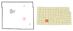
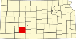
Ford is a city in Ford County, Kansas, United States. [1] As of the 2020 census, the population of the city was 203. [3]
Ford was founded around 1885. [4] It was named for Col. James Hobart Ford, a notable Union colonel and brevet brigadier general during the American Civil War. [5]
The first post office in Ford was established in February 1885. [6]
According to the United States Census Bureau, the city has a total area of 0.42 square miles (1.09 km2), all land. [7]
Census | Pop. | Note | %± |
---|---|---|---|
1890 | 148 | — | |
1900 | 82 | −44.6% | |
1910 | 205 | 150.0% | |
1920 | 272 | 32.7% | |
1930 | 382 | 40.4% | |
1940 | 296 | −22.5% | |
1950 | 244 | −17.6% | |
1960 | 252 | 3.3% | |
1970 | 246 | −2.4% | |
1980 | 272 | 10.6% | |
1990 | 247 | −9.2% | |
2000 | 314 | 27.1% | |
2010 | 216 | −31.2% | |
2020 | 203 | −6.0% | |
U.S. Decennial Census |
The 2020 United States census counted 203 people, 86 households, and 54 families in Ford. [8] [9] The population density was 479.9 per square mile (185.3/km2). There were 115 housing units at an average density of 271.9 per square mile (105.0/km2). [9] [10] The racial makeup was 86.7% (176) white or European American (83.74% non-Hispanic white), 0.0% (0) black or African-American, 0.99% (2) Native American or Alaska Native, 0.0% (0) Asian, 0.0% (0) Pacific Islander or Native Hawaiian, 0.0% (0) from other races, and 12.32% (25) from two or more races. [11] Hispanic or Latino of any race was 10.34% (21) of the population. [12]
Of the 86 households, 29.1% had children under the age of 18; 43.0% were married couples living together; 27.9% had a female householder with no spouse or partner present. 29.1% of households consisted of individuals and 17.4% had someone living alone who was 65 years of age or older. [9] The average household size was 2.4 and the average family size was 2.9. [13] The percent of those with a bachelor’s degree or higher was estimated to be 11.3% of the population. [14]
26.1% of the population was under the age of 18, 4.4% from 18 to 24, 28.1% from 25 to 44, 22.2% from 45 to 64, and 19.2% who were 65 years of age or older. The median age was 37.9 years. For every 100 females, there were 101.0 males. [9] For every 100 females ages 18 and older, there were 105.5 males. [9]
The 2016-2020 5-year American Community Survey estimates show that the median household income was $57,500 (with a margin of error of +/- $25,887) and the median family income was $70,938 (+/- $16,809). [15] Males had a median income of $40,000 (+/- $21,183) versus $33,750 (+/- $13,201) for females. The median income for those above 16 years old was $36,563 (+/- $13,542). [16] Approximately, 0.0% of families and 2.8% of the population were below the poverty line, including 0.0% of those under the age of 18 and 14.3% of those ages 65 or over. [17] [18]
As of the census [19] of 2010, there were 216 people, 96 households, and 59 families residing in the city. The population density was 514.3 inhabitants per square mile (198.6/km2). There were 120 housing units at an average density of 285.7 per square mile (110.3/km2). The racial makeup of the city was 87.0% White, 0.5% African American, 3.7% Native American, 6.9% from other races, and 1.9% from two or more races. Hispanic or Latino of any race were 8.3% of the population.
There were 96 households, of which 25.0% had children under the age of 18 living with them, 44.8% were married couples living together, 12.5% had a female householder with no husband present, 4.2% had a male householder with no wife present, and 38.5% were non-families. 33.3% of all households were made up of individuals, and 10.5% had someone living alone who was 65 years of age or older. The average household size was 2.25 and the average family size was 2.88.
The median age in the city was 44.1 years. 20.4% of residents were under the age of 18; 6% were between the ages of 18 and 24; 26.3% were from 25 to 44; 31.5% were from 45 to 64; and 15.7% were 65 years of age or older. The gender makeup of the city was 50.0% male and 50.0% female.
As of the census [20] of 2000, there were 314 people, 111 households, and 87 families residing in the city. The population density was 748.3 inhabitants per square mile (288.9/km2). There were 121 housing units at an average density of 288.4 per square mile (111.4/km2). The racial makeup of the city was 94.90% White, 0.32% Native American, 3.50% from other races, and 1.27% from two or more races. Hispanic or Latino of any race were 10.51% of the population.
There were 111 households, out of which 36.0% had children under the age of 18 living with them, 67.6% were married couples living together, 4.5% had a female householder with no husband present, and 21.6% were non-families. 20.7% of all households were made up of individuals, and 7.2% had someone living alone who was 65 years of age or older. The average household size was 2.83 and the average family size was 3.26.
In the city, the population was spread out, with 30.3% under the age of 18, 9.6% from 18 to 24, 30.3% from 25 to 44, 19.7% from 45 to 64, and 10.2% who were 65 years of age or older. The median age was 31 years. For every 100 females, there were 113.6 males. For every 100 females age 18 and over, there were 112.6 males.
The median income for a household in the city was $34,545, and the median income for a family was $36,346. Males had a median income of $27,917 versus $11,944 for females. The per capita income for the city was $15,037. About 8.7% of families and 9.7% of the population were below the poverty line, including 12.8% of those under age 18 and none of those age 65 or over.
Ford is a part of USD 459 Bucklin. The Bucklin High School mascot is Bucklin Red Aces. [21]
Ford High School was closed in school unification. The Ford Bulldogs [22] won the Kansas State High School boys class BB Track & Field championship in 1964 and 1966. [23]
Leon is a city in Butler County, Kansas, United States. As of the 2020 census, the population of the city was 669.
Glasco is a city in Cloud County, Kansas, United States. As of the 2020 census, the population of the city was 441.
Hepler is a city in Crawford County, Kansas, United States. As of the 2020 census, the population of the city was 90.
McCune is a city in Crawford County, Kansas, United States. As of the 2020 census, the population of the city was 370.
Mulberry is a city in Crawford County, Kansas, United States. As of the 2020 census, the population of the city was 409.
Bucklin is a city in Ford County, Kansas, United States. As of the 2020 census, the population of the city was 727. It is located along U.S. Route 54 highway.
Gove City, more commonly known as Gove, is a city in and the county seat of Gove County, Kansas, United States. As of the 2020 census, the population of the city was 80.
Harper is a city in Harper County, Kansas, United States. As of the 2020 census, the population of the city was 1,313.
Hoyt is a city in Jackson County, Kansas, United States. As of the 2020 census, the population of the city was 593.
Kingman is a city in and the county seat of Kingman County, Kansas, United States. As of the 2020 census, the population of the city was 3,105.
Meade is a city in and the county seat of Meade County, Kansas, United States. As of the 2020 census, the population of the city was 1,505.
Ness City is a city in and the county seat of Ness County, Kansas, United States. As of the 2020 census, the population of the city was 1,329. Ness City is famous for its four-story Old Ness County Bank Building located downtown and nicknamed Skyscraper of the Plains.
Lyndon is a city in and the county seat of Osage County, Kansas, United States. As of the 2020 census, the population of the city was 1,037.
Belleville is a city in and the county seat of Republic County, Kansas, United States. As of the 2020 census, the population of the city was 2,007.
Andale is a city in Sedgwick County, Kansas, United States. As of the 2020 census, the population of the city was 941.
Mount Hope is a city in Sedgwick County, Kansas, United States. As of the 2020 census, the population of the city was 806.
Mayfield is a city in Sumner County, Kansas, United States. As of the 2020 census, the population of the city was 75.
Alta Vista is a city in Wabaunsee County, Kansas, United States. As of the 2020 census, the population of the city was 409.
Haddam is a city in Washington County, Kansas, United States. It is named after Haddam, Connecticut. As of the 2020 census, the population of the city was 110.
Fort Dodge is a census-designated place (CDP) in Grandview Township, Ford County, Kansas, United States. As of the 2020 census, the population was 97. It is located on U.S. Route 400 5 miles (8 km) southeast of Dodge City. Fort Dodge has a post office with ZIP code 67843.