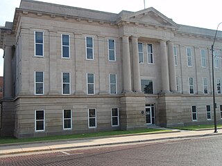
Ford County is a county located in the U.S. state of Kansas. Its county seat and most populous city is Dodge City. As of the 2020 census, its population was 34,287. The county was named in honor of James Ford, a brevet brigadier general during the American Civil War.

Ford is a city in Ford County, Kansas, United States. As of the 2020 census, the population of the city was 203.

Silverdale is an unincorporated community in Silverdale Township, Cowley County, Kansas, United States. As of the 2020 census, the population of the community and nearby areas was 61.

Bloom is an unincorporated community in Ford County, Kansas, United States. Its post office closed in 1992. At a 2018 estimate, the community had a population of 94.

Holland is an unincorporated community in Dickinson County, Kansas, United States.

Windhorst is an unincorporated community in Ford County, Kansas, United States. It is located in a rural area southeast of Spearville and northeast of Ford.
Fort Dodge is an unincorporated community in Grandview Township, Ford County, Kansas, United States. As of the 2020 census, the population of the community and nearby areas was 97. It is located on U.S. Route 400 5 miles (8 km) southeast of Dodge City. Fort Dodge has a post office with ZIP code 67843.

Plymell is an unincorporated community in Finney County, Kansas, United States. It is located on U.S. Route 83, 11 miles (18 km) south of Garden City.
Ravanna is a ghost town in Finney County, Kansas, United States. It is located approximately 30 miles (48 km) east-northeast of Garden City.

Odin is an unincorporated community in Barton County, Kansas, United States. As of the 2020 census, the population of the community and nearby areas was 87. It is located northwest of Claflin at the intersection of NE 140 Rd and NE 90 Ave.
Bellefont is an unincorporated community in Ford County, Kansas, United States.
Charleston is an unincorporated community in Gray County, Kansas, United States.
Moray is an unincorporated community in Doniphan County, Kansas, United States.
Peoria is an unincorporated community in Franklin County, Kansas, United States.
Midway is an unincorporated community in Crawford County, Kansas, United States.

Norwood is a ghost town in north Franklin County, Kansas, United States. It is located approximately 1.25 miles (2.01 km) east of U.S. Route 59 on Stafford Rd, and 2 miles (3.2 km) south of the Franklin-Douglas county line.
Homewood is an unincorporated community in Franklin County, Kansas, United States.
Centropolis is an unincorporated community in Franklin County, Kansas, United States. As of the 2020 census, the population of the community and nearby areas was 100. It is located about 11 miles northwest of Ottawa. In the 1850s, Centropolis had the distinction of briefly vying for territorial capital of Kansas.

Thrall is a ghost town in Greenwood County, Kansas, United States.
Boyle is an unincorporated community in Jefferson County, Kansas, United States.


