White Bear Lake Township, Pope County, Minnesota

Last updated
White Bear Lake Township, Minnesota
USA Minnesota location map.svg
Red pog.svg
White Bear Lake Township, Minnesota
Location within the state of Minnesota
Usa edcp location map.svg
Red pog.svg
White Bear Lake Township, Minnesota
White Bear Lake Township, Minnesota (the United States)
Coordinates: 45°37′53″N95°34′14″W / 45.63139°N 95.57056°W / 45.63139; -95.57056 Coordinates: 45°37′53″N95°34′14″W / 45.63139°N 95.57056°W / 45.63139; -95.57056
Country United States
State Minnesota
County Pope
Area
  Total34.6 sq mi (89.6 km2)
  Land32.7 sq mi (84.8 km2)
  Water1.9 sq mi (4.8 km2)
Elevation
1,280 ft (390 m)
Population
 (2000)
  Total440
  Density13.4/sq mi (5.2/km2)
Time zone UTC-6 (Central (CST))
  Summer (DST) UTC-5 (CDT)
FIPS code 27-69952 [1]
GNIS feature ID0665982 [2]

White Bear Lake Township is a township in Pope County, Minnesota, United States. The population was 440 at the 2000 census.

Contents

The township was named for White Bear, an Ojibwe chief, who is buried there near a lake shore. [3]

History

The township was surveyed in 1866 and organized in 1869. The Wadsworth Trail from St. Cloud, Minnesota to Fort Wadsworth ran through the township. [4]

White Bear Lake Township contains the city of Starbuck, Minnesota.

Geography

According to the United States Census Bureau, the township has a total area of 34.6 square miles (89.6 km2), of which 32.7 square miles (84.8 km2) is land and 1.9 square miles (4.8 km2) (5.38%) is water.

Demographics

As of the census [1] of 2000, there were 440 people, 162 households, and 131 families residing in the township. The population density was 13.4 people per square mile (5.2/km2). There were 234 housing units at an average density of 7.1/sq mi (2.8/km2). The racial makeup of the township was 99.32% White and 0.68% from two or more races. Hispanic or Latino of any race were 0.23% of the population.

There were 162 households, out of which 37.0% had children under the age of 18 living with them, 75.3% were married couples living together, 1.9% had a female householder with no husband present, and 19.1% were non-families. 18.5% of all households were made up of individuals, and 9.9% had someone living alone who was 65 years of age or older. The average household size was 2.69 and the average family size was 3.07.

In the township the population was spread out, with 28.0% under the age of 18, 4.3% from 18 to 24, 25.0% from 25 to 44, 26.4% from 45 to 64, and 16.4% who were 65 years of age or older. The median age was 43 years. For every 100 females, there were 110.5 males. For every 100 females age 18 and over, there were 109.9 males.

The median income for a household in the township was $46,250, and the median income for a family was $49,583. Males had a median income of $29,688 versus $21,250 for females. The per capita income for the township was $18,864. About 7.3% of families and 6.3% of the population were below the poverty line, including 2.7% of those under the age of 18 and 18.8% of those 65 and older.

Related Research Articles

<span class="mw-page-title-main">Pope County, Minnesota</span> County in Minnesota, United States

Pope County is a county in the U.S. state of Minnesota. As of the 2020 census, the population was 11,308. Its county seat is Glenwood. The county was formed in 1862 and organized in 1866.

Blackhoof Township is a township in Carlton County, Minnesota, United States. The population was 753 as of the 2000 census. The township took its name from the Blackhoof River.

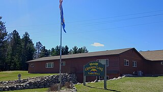
Bungo Township is a township in Cass County, Minnesota, United States. The population was 111 as of the 2000 census. Bungo Township was named for the family of George Bonga.

<span class="mw-page-title-main">Crooked Lake Township, Cass County, Minnesota</span> Township in Minnesota, United States

Crooked Lake Township is a township in Cass County, Minnesota, United States. The population was 498 as of the 2000 census. It is named after Roosevelt Lake, formerly known as Crooked Lake, a large lake located in this township. Crooked Lake is a translation from the Ojibwe Wewaagigamaag-zaaga'igan.

<span class="mw-page-title-main">Eglon Township, Clay County, Minnesota</span> Township in Minnesota, United States

Eglon Township is a township in Clay County, Minnesota, United States. The population was 440 at the 2000 census.

Walnut Lake Township is a township in Faribault County, Minnesota, United States. The population was 251 at the 2000 census.

Eagle Lake Township is a township in Otter Tail County, Minnesota, United States. The population was 367 at the 2000 census.

Grove Lake Township is a township in Pope County, Minnesota, United States. The population was 268 at the 2000 census.

Lake Johanna Township is a township in Pope County, Minnesota, United States. The population was 151 at the 2000 census.

Minnewaska Township is a township in Pope County, Minnesota, United States. The population was 504 at the 2000 census.

Reno Township is a township in Pope County, Minnesota, United States. The population was 355 at the 2000 census.

Westport Township is a township in Pope County, Minnesota, United States. The population was 279 at the 2000 census. It contains the village of Westport, Minnesota.

White Bear Township is an urban township in Ramsey County, Minnesota, United States. The population was 10,949 at the 2010 census. White Bear Township was organized in 1858, and named after its White Bear Lake. Over the years, the cities of White Bear Lake, Vadnais Heights, Gem Lake, and North Oaks were carved out of the township's original 36 square miles (93 km2). It now comprises four discontiguous parcels over an area of 9.3 square miles (24 km2). It is the only remaining township in Ramsey County. The unincorporated communities of Bald Eagle and Bellaire are located in the township.

Lake Township is a township in Roseau County, Minnesota, United States. The population was 2,087 at the 2000 census. This township was originally called Algoma Township, which bears a name of Indian derivation, "formed by Schoolcraft from Algonquin and goma meaning 'Algonquin waters.' It designates a large district in Canada, bordering Lakes Huron and Superior. The name was changed sometime between 1954 and 1965.

Breitung Township is a township in Saint Louis County, Minnesota, United States. The population was 605 at the 2010 census.

French Township is a township in Saint Louis County, Minnesota, United States. The population was 567 at the 2010 census.

Morse Township is a township in Saint Louis County, Minnesota, United States. The population was 1,213 at the 2010 census.

Waasa Township is a township in Saint Louis County, Minnesota, United States. The population was 249 at the 2010 census.

Lake George Township is a township in Stearns County, Minnesota, United States. The population was 335 at the 2010 census.

Fawn Lake Township is a township in Todd County, Minnesota, United States. The population was 440 at the 2000 census.

References

  1. 1 2 "U.S. Census website". United States Census Bureau . Retrieved 2008-01-31.
  2. "US Board on Geographic Names". United States Geological Survey. 2007-10-25. Retrieved 2008-01-31.
  3. Upham, Warren (1920). Minnesota Geographic Names: Their Origin and Historic Significance. Minnesota Historical Society. p.  433.
  4. Armstrong, Hart (1966). A Hundred Years of Greatness in Pope County, Minnesota. Pope County Historical Society. p. 8.