
Fotheringhay is a village and civil parish in North Northamptonshire, England. It is 4 miles (6.4 km) north-east of Oundle and around 13 miles (21 km) west of Peterborough. It is most noted for being the site of Fotheringhay Castle which was razed in 1627. There is nothing left of the castle to be seen today other than the motte on which it was built that provides excellent views of the River Nene. The Nene Way long distance footpath runs through the village.

Rothwell is a town in the south-east of the City of Leeds metropolitan borough in West Yorkshire, England. It is situated between Leeds and Wakefield.
Biddlesden is a village and civil parish in Aylesbury Vale district in north-west Buckinghamshire, England on the boundary with Northamptonshire. It is about 5 miles (8 km) east-north-east of Brackley, Northamptonshire and 5 miles (8 km) north-west of Buckingham. The River Great Ouse forms part of the western boundary of the parish, separating the village from Northamptonshire. The ancient royal forest of Whittlewood extended to the northern edge of the village.

Lillingstone Lovell is a village and civil parish in north Buckinghamshire, England. It is located around 4 miles (6.4 km) north of Buckingham and 8 miles (13 km) west of Milton Keynes, and around 5 miles (8 km) south of Towcester in the neighbouring county of Northamptonshire. Silverstone Circuit is located just over 2 miles (3.2 km) north-west of Lillingstone Lovell.

South Northamptonshire was a local government district in Northamptonshire, England, from 1974 to 2021. Its council was based in the town of Towcester, first established as a settlement in Roman Britain. The population of the Local Authority District Council in 2011 was 85,189.
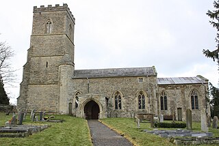
Silverstone is a village and civil parish in Northamptonshire, England. It is about 4 miles (6.4 km) from Towcester on the former A43 main road, 10 miles (16 km) from the M1 motorway junction 15A and about 12 miles (19 km) from the M40 motorway junction 10, Northampton, Milton Keynes and Banbury. The population of the civil parish at the 2011 census was 2,176. The A43 now bypasses to the south-east of the village.

Geddington is a village and civil parish on the A4300, previously A43, in North Northamptonshire between Kettering and Corby. The population of the civil parish at the 2011 census was 1,503, virtually unchanged from 1,504 at the 2001 census.

Farthingstone is a village in West Northamptonshire in England. It is close to the major trunk routes of the M1 junction 16, M40 motorway, and A5 road, at the head of a valley and is 7 miles (11 km) south of Daventry and 3.5 miles (5.6 km) south west of Weedon Bec.

Church Brampton is a village and former civil parish, now in the parish of Church with Chapel Brampton, in the West Northamptonshire district, in the ceremonial county of Northamptonshire, England. Together with nearby Chapel Brampton the two villages are known as The Bramptons. At the time of the 2001 census, the parish's population was 251 people. On 1 April 2009 the parish was abolished and merged with Chapel Brampton to form "Church with Chapel Brampton".

Whittlewood Forest is a former medieval hunting forest east of Silverstone in Northamptonshire in England. It is managed by the Forestry England. There are tracts of ancient woodland within it and old ditches can be found at the edges of several individual woods. The area has been the subject of extensive academic historical research. An area of 400 hectares in seven different patches has been designated a biological Site of Special Scientific Interest (SSSI), which is about half the size of an average English parish. It is a Nature Conservation Review site, Grade 2.

Duston is a suburb of Northampton and a civil parish in West Northamptonshire, England.
Grafton Regis is a village and civil parish in West Northamptonshire, England, on the border with Buckinghamshire. The village is east of the A508 road, on which it has a short frontage and two bus stops, and is around 8 miles (13 km) south of Northampton and 9 miles (14 km) north of Milton Keynes. The population of the civil parish at the 2001 census was 152. This increased to 253 at the 2011 census.

Greens Norton is a village and civil parish in West Northamptonshire, England, just over 1 mile (1.6 km) north-west of Towcester. At the 2011 census the parish, including Caswell and Duncote, had a population of 1,526, a slight decrease since the 2001 census.

Potterspury is a populous village and civil parish in West Northamptonshire, England. The nearest main town is Milton Keynes, the centre of which is about 7 miles south-east. At the time of the 2011 census, the parish's population was 1,453 people.
The Honour of Grafton is a contiguous set of manors in the south of Northamptonshire, England up to the county's eastern border with Buckinghamshire. Its dominant legacies are semi-scattered Whittlewood Forest and a William Kent wing of Wakefield Lodge in the body of that woodland.
Syresham is a village and civil parish in the English district of West Northamptonshire. The civil parish population at the 2011 census was 855. It is near Brackley town and close to Silverstone Circuit. It is surrounded by villages and hamlets such as Biddlesden, Whitfield, Helmdon, Silverstone and Wappenham, and the border with Buckinghamshire lies just to the south of the village. The border itself is defined by the River Great Ouse, which rises within the parish. There are two small hamlets in the parish: Crowfield and Pimlico.

Burley is a village and civil parish in the New Forest, Hampshire, England. It has ancient origins and is now somewhat tourist-orientated.

Abthorpe is a village and civil parish in the valley of the River Tove in West Northamptonshire, England, about 4 miles (6.4 km) west of Towcester, 2 miles (3.2 km) northwest of Silverstone and approximately midway between London and Birmingham.

West Northamptonshire is a local government district in the ceremonial county of Northamptonshire, England, created in 2021. West Northamptonshire Council is a unitary authority, being a district council which also performs the functions of a county council.
Charles FitzRoy, 3rd Baron Southampton was a British peer.

