The Shire of Baw Baw is a local government area in Victoria, Australia, in the eastern part of the state. It covers an area of 4,028 square kilometres (1,555 sq mi) and in June 2018 had a population of 52,015.

The Shire of Campaspe is a local government area in Victoria, Australia, located in the northern part of the state. It covers an area of 4,519 square kilometres (1,745 sq mi) and in August 2021 had a population of 38,735.

Eltham is a suburb of Melbourne, Victoria, Australia, 20 km north-east of the Central Business District, located within the Shire of Nillumbik local government area. Eltham recorded a population of 18,847 at the 2021 census.

Belgrave is a town and outer suburb in Melbourne, Victoria, Australia, 36 km east of Melbourne's central business district, located within the Shire of Yarra Ranges local government area. Belgrave recorded a population of 3,894 at the 2021 census.

Cape Schanck is a locality at the southernmost tip of the Mornington Peninsula in Melbourne, Victoria, Australia, approximately 72 km (45 mi) south of Melbourne's Central Business District, located within the Shire of Mornington Peninsula local government area. Cape Schanck recorded a population of 569 at the 2021 census.
Terang is a town in the Western District of Victoria, Australia. The town is in the Shire of Corangamite and on the Princes Highway 212 kilometres (132 mi) south west of the state's capital, Melbourne. At the 2006 census, Terang had a population of 1,824. At the 2001 census, Terang had a population of 1,859. The population of Terang has since risen according to the 2011 Census; the population is now 2,348, of which 1,155 are male and 1,193 are female, with the median age being 44.

Quilpie is a rural town and locality in the Shire of Quilpie, Queensland, Australia. In the 2021 census, the locality of Quilpie had a population of 530 people.

Chillagoe is a rural town and locality in the Shire of Mareeba, Queensland, Australia. In the 2016 census the locality of Chillagoe had a population of 251 people.

Winchelsea is a town in Victoria, Australia. The town is located in the Surf Coast Shire local government area, the suburb or locality of Winchelsea is predominantly within Surf Coast Shire with a small section within the Colac Otway Shire. Winchelsea is located on the Barwon River 115 km south-west of Melbourne and close to Geelong.

Williams is a town located in the Wheatbelt region of Western Australia, 161 kilometres (100 mi) south-southeast of the state capital, Perth along Albany Highway and 32 kilometres (20 mi) west of Narrogin. The Williams River passes through the town. At the 2016 census, Williams had a population of 411.

Thallon is a town and a locality in the Shire of Balonne, Queensland, Australia. In the 2021 census, the locality of Thallon had a population of 231 people.
The Rushworth Football Club is an Australian rules football club based in the town of Rushworth, Victoria, Australia. The club is one of 12 member clubs in the Kyabram & District Football League and are known as the 'Tigers'. They wear a black jumper with horizontal gold stripe.

Jundah is a rural town and locality in the Shire of Barcoo, Queensland, Australia. Jundah is the administrative centre of the Barcoo Shire local government area. In the 2016 census, the locality of Jundah had a population of 106 people.

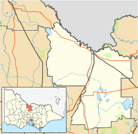
The Shire of Waranga was a local government area about 165 kilometres (103 mi) north of Melbourne, the state capital of Victoria, Australia. The shire covered an area of 1,644.19 square kilometres (634.8 sq mi), and existed from 1863 until 1994.

Glenlyon is a small village in the Shire of Hepburn local government area, Victoria, Australia around 10 km from Daylesford along the Daylesford–Malmsbury Road, and around 101 km from the Melbourne CBD via Kyneton and Malmsbury.

Cooktown is a coastal town and locality in the Shire of Cook, Queensland, Australia. Cooktown is at the mouth of the Endeavour River, on Cape York Peninsula in Far North Queensland where James Cook beached his ship, the Endeavour, for repairs in 1770. Both the town and Mount Cook which rises up behind the town were named after James Cook.
Crowlands is a locality nestled on the Wimmera River and is located approximately 24 kilometres (15 mi) northeast of the town of Ararat, in the state of Victoria, Australia. It comprises a small village area of scattered houses and larger farms.
Mount Moriac is a rural locality in the Surf Coast Shire, Victoria, Australia. In the 2016 census, Mount Moriac had a population of 240 people.

The Balaclava Mine was an open-cut mine in the Australian ghost town of Whroo, Victoria. It opened in October 1854, one year after gold was found at the nearby Rushworth. By 1881 the number of employed miners in the area had dropped to 150, and mining in the Balaclava Mine ceased in the 1920s. The site now operates as a tourist attraction.
Coopers Creek is a locality and mine in the Gippsland region of Victoria, Australia. In the 1860s, Coopers Creek was settled during the Victorian gold rush and, throughout its history, gold, copper and lime have been mined there. Today, Coopers Creek is effectively limited to two camping sites, the first near the site of the mining town and the second to the east at Bruntons Bridge. Ruins from the locality's mining history, and the Copper Mine Hotel are all of the locality's history which survives. In August 2022, the 21 properties that comprise the town were listed for sale.