Murchison is a small riverside rural village located on the Goulburn River in Victoria, Australia. Murchison is located 167 kilometres from Melbourne and is just to the west of the Goulburn Valley Highway between Shepparton and Nagambie. The surrounding countryside contains orchards, vineyards and dairy farms and also HM Prison Dhurringile. At the 2016 census, Murchison had a population of 925.

Avenel is a small town in Victoria, Australia. It is in the Shire of Strathbogie local government area. At the 2016 census, Avenel had a population of 1,048, up from 728 at the 2006 census and 552 at the 2001 census.

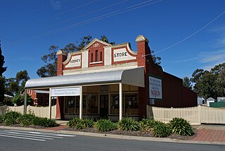
Rushworth is a township in Victoria, Australia. It is located 157 kilometres (98 mi) north of Melbourne and, at the 2016 Census, had a population of 1,335.

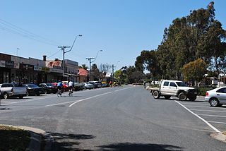
Kyabram is a large town in north central Victoria, Australia. Kyabram is located in the centre of a rich irrigation district in the Goulburn River Valley, 200 kilometres (120 mi) north of Melbourne. It is the second-largest town in the Shire of Campaspe, situated between the towns of Echuca and Shepparton and is close to the Murray River, Goulburn River, Campaspe River and Waranga Basin. As of the 2016 census the town had a population of 7,331 people and provides services to a district population of around 16,000.

Buchan is a town in the east Gippsland region of Victoria, Australia. The town is situated adjacent to the Buchan River, in the Shire of East Gippsland, upstream from the river's junction with the Snowy River. At the 2011 census, Buchan and the surrounding area had a population of 385. The town is probably best known for the limestone Buchan Caves.

Werrimull is a small Australian town and locality in the state of Victoria and a part of the Sunraysia region. The place by road, is situated about 10 kilometres west of Karawinna and 10 kilometres east of Bambill. It is 79 kilometres (49 mi) west southwest of Mildura, 13 kilometres south of the Sturt Highway opposite Lake Cullulleraine. At the 2016 census, Werrimull and the surrounding area had a population of 112, declining from 320 in 2011.

Undera is a town in the Goulburn Valley region of northern Victoria, Australia. The town in the City of Greater Shepparton local government area, 211 kilometres (131 mi) north of the state capital, Melbourne and 26 kilometres (16 mi) north-west of the regional centre of Shepparton. At the 2011 census, Undera and the surrounding area had a population of 545, declining to just 442 by 2016.
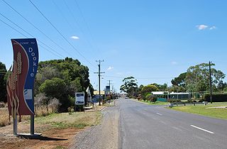
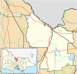
Dookie (/ˈduːki/) is a town in the Goulburn Valley region of Victoria, Australia. It is situated in a valley between Mount Major and Mount Saddleback. Dookie is a farming community. At the 2016 census, Dookie had a population of 328.
Tallygaroopna is a town in the Goulburn Valley region of Victoria, Australia. The town is on the Goulburn Valley Highway in the City of Greater Shepparton local government area, 207 kilometres (129 mi) north of the state capital, Melbourne. At the 2016 census, Tallygaroopna had a population of 579.

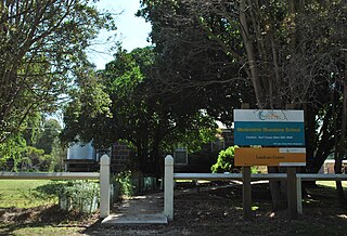
Longwood is a town in northern Victoria, Australia. The town is located in the Shire of Strathbogie local government area, 149 kilometres (93 mi) from the state capital, Melbourne. At the 2016 census, Longwood and the surrounding area had a population of 240.
Lucindale is a small town in the south-east region of South Australia. The town is located 345 kilometres (214 mi) south east of the state capital, Adelaide. At the 2006 census, Lucindale had a population of 301. The town is best known for hosting the annual South East Field Days, attracting over 26,000 visitors every March.

Tyntynder is a town in the south-east of the Mallee region of Victoria, Australia. Tyntynder Football Club is an Australian rules football team in the Central Murray Football League.

Macalister is a rural town and locality in the Western Downs Region, Queensland, Australia. In the 2016 census the locality of Macalister had a population of 153.
Merrigum is a town in the Goulburn Valley region of Victoria, Australia. The town is in the City of Greater Shepparton local government area, 197 kilometres (122 mi) north of the state capital, Melbourne. At the 2011 census, Merrigum had a population of 672.

Bonegilla is a bounded rural locality of the City of Wodonga local government area in north-east Victoria, Australia, 10 kilometres (6.2 mi) east of Wodonga, and around 300 kilometres (190 mi) north-east of Melbourne. In the 2016 census, Bonegilla and surrounding area had a population of 693.
Tongala is a town in the Goulburn Valley region of northern Victoria, Australia. The town is in the Shire of Campaspe local government area, between Kyabram and Echuca, 225 kilometres (140 mi) north of the state capital, Melbourne. At the 2016 census, Tongala had a population of 1,926.
Modewarre is a locality in the Surf Coast Shire, Victoria, Australia. The town adjoins Lake Modewarre. In the 2016 census, Modewarre had a population of 276 people.

Buckley is a rural locality in the Surf Coast Shire, Victoria, Australia. It was formerly known as Laketown. In the 2016 census, Buckley had a population of 211 people.
Bendoc is a locality in the Shire of East Gippsland, Victoria, Australia. It sits on the Bendoc River. In the 2016 census, Bendoc had a population of 115 people.
Deptford is a locality in the Shire of East Gippsland, Victoria, Australia. In the 2016 census, Deptford had a population of zero.