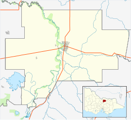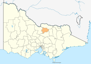
The City of Greater Shepparton is a local government area in the Hume region of Victoria, Australia, located in the north-east part of the state. It covers an area of 2,422 square kilometres (935 sq mi) and, in August 2021, had a population of 68,409. It includes the city of Shepparton and the towns of Arcadia, Ardmona, Congupna, Dookie, Grahamvale, Kialla, Lemnos, Merrigum, Mooroopna, Murchison, Tallygaroopna, Tatura, Toolamba and Undera. It was formed in 1994 from the amalgamation of the City of Shepparton, Shire of Shepparton, and parts of the Shire of Rodney, Shire of Euroa, Shire of Goulburn, Shire of Tungamah, Shire of Violet Town and Shire of Waranga.

Murchison is a town located on the Goulburn River in Victoria, Australia. Murchison is located 167 kilometres from Melbourne and is just to the west of the Goulburn Valley Highway between Shepparton and Nagambie. The surrounding countryside contains orchards, vineyards and dairy farms and also HM Prison Dhurringile. At the 2016 census, Murchison had a population of 925.

Wallan, traditionally known as Wallan Wallan, is a town in Victoria, 45 kilometres north of Melbourne's Central Business District. The town sits at the southern end of the large and diverse Shire of Mitchell which extends from the northern fringes of Melbourne into the farming country of north-central Victoria and the lower Goulburn Valley. The township flanks the Hume Freeway and is set against the backdrop of the Great Dividing Range. At the 2021 census it had a population 15,004.

Erica is a town in Victoria, Australia, on Rawson Road, in the Shire of Baw Baw.

Toolamba is a town in the Goulburn Valley region of Victoria, Australia. It is in the City of Greater Shepparton local government area, 181 kilometres (112 mi) north of the state capital, Melbourne. At the 2021 census, Toolamba and the surrounding area had a population of 822.
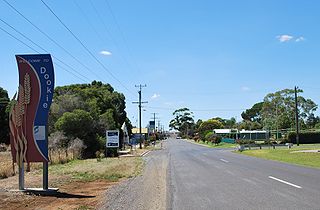
Dookie (/ˈduːki/) is a town in the Goulburn Valley region of Victoria, Australia. It is situated in a valley between Mount Major and Mount Saddleback. Dookie is a farming community. At the 2021 census, Dookie had a population of 333.

Lancaster is a locality in the Goulburn Valley region of Victoria, Australia. The town is located in Shire of Campaspe and the City of Greater Shepparton. At the 2016 census, Lancaster had a population of 393.

Picola is a town in the Shire of Moira in northern Victoria, Australia. At the 2021 census, Picola had a population of 206.
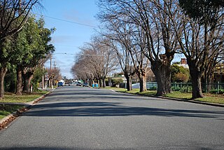
Tallygaroopna is a town in the Goulburn Valley region of Victoria, Australia. The town is on the Goulburn Valley Highway in the City of Greater Shepparton local government area, 207 kilometres (129 mi) north of the state capital, Melbourne. At the 2021 census, Tallygaroopna had a population of 600.

Koonoomoo is a town in northern Victoria, Australia. The town is located in the Shire of Moira local government area, 264 kilometres (164 mi) north of the state capital, Melbourne on the Goulburn Valley Highway, near the Murray River. At the 2011 census, Koonoomoo had a population of 255.

Invergordon is a town in northern Victoria, Australia.
Grahamvale is a town in Victoria, Australia that encompasses the outer-most eastern regions of the city of Shepparton. At the 2021 census, Grahamvale had a population of 685.
Tresco is a locality in Victoria, Australia, located approximately 23 km from Swan Hill. It was named after Tresco, Isles of Scilly, England. At the 2016 census, Tresco had a population of 209.
Mundoo is a rural town and locality in the Cassowary Coast Region, Queensland, Australia. In the 2021 census, the locality of Mundoo had a population of 197 people.

Congupna is a town in the Goulburn Valley region of Victoria, Australia. The town is in the City of Greater Shepparton local government area, 203 kilometres (126 mi) north of the state capital, Melbourne and 10 kilometres (6 mi) north of the regional centre of Shepparton. At the 2021 census, Congupna had a population of 620.

Mysia is a locality in north central Victoria, Australia in the Shire of Loddon local government area, 243 kilometres (151 mi) north of the state capital, Melbourne. At the 2006 census, Mysia and the surrounding area had a population of 105. In 2016, this had declined to 43.
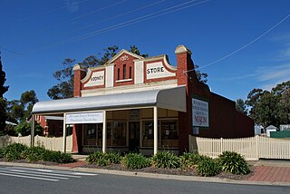
Merrigum is a town in the Goulburn Valley region of Victoria, Australia. The town is in the City of Greater Shepparton local government area, 197 kilometres (122 mi) north of the state capital, Melbourne. At the 2011 census, Merrigum had a population of 672.

Brooloo is a rural town and locality in the Gympie Region, Queensland, Australia. In the 2021 census, the locality of Brooloo had a population of 369 people.

Kialla is a suburb within the City of Greater Shepparton local government area in the Goulburn Valley, Victoria, Australia. At the 2016 census, Kialla and surrounding area had a population of approximately 6,800.

Garradunga is a rural locality in the Cassowary Coast Region, Queensland, Australia. In the 2021 census, Garradunga had a population of 170 people.

