Cobram East is locality situated in the Shire of Moira, Victoria, Australia. The locality is close to Murray River.

Rosewood is a village community and locality in the south east part of the Riverina, New South Wales, Australia. It is situated about 16 kilometres (9.9 mi) south east from Carabost and 19 kilometres (12 mi) north west from Tumbarumba. At the 2016 census, Rosewood had a population of 214. The village is administered by two local governments; the northern part of the locality by the Greater Hume Shire and the southern part of the locality by the Snowy Valleys Council. The village of Rosewood is within the Snowy Valleys Council area.

Malebo is an unbounded neighbourhood in the locality of Euberta in the central east part of the Riverina. It is situated by road, about 10 km west of Wagga Wagga and 16 km east of Millwood.
Peranga is a rural town and locality in the Toowoomba Region, Queensland, Australia. In the 2016 census the locality of Peranga had a population of 85 people.
Yosemite is an unbounded locality within the locality of Katoomba and to the north of the township of Katoomba in the state of New South Wales, Australia in the City of Blue Mountains.
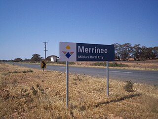
Merrinee is a locality situated in the Sunraysia region. It is situated about 7 kilometres west of Pirlta and 11 kilometres east of Karawinna, on the Red Cliffs-Meringur Road.

Borallon is a rural locality in the Somerset Region, Queensland, Australia. In the 2016 census, Borallon had a population of 81 people.

Pilton is a town and a locality in the Toowoomba Region, Queensland, Australia. It is south of the city of Toowoomba. In the 2016 census, Pilton had a population of 88 people.
Meatian is a locality in Victoria, Australia, located approximately 37 kilometers from Swan Hill, Victoria. Meatian is a small Victorian unbounded locality within the local government area of Gannawarra, it is located approximately 288 km from the capital Melbourne.

Speewa is a locality in Victoria, Australia, located approximately 19 km from Swan Hill, Victoria on the Murray River. It is unusual in that it shares its name with a contiguous locality in New South Wales.
Mundoo is a rural town and locality in the Cassowary Coast Region, Queensland, Australia. In the 2016 census the locality of Mundoo had a population of 224 people.

Brooloo is a rural town and locality in the Gympie Region, Queensland, Australia. In the 2016 census, the locality of Brooloo had a population of 348 people.
Lilyvale is a locality most of whose area is within the Royal National Park, south of Sydney, New South Wales, Australia. Helensburgh railway station was within the southern populated part of the locality. A Lilyvale railway station was open from 1890 until 1983.
Tyrrell is a locality in the local government area of the Rural City of Swan Hill and the Shire of Buloke, Victoria, Australia. Tyrrell West post office opened on 29 May 1909 and was closed on the 2 November 1914. Long Plains post office opened in 1902 and was closed on 31 July 1940.
Wilkur is a locality in the Mount Jeffcot ward of the local government area of the Shire of Buloke and the Warracknabeal ward of the Shire of Yarriambiack, Victoria, Australia. Wilkur post office there opened in 1905, closed on 30 September 1912 reopened on 1 February 1926 and later closed on 27 May 1950. Wilkur South post office opened on 28 June 1920 and was closed on 31 July 1957. Cameron's post office opened on 1 October 1904 renamed Beyal in April 1911 and was closed on 31 August 1929.
Corack East is a locality in the Mount Jeffcott ward of the local government area of the Shire of Buloke, Victoria, Australia. A rural CFA station is located in the town. Corack East post office opened on 1 August 1891 and was closed on 24 May 1976.
Cardstone is a rural locality in the Cassowary Coast Region, Queensland, Australia. In the 2016 census Cardstone had a population of 17 people.
Bloomsbury is a town and coastal locality in the Mackay Region, Queensland, Australia. In the 2016 census the locality of Bloomsbury had a population of 598 people.
Wondecla is a rural locality in the Tablelands Region, Queensland, Australia. In the 2016 census Wondecla had a population of 638 people.

