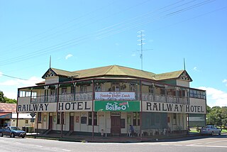
Ardlethan is a small service town in the Coolamon Shire in New South Wales, Australia. Ardlethan is at the intersection of the Burley Griffin Way and Newell Highway.

Burnett Heads is a coastal town and locality at the mouth of the Burnett River in Bundaberg Region, Queensland, Australia, located 16 kilometres (9.9 mi) north of the regional city of Bundaberg. In the 2016 census, Burnett Heads recorded a population of 2,656 people.

Yan Yean is a locality in Melbourne, Victoria, Australia, 38 km north-east of Melbourne's central business district. Its local government areas are the City of Whittlesea and the Shire of Nillumbik. At the 2016 census, Yan Yean had a population of 252.

Coominya is a town and locality in the Somerset Region in South East Queensland, Australia. The town is located 83 kilometres (52 mi) west of the state capital, Brisbane and approximately 2 kilometres (1.2 mi) from Wivenhoe Dam. In the 2016 census, Coominya had a population of 1,200 people.

Booroorban is a locality in the central part of the Riverina. It is in the Edward River Council local government area and on the Cobb Highway between Hay and Deniliquin, around 769 kilometres (478 mi) south west of the state capital, Sydney. At the 2016 census, Booroorban had a population of 33.

Woolgarlo is a locality on the foreshores of the Yass River arm of Lake Burrinjuck, in the far eastern part of the Riverina in the Yass Valley Shire of New South Wales, Australia. At the 2016 census, it had a population of 26.

Hungerford is an outback town in the Shire of Bulloo and a locality in the Shire of Bulloo and Shire of Paroo, South West Queensland, Australia. It is immediately north of the border with New South Wales and the Dingo fence. At the 2016 census, Hungerford and the surrounding area within Queensland had a population of 23. The locality of Hungerford on the New South Wales side of the border had a population of 15.

Sutherlands Creek is a rural locality in Victoria, Australia. The locality is in the Golden Plains Shire, near the regional city of Geelong and 84 kilometres (52 mi) west of the state capital, Melbourne. At the 2016 census, Sutherlands Creek had a population of 108.

Balliang is a locality in Victoria, Australia. It is divided between the Shire of Moorabool and City of Greater Geelong local government areas. It lies north of Geelong and 54 kilometres (34 mi) from the state capital, Melbourne. At the 2016 census, Balliang had a population of 290.

Imbil is a town and a locality in the Gympie Region, Queensland, Australia. At the 2011 census, Imbil had a population of 942.

Cora Lynn is a bounded rural locality in Victoria, Australia, 68 km south-east of Melbourne's Central Business District, located within the Shire of Cardinia local government area. Cora Lynn recorded a population of 243 at the 2016 Census.

Yalca is a locality in northern Victoria, Australia in the local government area of the Shire of Moira. At the 2011 census, Yalca had a population of 301.

Apple Tree Creek is a town and a locality in the Bundaberg Region local government area in central Queensland, Australia. It was formerly known as Bodalla but was renamed in 1962. In the 2016 census, Apple Tree Creek had a population of 639 people.

Boyland is a locality in the Scenic Rim Region, Queensland, Australia. At the 2016 Australian Census, the locality recorded a population of 823.

Pennyroyal is a rural locality in Victoria, Australia. Most of the locality is situated in the Surf Coast Shire; a small section is situated in the Shire of Colac Otway. In the 2016 census, Pennyroyal had a population of 86.

Hesse is a rural locality in the Golden Plains Shire, Victoria, Australia. In the 2016 census, Hesse had a population of 19 people.

Franklyn is a rural locality in the Mid North region of South Australia, situated in the Regional Council of Goyder. It was established in August 2000, when boundaries were formalised for the "long established local name". It comprises the northern section of the cadastral Hundred of Wonna. The name stems from a Franklyn House in Devonshire.

Haly Creek is a locality in the South Burnett Region, Queensland, Australia. In the 2011 census, Haly Creek had a population of 235 people.

Bloomsbury is a town and coastal locality in the Mackay Region, Queensland, Australia. In the 2016 census, Bloomsbury had a population of 598 people.

Kentville is a locality in the Lockyer Valley Region, Queensland, Australia.


