East Warburton is a town in Victoria, Australia, 67 km east from Melbourne's central business district. Its local government area is the Shire of Yarra Ranges. At the 2016 census, East Warburton had a population of 864.

Wilby is a suburban linear village and civil parish in Northamptonshire and is a part of the Borough of Wellingborough. It is directly south-west of the town of Wellingborough on the former trunk road, the A4500, to the county town of Northampton. At the time of the 2011 census, the parish's population was 624 people. It is also thought to date to the Victorian times.

Port Campbell is a coastal town in Victoria, Australia. The town is on the Great Ocean Road, west of the Twelve Apostles, in the Shire of Corangamite. At the 2016 census, Port Campbell had a population of 478.

Tittybong is a locality in the northwest of Victoria, Australia, within the Shires of Gannawarra and Buloke. Tittybong is located west of Kerang and east of the Calder Highway. It is south of Swan Hill, Tittybong's nearest large town. At the 2016 Census, Tittybong had a population of 3.
Peter John Wilby is a British journalist. He is a former editor of The Independent on Sunday and the New Statesman.

Irymple is a town in the state of Victoria in Australia. Located in the region of Sunraysia in the far North-West Victoria, Irymple is 6 km south of Mildura and 550 km northwest of Melbourne. At the 2016 census, Irymple and the surrounding area had a population of 5,325.

Patchewollock is a town in north-west Victoria, Australia. At the 2016 census, Patchewollock had a population of 133.

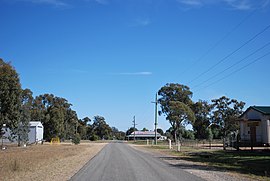
Rupanyup is a small town in rural Victoria, Australia. As of the 2016 census, it had a population of 536. The name Rupanyup is an Aboriginal word meaning 'branch hanging over water'.

Piangil, once frequently spelled "Pyangil", is a town in the Mallee region of northern Victoria, Australia. It is approximately 382 kilometres (237 mi) north west of the state capital, Melbourne and 46 kilometres (29 mi) north west of the regional centre of Swan Hill. At the 2016 census, Piangil and the surrounding rural area had a population of 259.

Old Buckenham is a village and civil parish in the English county of Norfolk, approximately 29 km (18 mi) south-west of Norwich.

Cabarita is a locality in Victoria, Australia, located approximately 10 km from Mildura, Victoria. At the 2016 census, Cabarita had a population of 488.

Merbein South is a locality in Victoria, Australia, located approximately 16 kilometres (9.9 mi) from Mildura. At the 2016 census, Merbein South had a population of 405.

Vinifera is a locality in Victoria, Australia, located approximately 22 km from Swan Hill, Victoria. It was named after Vitis vinifera the Common Grape Vine, when grapes were planted here on irrigated land. At the 2016 census, Vinifera had a population of 159.

Nullawil is a locality in Victoria, Australia, located approximately 302 kilometres (188 mi) from the state capital, Melbourne. At the 2016 census, Nullawil had a population of 93.
Waitchie is a locality in Victoria, Australia, located approximately 44 km from Swan Hill, Victoria. At the 2006 census, Waitchie had a population of 118, decreasing to 48 at the 2016 census.
Tresco is a locality in Victoria, Australia, located approximately 23 km from Swan Hill. It was named after Tresco, Isles of Scilly, England. At the 2016 census, Tresco had a population of 209.

Balliang is a locality in Victoria, Australia. It is divided between the Shire of Moorabool and City of Greater Geelong local government areas. It lies north of Geelong and 54 kilometres (34 mi) from the state capital, Melbourne. At the 2016 census, Balliang had a population of 290.
Tyntynder is a town in the south-east of the Mallee region of Victoria, Australia. It has an Australian rules football team in the Central Murray Football League. Tyntynder post office opened on 4 May 1894, then it was renamed Nyah Post Office 1 November 1894, but closed on 8 August 1944. At the 2016 census, Tyntynder and the surrounding area had a population of 151.

McMahons Creek is a bounded rural locality in Victoria, Australia, on the Warburton–Woods Point Road bordering the Yarra Ranges National Park. Its local government area is the Shire of Yarra Ranges. At the 2016 census, McMahons Creek had a population of 125.
Noel Wilby was an Australian police officer and chief commissioner of Victoria Police from 1969 to 1971.