
Gargett is a rural locality in the Mackay Region, Queensland, Australia. In the 2016 census Gargett had a population of 261 people.
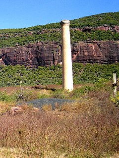
Mount Mulligan is a former mining town and rural locality in Shire of Mareeba, Queensland, Australia. It is the site of the Mount Mulligan mine disaster, Queensland's worst mining disaster.

Bungowannah is a locality in the Riverina region of New South Wales, Australia. The locality is on the Riverina Highway, about 16 kilometres (9.9 mi) north west of Albury and 8 kilometres (5.0 mi) south east of Howlong.

Torrita is a locality situated on the section of the Mallee Highway and Pinnaroo railway line between Ouyen and the South Australian border in the Sunraysia region. The place by road, is situated about 13 kilometres east from Underbool and 8 kilometres west from Walpeup.

Chinkapook is a locality in Victoria, Australia, located approximately 67 km from Swan Hill, Victoria. It is on the Robinvale railway line, 70 km south of the terminus at Robinvale.

Nowie is a locality in Victoria, Australia, located approximately 26 km from Swan Hill, Victoria.
Tresco is a locality in Victoria, Australia, located approximately 23 km from Swan Hill. It was named after Tresco, Isles of Scilly, England. At the 2016 census, Tresco had a population of 209.

Brooloo is a rural town and locality in the Gympie Region, Queensland, Australia. In the 2016 census the locality of Brooloo had a population of 348 people.

Toorongo is a bounded rural locality in Victoria, Australia. Its local government area is the Shire of Yarra Ranges. At the 2006 census, Toorongo had a population of 325.

Rudall is a town and locality in South Australia. At the 2016 census, Rudall had a population of 90. It is named for the cadastral Hundred of Rudall, which was named after politician Samuel Rudall.
Wharminda is a locality in the Australian state of South Australia located on the Eyre Peninsula about 242 kilometres west of the state capital of Adelaide.
Youarang is a locality in northern Victoria, Australia in the local government area of the Shire of Moira.
Burramine is a locality in the local government area of the Shire of Moira in Australia.
Tyrrell is a locality in the local government area of the Rural City of Swan Hill and the Shire of Buloke, Victoria, Australia. Tyrrell West post office opened on 29 May 1909 and was closed on the 2 November 1914. Long Plains post office opened in 1902 and was closed on 31 July 1940.

Maidenwell is a rural town and locality in the South Burnett Region, Queensland, Australia. In the 2016 census the locality of Maidenwell had a population of 199 people.

Cannonvale is a coastal locality in the Whitsunday Region, Queensland, Australia. In the 2016 census, Cannonvale had a population of 5,716 people.

Gooroolba is a rural locality in the North Burnett Region, Queensland, Australia. In the 2016 census Gooroolba had a population of 12 people.
Frankton is a rural locality in the Mid North region of South Australia, situated in the Regional Council of Goyder and Mid Murray Council. The section within the Goyder council was established in August 2000, when boundaries were formalised for the "long established local name"; the section within the Mid Murray council was added in March 2003. It is believed to be named after the son of two early residents, Mr. and Mrs. Rice.
Kidaman Creek is a rural locality in the Sunshine Coast Region, Queensland, Australia. In the 2016 census Kidaman Creek had a population of 130 people.
Glen Aplin is a rural locality in the Southern Downs Region, Queensland, Australia. In the 2016 census Glen Aplin had a population of 503 people.

