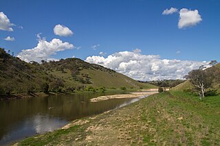
Allendale is a town in Victoria, Australia, located north-east of Creswick, in the Shire of Hepburn. At the 2016 census, Allendale and the surrounding area had a population of 166.

Bungowannah is a locality in the Riverina region of New South Wales, Australia. The locality is on the Riverina Highway, about 16 kilometres (9.9 mi) north west of Albury and 8 kilometres (5.0 mi) south east of Howlong.

Kamarah, is a village community in the central north part of the Riverina. It is situated by road, about 11 kilometres west of Ardlethan and 12 kilometres east of Moombooldool. At the 2006 census, Kamarah had a population of 130 people.

Cavan is a rural community situated on the south bank of the Murrumbidgee River in the Yass Valley Shire. At the 2016 census, it had a population of 47. It is situated by road, about 40 kilometres southwest of Yass and 43 northwest of Canberra. It was named after the town of Cavan in Ireland. It is reportedly owned by Rupert Murdoch.

Linga is a locality situated on the section of the Mallee Highway and Pinnaroo railway line between Ouyen and the South Australian border in the Sunraysia region. It is situated about 8 kilometres east from Boinka and 11 kilometres west from Underbool.
Mittyack is a locality in Victoria, Australia, located approximately 37 km from Ouyen on the Calder Highway.
Cocamba is a locality in Victoria, Australia, located approximately 10 km from Manangatang, Victoria.

Chinkapook is a locality in Victoria, Australia, located approximately 67 km from Swan Hill. It is on the Robinvale railway line, 70 km south of the terminus at Robinvale.
Pira is a locality in Victoria, Australia, located approximately 23 km from Swan Hill. It was a stop on the Piangil railway line but the station is now closed.
The Mortlake line is a closed railway line in the west of Victoria, Australia. Branching off of the main Port Fairy railway line at Terang, then running North to the small town of Mortlake, Victoria.
Almonds is a locality in Victoria, Australia. The post office opened on 15 August 1901, closed on 28 December 1919, reopened on 23 December 1925 and later closed on 24 November 1952.

Yalca is a locality in northern Victoria, Australia in the local government area of the Shire of Moira. At the 2016 census, Yalca had a population of 206, down from 301 in 2011.
Mundoona is a locality in northern Victoria, Australia in the local government area of the Shire of Moira. At the 2016 census, Mundoona had a population of 119.
Burramine is a locality in the local government area of the Shire of Moira in Australia.
Curyo is a town in the Mallee Ward of the Shire of Buloke, Victoria, Australia. Curyo has a Grain Depot on the Mildura railway line; however, the station closed to passenger and parcels traffic on 11 November 1975. A CFA fire brigade in the area is located on Pratt Road, adjacent to the grain depot. The post office there opened on 20 January 1900 and was closed on 9 January 1976. Curyo used to have a football club and a golf course.

Pechey is a rural locality in the Toowoomba Region, Queensland, Australia. In the 2016 census Pechey had a population of 105 people.
Cardstone is a rural locality in the Cassowary Coast Region, Queensland, Australia. In the 2016 census Cardstone had a population of 17 people.

Aubigny is a rural town and locality in the Toowoomba Region, Queensland, Australia. In the 2016 census, Aubigny had a population of 254 people.
Frankton is a rural locality in the Mid North region of South Australia, situated in the Regional Council of Goyder and Mid Murray Council. The section within the Goyder council was established in August 2000, when boundaries were formalised for the "long established local name"; the section within the Mid Murray council was added in March 2003. It is believed to be named after the son of two early residents, Mr. and Mrs. Rice.
Kidaman Creek is a rural locality in the Sunshine Coast Region, Queensland, Australia. In the 2016 census Kidaman Creek had a population of 130 people.


