
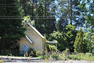
Badger Creek is a town in Victoria, Australia, 53 km north-east from Melbourne's central business district. Its local government area is the Shire of Yarra Ranges. At the 2016 census, Badger Creek had a population of 1,563.

Dixons Creek is a town in Victoria, Australia, 46 km north-east of Melbourne's central business district. Its local government area is the Shire of Yarra Ranges. At the 2016 census, Dixons Creek had a population of 334.
Yellingbo is a town in Victoria, Australia, 48 km east from Melbourne's central business district. Its local government area is the Shire of Yarra Ranges. At the 2016 census, Yellingbo had a population of 534.

Broadmeadows is a suburb of Melbourne, Victoria, Australia, 16 km (9.9 mi) north of Melbourne's central business district. Its local government area is the City of Hume. At the 2016 Census, Broadmeadows had a population of 11,970.

Fawkner is a suburb of Melbourne, Victoria, Australia, 12 km north of Melbourne's central business district. Its local government areas are the City of Moreland and the City of Hume. At the 2016 Census, Fawkner had a population of 14,043.

Allendale is a town in Victoria, Australia, located north-east of Creswick, in the Shire of Hepburn. At the 2016 census, Allendale and the surrounding area had a population of 166.
Connewarre, is a locality in Victoria, Australia, is located in the City of Greater Geelong and Surf Coast Shire, and is named after Lake Connewarre which is situated immediately to its north-east. Connewarre is a version of "kunuwarra", the name of the black swan in the Wathawurrung language. At the 2016 census, Connewarre and the surrounding area had a population of 788.

Bearii is a town in Victoria, Australia. The town is in the Shire of Moira local government area. Bearii is located 252 kilometres (157 mi) north of the state capital, Melbourne, 18 kilometres (11 mi) north of Waaia and is just south of the Barmah National Park. At the 2011 census, Bearii had a population of 136, by 2016 the town had 145 citizens.

Peechelba is a town in north eastern Victoria, Australia. The town is located in the Rural City of Wangaratta and the Shire of Moira local government area between Wangaratta and Yarrawonga and 277 kilometres (172 mi) north west of the state capital, Melbourne. At the 2011 census, Peechelba and the surrounding area had a population of 345. The town is home to a nature reserve, not far from the Ovens River.
Bunguluke is a locality in Victoria, Australia, located approximately 17 km from Wycheproof, Victoria.
Kinglake West is a town in central Victoria, Australia. The town is located 56 kilometres (35 mi) north-east of the state capital, Melbourne. Its local government area is the City of Whittlesea and the Shires of Murrindindi and Nillumbik. At the 2016 Census, Kinglake West had a population of 1,166.
Humevale is a rural locality in Victoria, Australia between Whittlesea and Kinglake West, about 40 kilometres (25 mi) north-north-east of Melbourne, within the City of Whittlesea. At the 2016 Census, Humevale had a population of 307.
Koo Wee Rup North is a bounded rural locality in Victoria, Australia, 62 kilometres (39 mi) south-east of Melbourne's Central Business District, located within the Shire of Cardinia local government area. Koo Wee Rup North recorded a population of 44 at the 2016 Census.
Vervale is a bounded rural locality in Victoria, Australia, 71 kilometres (44 mi) south-east of Melbourne's Central Business District, located within the Shire of Cardinia local government area. Vervale recorded a population of 39 at the 2016 Census.

Bonegilla is a bounded rural locality of the City of Wodonga local government area in north-east Victoria, Australia, 10 kilometres (6.2 mi) east of Wodonga, and around 300 kilometres (190 mi) north-east of Melbourne. In the 2016 census, Bonegilla and surrounding area had a population of 693.
Mundoona is a locality in northern Victoria, Australia in the local government area of the Shire of Moira. At the 2016 census, Mundoona had a population of 119.
Yabba South is a locality in Victoria, Australia. The locality is in the southern part of the Shire of Moira. The former Katamatite Tramway ran through Yabba South.
Kinnabulla is a locality located in the local government area of the Shire of Buloke, Victoria, Australia. The population of the locality is 173 people, 91 being male, and 82 being female. Kinnabulla Railway Station was a station on the Mildura railway line. The station closed to passenger and parcels traffic on 11 November 1975. The post office there opened in 1902 and was closed on 11 November 1973.
Delegate River is a locality in the Shire of East Gippsland, Victoria, Australia. It is situated on the river of the same name. In the 2016 census, Delegate River had a population of 27 people.
Bendoc is a locality in the Shire of East Gippsland, Victoria, Australia. It sits on the Bendoc River. In the 2016 census, Bendoc had a population of 115 people.

