Pieszków is a village in the administrative district of Gmina Lwówek Śląski, within Lwówek Śląski County, Lower Silesian Voivodeship, in south-western Poland. Prior to 1945 it was in Germany.
Słączno is a village in the administrative district of Gmina Milicz, within Milicz County, Lower Silesian Voivodeship, in south-western Poland. Prior to 1945 it was in Germany.

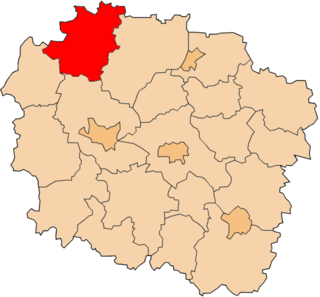
Budziszewo is a village in the administrative district of Gmina Jabłonowo Pomorskie, within Brodnica County, Kuyavian-Pomeranian Voivodeship, in north-central Poland. It lies 5 kilometres (3 mi) south-west of Jabłonowo Pomorskie, 24 km (15 mi) north-west of Brodnica, and 50 km (31 mi) north-east of Toruń.

Drzewce is a village in the administrative district of Gmina Białe Błota, within Bydgoszcz County, Kuyavian-Pomeranian Voivodeship, in north-central Poland. It lies 4 kilometres (2 mi) west of Białe Błota and 9 km (6 mi) west of Bydgoszcz.
Białobłoty is a village in the administrative district of Gmina Świecie nad Osą, within Grudziądz County, Kuyavian-Pomeranian Voivodeship, in north-central Poland.

Iłowo is a village in the administrative district of Gmina Topólka, within Radziejów County, Kuyavian-Pomeranian Voivodeship, in north-central Poland. It lies approximately 2 kilometres (1 mi) west of Topólka, 18 km (11 mi) south-east of Radziejów, and 58 km (36 mi) south of Toruń.

Turzno is a village in the administrative district of Gmina Łysomice, within Toruń County, Kuyavian-Pomeranian Voivodeship, in north-central Poland. It lies approximately 9 kilometres (6 mi) east of Łysomice and 12 km (7 mi) north-east of Toruń.

Lisowice is a village in the administrative district of Gmina Działoszyn, within Pajęczno County, Łódź Voivodeship, in central Poland. It lies approximately 3 kilometres (2 mi) south-west of Działoszyn, 13 km (8 mi) west of Pajęczno, and 88 km (55 mi) south-west of the regional capital Łódź.

Postronna is a village in the administrative district of Gmina Koprzywnica, within Sandomierz County, Świętokrzyskie Voivodeship, in south-central Poland. It lies approximately 7 kilometres (4 mi) north-west of Koprzywnica, 18 km (11 mi) west of Sandomierz, and 70 km (43 mi) south-east of the regional capital Kielce.
Wojsławice is a village in the administrative district of Gmina Byczyna, within Kluczbork County, Opole Voivodeship, in south-western Poland.

Rzeczenica is a village in Człuchów County, Pomeranian Voivodeship, in northern Poland. It is the seat of the gmina called Gmina Rzeczenica. It lies approximately 21 kilometres (13 mi) north-west of Człuchów and 121 km (75 mi) south-west of the regional capital Gdańsk.

Kochanowo is a village in the administrative district of Gmina Luzino, within Wejherowo County, Pomeranian Voivodeship, in northern Poland. It lies approximately 5 kilometres (3 mi) north of Luzino, 10 km (6 mi) west of Wejherowo, and 44 km (27 mi) north-west of the regional capital Gdańsk.
Lisiak is a village in the administrative district of Gmina Górowo Iławeckie, within Bartoszyce County, Warmian-Masurian Voivodeship, in northern Poland, close to the border with the Kaliningrad Oblast of Russia.

Bagno is a village in the administrative district of Gmina Nowe Miasto Lubawskie, within Nowe Miasto County, Warmian-Masurian Voivodeship, in northern Poland. It lies approximately 12 kilometres (7 mi) north of Nowe Miasto Lubawskie and 71 km (44 mi) south-west of the regional capital Olsztyn.

Klonowo is a village in the administrative district of Gmina Ostróda, within Ostróda County, Warmian-Masurian Voivodeship, in northern Poland. It lies approximately 21 kilometres (13 mi) south of Ostróda and 47 km (29 mi) south-west of the regional capital Olsztyn.
Strzeżewo is a settlement in the administrative district of Gmina Polanów, within Koszalin County, West Pomeranian Voivodeship, in north-western Poland.
Strzeżysław is a settlement in the administrative district of Gmina Szczecinek, within Szczecinek County, West Pomeranian Voivodeship, in north-western Poland.

Łąkówko is a settlement in the administrative district of Gmina Połczyn-Zdrój, within Świdwin County, West Pomeranian Voivodeship, in north-western Poland. It lies approximately 12 kilometres (7 mi) north of Połczyn-Zdrój, 25 km (16 mi) north-east of Świdwin, and 113 km (70 mi) north-east of the regional capital Szczecin.
Lielauce Parish is an administrative unit of the Auce Municipality, Latvia. Before the 2009 administrative reforms it was part of Dobele District.

Nairi Cinema, is the second-largest cinema hall in the Armenian capital of Yerevan, located on the intersection of Mashtots Avenue with the Isahakyan street at the central Kentron District.


