Wike, West Yorkshire

Last updated

Wike milestone Milestone near Wikefield Farm.jpg
Wike milestone

Wike is a hamlet and (as Wyke) a former civil parish, now in the parish of Harewood, north of Leeds, West Yorkshire, England. It is in the City of Leeds metropolitan borough and is north of Shadwell and Roundhay, west of Scarcroft and south of East Keswick. Many residents use facilities in Leeds as well as in the nearby town of Wetherby. In 1931 the parish had a population of 88. [1]

Contents

Wike is one of the few villages in Leeds not to be served by a public bus service: the last service 923, operated by Utopia, was rerouted in early 2003.

Wike is in the Harewood ward of the Leeds Metropolitan Council and is home to a local Scout and Guide 'back-to-basics' campsite operated by North Leeds District Scout Council, [2] as well as several golf courses including Leeds Golf Centre, which is home to Wike Ridge Golf Course, an 18-hole USGA-standard course, The Oaks, a par 3 course and a footgolf pitch. Also provided is a driving range with Toptracer technology. The golf course has a David Leadbetter teaching academy for all abilities.

The Old Schoolhouse Old Schoolhouse, Wike 14 June 2022.jpg
The Old Schoolhouse

A notable building which dates from 1726 has a nameplate "The Old Schoolhouse" on School Lane. Funded by Lady Elizabeth Hastings, it served as a school from Monday to Friday and a church on Sunday, and could be used for meetings until at least 1991. On Fridays the children would put their books away in cupboards, and arrange the desks to make pews for the church, rearranging on Monday. There is also the School Cottage, a one-bedroom bungalow for the teacher. [3] The Schoolhouse has been extended to make a large detached house.

Wike Manor is a grade II listed building built in the mid-eighteenth century, [4] and there is a guide post to the east of Island Cottage in Backstone Gill Lane which is also grade II listed. [5]

History

Wike was formerly a township in Harewood and Bardsey parishes, [6] from 1866 Wyke was a civil parish in its own right until it was abolished on 1 April 1937 and merged with Harewood. [7]

Related Research Articles

<span class="mw-page-title-main">Esholt</span> Village in West Yorkshire, England

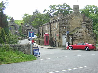
Esholt is a village and former civil parish in the metropolitan district of the City of Bradford, West Yorkshire, England. It is situated 3 miles (4.8 km) east of Shipley town centre, 1.5 miles (2.4 km) south-west of the A65 in Guiseley, 7 miles (11 km) north of Bradford City Centre, and 10 miles (16 km) north-west of Millennium Square, Leeds.

<span class="mw-page-title-main">Riddlesden</span> Suburb in West Yorkshire, England

Riddlesden is a suburb of Keighley in the county of West Yorkshire, England and on the Leeds and Liverpool Canal.

<span class="mw-page-title-main">Alwoodley</span> Suburb of Leeds and civil parish in West Yorkshire, England

Alwoodley is a suburb and civil parish of Leeds in West Yorkshire, England. It is 5 miles (8.0 km) north of central Leeds and is one of the most affluent areas of the county. Alwoodley lies in the LS17 postcode area which was reported to contain the most expensive housing area in Yorkshire and the Humber by The Times.

<span class="mw-page-title-main">Middleton, Leeds</span> Suburb of Leeds, West Yorkshire, England

Middleton is a largely residential suburb of Leeds in West Yorkshire, England and historically a village in the West Riding of Yorkshire. It is situated on a hill 4 miles (6 km) south of Leeds city centre and 165 miles (266 km) north north-west of London.

<span class="mw-page-title-main">Bramhope</span> Village and civil parish in West Yorkshire, England

Bramhope is a village and civil parish in the City of Leeds metropolitan borough, West Yorkshire, England, north of Holt Park and north east of Cookridge.

<span class="mw-page-title-main">Linton, West Yorkshire</span> Village in West Yorkshire, England

Linton is a village in the civil parish of Collingham, in the City of Leeds metropolitan borough, in West Yorkshire, England. It is 1.5 miles (2.4 km) south-west of Wetherby Wetherby on the north bank of the River Wharfe, Collingham is on the opposite bank.

<span class="mw-page-title-main">Skyrack</span> Wapentake of the West Riding of Yorkshire, England

Skyrack was a wapentake of the West Riding of Yorkshire, England. It was split into upper and lower divisions and centred in Headingley, Leeds. The Lower Division included the parishes of Aberford, Bardsey, Barwick-in-Elmet, Kippax, Thorner, Whitkirk and part of Harewood, while the Upper Division included the parishes of Adel, Bingley, Guiseley and parts of Harewood, Ilkley and Otley.

<span class="mw-page-title-main">Calverley</span> Village in West Yorkshire, England

Calverley is a village in the City of Leeds metropolitan borough in West Yorkshire, England, on the A657 road, about ten miles (16 km) from Leeds city centre and four miles (7 km) from Bradford, and lying north of the town of Pudsey. The population of Calverley in 2011 was 4,328. It is part of the City of Leeds ward Calverley and Farsley, with a population of 22,594 at the 2011 Census.

<span class="mw-page-title-main">Shadwell, West Yorkshire</span> Village and civil parish in West Yorkshire, England

Shadwell is a village and civil parish in north-east Leeds, West Yorkshire, England. The village is 6 miles (9.7 km) to the north east of Leeds city centre.

<span class="mw-page-title-main">Collingham, West Yorkshire</span> Village and civil parish in West Yorkshire, England

Collingham is a village and civil parish 2 miles (3 km) south-west of Wetherby in West Yorkshire, England. It is in the City of Leeds metropolitan borough. The population of the civil parish as of the 2011 census was 2,991.

<span class="mw-page-title-main">Bardsey, West Yorkshire</span> Village near Leeds, West Yorkshire, England

Bardsey, West Yorkshire, England is a small village in the City of Leeds metropolitan borough, 8 miles (13 km) north east of Leeds city centre. The village is in the LS17 Leeds postcode district. It is part of the civil parish of Bardsey cum Rigton. The village itself lies just off the A58 road between Leeds and Wetherby.

<span class="mw-page-title-main">Weardley</span> Village in West Yorkshire, England

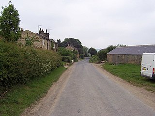
Weardley is a village on the Harewood Estate in the parish of Harewood, at the northern edge of the City of Leeds metropolitan borough, West Yorkshire, England. The village is in the Harewood ward of the City of Leeds Metropolitan Council. In 1931 the parish had a population of 94.

<span class="mw-page-title-main">Weston, Cheshire East</span> Human settlement in England

Weston is a village and former civil parish, now in the parish of Weston and Crewe Green, in the unitary authority area of Cheshire East and the ceremonial county of Cheshire, England. The village lies 3 miles to the south east of Crewe. The parish also includes the small settlements of Carters Green, Gorstyhill, Rose Hill, Snape, Stowford and part of Englesea Brook, as well as the new settlements of Wychwood Park and Wychwood Village. Plans in 2015 to develop a golf course surrounding Wychwood Village for residential housing have been opposed by some residents. The plans were refused planning permission by Cheshire East Council; the developer was later unsuccessful in an appeal to the Secretary of State and the council's refusal was upheld. Nearby villages include Basford, Hough and Shavington. In 2011 the parish had a population of 1,855.

<span class="mw-page-title-main">Leeds Country Way</span> Long-distance footpath in Leeds, West Yorkshire, England

The Leeds Country Way is a circular long-distance footpath of 62 miles (99 km) around Leeds, West Yorkshire, England. It is never more than 7 miles (11 km) from City Square, Leeds, but is mainly rural with extensive views in the outlying areas of the Leeds metropolitan district. It follows public Rights of Way including footpaths, bridleways and minor lanes, with a few short sections along roads.

<span class="mw-page-title-main">East Heslerton</span> Village in North Yorkshire, England

East Heslerton is a village in the civil parish of Heslerton, near Malton, in North Yorkshire, England. It lies between the villages of West Heslerton and Sherburn, at the interface between the Vale of Pickering to the north and the Yorkshire Wolds to the south. Heslerton had a population of 409 at the 2011 census. The village was named on early maps as Heslerton Parva.

<span class="mw-page-title-main">Wothersome</span> Village and civil parish in West Yorkshire, England

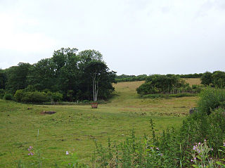
Wothersome is a civil parish in the City of Leeds metropolitan borough, West Yorkshire, England. It is south of Wetherby, north east of Leeds and west of Bramham. It has a population of 40. From the 2011 Census the village is shown as being in the Harewood ward of Leeds Metropolitan Council.

<span class="mw-page-title-main">Bickerton, North Yorkshire</span> Village in North Yorkshire, England

Bickerton is a village on the B1224 road, in the civil parish of Bilton-in-Ainsty with Bickerton, in North Yorkshire, England. The nearest town is Wetherby. There is a plantation nearby called Bickerton Plantation.

<span class="mw-page-title-main">Sawdon</span> Village in North Yorkshire, England

Sawdon is a village in the civil parish of Brompton, in North Yorkshire, England, about 8 miles (13 km) west of Scarborough.

<span class="mw-page-title-main">Hawksworth, Guiseley</span> Human settlement in England

Hawksworth is a village 1 mile (1.6 km) west of the town of Guiseley in West Yorkshire, England. It is located to the south of Menston and north of Baildon.

<span class="mw-page-title-main">Dunkeswick</span> Hamlet in North Yorkshire, England

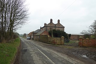
Dunkeswick is a hamlet in the civil parish of Kirkby Overblow, in North Yorkshire, England, just north of the River Wharfe, off the A61, around a kilometre north of Harewood and two kilometres south of Kirkby Overblow.

References

  1. "Population statistics Wyke Tn/CP through time". A Vision of Britain through Time . Retrieved 16 January 2022.
  2. "Wike Campsite". North Leeds Scout District. Retrieved 5 August 2016.
  3. South and West Yorkshire Federations of Women's Institutes (1991). The South and West Yorkshire Village Book. Newbury: Countryside Books. p. 241. ISBN   1-85306-136-0.
  4. Historic England. "Wike Manor (1227563)". National Heritage List for England . Retrieved 24 January 2019.
  5. Historic England. "Guide Post 20 Metres East of Island Cottage (1225854)". National Heritage List for England . Retrieved 7 December 2019.
  6. "History of Wyke, in Leeds and West Riding". A Vision of Britain through Time. Retrieved 16 January 2022.
  7. "Relationships and changes Wyke Tn/CP through time". A Vision of Britain through Time. Retrieved 16 January 2022.

53°52′20″N1°29′20″W / 53.8722°N 1.4889°W / 53.8722; -1.4889