Wilber, New South Wales

Last updated

Wilber Prish
New South Wales
Australia New South Wales location map blank.svg
Red pog.svg
Wilber Prish
Coordinates 31°20′S148°28′E / 31.333°S 148.467°E / -31.333; 148.467 Coordinates: 31°20′S148°28′E / 31.333°S 148.467°E / -31.333; 148.467
Postcode(s) 2828
Location
LGA(s) Coonamble Shire Council
County Gowen
State electorate(s) Barwon
Federal Division(s) Parkes

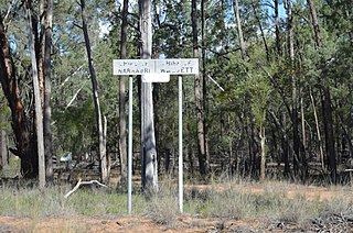
Wilber Parish, New South Walesis a bounded rural locality of Coonamble Shire and a civil parish of Gowen County, New South Wales. [1] [2]

Suburbs and localities are the names of geographic subdivisions in Australia, used mainly for address purposes. The term locality is used in rural areas, while the term suburb is used in urban areas. Australian postcodes closely align with the boundaries of localities and suburbs.

Coonamble Shire Local government area in New South Wales, Australia

Coonamble Shire is a local government area in the Orana region of New South Wales, Australia. The Shire is located adjacent to the Castlereagh Highway and the Castlereagh River.

Lands administrative divisions of Australia

Lands administrative divisions of Australia are the cadastral divisions of Australia for the purposes of identification of land to ensure security of land ownership. Most states term these divisions as counties, parishes, hundreds, and other terms. The eastern states of Queensland, New South Wales, Victoria and Tasmania were divided into counties and parishes in the 19th century, although the Tasmanian counties were renamed land districts in the 20th century. Parts of South Australia (south-east) and Western Australia (south-west) were similarly divided into counties, and there were also five counties in a small part of the Northern Territory. However South Australia has subdivisions of hundreds instead of parishes, along with the Northern Territory, which was part of South Australia when the hundreds were proclaimed. There were also formerly hundreds in Tasmania. There have been at least 600 counties, 544 hundreds and at least 15,692 parishes in Australia, but there are none of these units for most of the sparsely inhabited central and western parts of the country.

The only town of the parish is Gulargambone. [3]

The Parish is on the banks of the Castlereagh River and the main settlement of the parish is Gulargambone, New South Wales.

Castlereagh River river in New South Wales

The Castlereagh River is located in the central–western district of New South Wales, Australia. It is part of the Macquarie-Castlereagh catchment within the Murray–Darling basin and is an unregulated river, meaning no dams or storage have been built on it to control flows. On a map of NSW, the Castlereagh has a distinctive appearance among the north-western rivers for its fish-hook-like shape: from upstream in the north at its confluence with the Macquarie River it extends southwards to a hook-shape, flattened-out at the base, which curves to the right through to the tip of the hook in the Warrumbungle Mountains at the river's source.

Related Research Articles

Pilliga (Baradine County parish)

Pilliga Parish is a civil parish of Baradine County, New South Wales.

Gulargambone Parish, New South Wales Town in New South Wales, Australia

Gulargambone Parish, New South Wales is a bounded rural locality of Coonamble Shire and a civil parish of Gowen County, a cadastral division of New South Wales. The only town of the county is Gulargambone.

Cobbinbil, New South Wales New South Wales, Australia

Cobbinbil Parish, New South Wales is a bounded rural locality and a civil parish of Cowen County, New South Wales.
Naman, New South Wales New South Wales, Australia

Naman, New South Wales is a bounded rural locality of Coonamble Shire and a civil parish of Gowen County, New South Wales.

Uargon, New South Wales New South Wales, Australia

Uargon, New South Wales is a bounded rural locality of Gilgandra Shire and a civil parish of Gowen County, New South Wales.

Youlbung, New South Wales New South Wales, Australia

Youlbung, New South Wales is a bounded rural locality of Gilgandra Shire and a civil parish of Gowen County, a cadastral division of New South Wales.

Kirban, New South Wales

Kirban, New South Wales is a bounded rural locality of Gilgandra Shire and a civil parish of Gowen County, New South Wales.

Dilly, New South Wales New South Wales, Australia

Dilly Parish, New South Wales is a bounded rural locality of Gilgandra Shire and a civil parish of Gowen County, a cadastral division of New South Wales.

Bearbong, New South Wales New South Wales, Australia

Bearbong, New South Wales is a bounded rural locality of Gilgandra Shire and a civil parish of Gowen County, a county of New South Wales.

Biralbung, New South Wales New South Wales, Australia

Biralbung, New South Wales is a bounded rural locality of Gilgandra Shire and a civil parish of Gowen County, a civil county of New South Wales.

Burrendah, New South Wales New South Wales, Australia

Burrendah, New South Wales is a bounded rural locality of Gilgandra Shire and a civil parish of Gowen County, a county of New South Wales.

Boyben, New South Wales

Boyben, New South Wales is a bounded rural locality of Gilgandra Shire and a civil parish of Gowen County, a county of New South Wales.

Callangoan, New South Wales

Callangoan, New South Wales is a bounded rural locality of Coonamble Shire, and a civil parish of Gowen County, a county of New South Wales.

Balumbridal, New South Wales

Balumbridal is a bounded rural locality and a civil parish of Gowen County, New South Wales.

Gundi, New South Wales New South Wales, Australia

Gundi, New South Wales is a bounded rural locality and civil parish of Gowen County, in New South Wales.

Greenbah, New South Wales

Greenbah, New South Wales is a bounded rural locality in the Warrumbungle Shire and a civil parish of Gowen County, New South Wales.

Yarrawin, New South Wales

Yarrawin, New South Wales is a bounded rural locality and a civil parish of Gowen County, New South Wales.

Timor Parish, New South Wales

Timor Parish is a bounded rural locality and civil parish of Gowen County, in the central north of New South Wales.

Belar, New South Wales

Yarrawin, New South Wales is a bounded rural locality of the Warrumbungle Shire and a civil parish of Gowen County, New South Wales.

Terrabile, New South Wales

Callangoan, New South Wales is a bounded rural locality of Gilgandra Shire, and a civil parish of Gowen County, a county of New South Wales.

References

  1. Robert McLean, The New atlas of Australia : the complete work containing over one hundred maps and full descriptive geography of New South Wales, Victoria, Queensland, South Australia and Western Australia, together with numerous illustrations and copious indices (Sydney :J. Sands, [1886) Map 1.
  2. Map of Gowan County, New South Wales].
  3. Robert McLean, The New atlas of Australia : the complete work containing over one hundred maps and full descriptive geography of New South Wales, Victoria, Queensland, South Australia and Western Australia, together with numerous illustrations and copious indices (Sydney :J. Sands, [1886) Map 14.