Nunawading is a suburb of Melbourne, Victoria, Australia, 18 km east of Melbourne's Central Business District, located within the City of Whitehorse and City of Manningham local government areas. Nunawading recorded a population of 12,413 at the 2021 census.

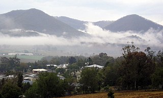
Killarney is a rural town and locality in the Southern Downs Region, Queensland, Australia. It borders New South Wales. In the 2021 census, the locality of Killarney had a population of 918 people.

Widgelli is a small village located in the local government area of the City of Griffith in the Australian state of New South Wales.

The Shire of Pingelly is a local government area in the Wheatbelt region of Western Australia, about 160 kilometres (99 mi) southeast of the state capital, Perth, between the Shires of Brookton and Cuballing along the Great Southern Highway. The Shire covers an area of 1,295 square kilometres (500 sq mi), and its seat of government is the town of Pingelly.

The City of Subiaco is a local government area in Western Australia. It covers an area of approximately 7 km² in inner western metropolitan Perth and lies about 3 km west of the Perth CBD. The City includes the historically working-class suburb of Subiaco centred around Rokeby Road. Since the 1990s the area has been extensively redeveloped and gentrified.

Bungowannah is a locality in the Riverina region of New South Wales, Australia. The locality is on the Riverina Highway, about 16 kilometres (9.9 mi) north west of Albury and 8 kilometres (5.0 mi) south east of Howlong.

Gidginbung is a town community in the north eastern part of the Riverina and situated about 18 kilometres north west of Temora and 50 kilometres south east of West Wyalong.

Harefield is a locality in New South Wales, Australia. It in the central east part of the Riverina and situated about 11 kilometres south of Junee and 35 kilometres north by road from Wagga Wagga.

Tantonan is a rural locality in the central south part of the Riverina, New South Wales, Australia. It is situated by road, about 8 kilometres north west from Caldwell and 13 kilometres south east from Bunnaloo.
Stony Crossing is a locality in the south western part of the Riverina on the south bank of the Wakool River. By road, it is about 22 kilometres (14 mi) south east from Kyalite and 35 kilometres (22 mi) north west from Swan Hill.
Israelite Bay is a bay and locality on the south coast of Western Australia.

Nullawil is a locality in Victoria, Australia, located approximately 302 kilometres (188 mi) from the state capital, Melbourne. At the 2021 census, Nullawil had a population of 92.

Ninda is a locality in Victoria, Australia, located approximately 13 km from Sea Lake, Victoria.
Towaninny is a locality in the Victoria, Australia, located approximately 35 km from Wycheproof, Victoria.
Marinna is a locality in Junee Shire in southern New South Wales, Australia. Its main feature is a grain silo on the Main South railway line. A station was opened in the locality between 1897 and 1975.
Turriff East is a locality in the Shire of Buloke, Victoria, Australia. The post office there opened on 16 October 1918 and was closed on 20 December 1940.
Wilkur is a locality in the Mount Jeffcot ward of the local government area of the Shire of Buloke and the Warracknabeal ward of the Shire of Yarriambiack, Victoria, Australia. Wilkur post office there opened in 1905, closed on 30 September 1912 reopened on 1 February 1926 and later closed on 27 May 1950. Wilkur South post office opened on 28 June 1920 and was closed on 31 July 1957. Cameron's post office opened on 1 October 1904 renamed Beyal in April 1911 and was closed on 31 August 1929.
Thalia is a town in the Mallee and Mount Jeffcot wards of the local government area of the Shire of Buloke, Victoria, Australia. Thalia post office opened on 14 October 1892 and was closed on 30 June 1969.
Joskeleigh is a coastal rural locality in the Livingstone Shire, Queensland, Australia. In the 2021 census, the locality of Joskeleigh had a population of 60 people.
Wondecla is a rural locality in the Tablelands Region, Queensland, Australia. In the 2021 census, Wondecla had a population of 661 people.


