Wise River, Montana | |
|---|---|
 Interactive map of Wise River, Montana | |
| Country | United States |
| State | Montana |
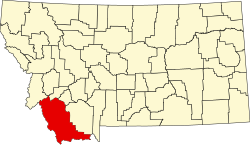
| County | Beaverhead |
| Area | |
• Total | 0.74 sq mi (1.91 km2) |
| • Land | 0.74 sq mi (1.91 km2) |
| • Water | 0 sq mi (0.00 km2) |
| Elevation | 5,653 ft (1,723 m) |
| Population (2020) | |
• Total | 42 |
| • Density | 56.9/sq mi (21.95/km2) |
| FIPS code | 30-07300 |
| GNIS feature ID | 2804265 [2] |
Wise River is an unincorporated community in northern Beaverhead County, Montana, United States. [3]
Contents
This community takes its name from the Wise River, which flows into the Big Hole River nearby. A post office was established in 1913. [4]