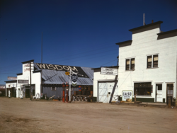
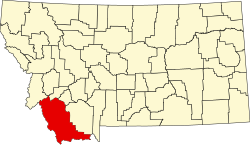
Wisdom, Montana

Last updated

Wisdom, Montana
Wisdom, Montana cropped.png
Wisdom in April 1942
Beaverhead County Montana Incorporated and Unincorporated areas Wisdom Highlighted.svg
Location of Wisdom, Montana
Coordinates: 45°36′58″N113°26′59″W / 45.61611°N 113.44972°W / 45.61611; -113.44972
CountryUnited States
State Montana
County Beaverhead
Area
[1]
  Total1.02 sq mi (2.63 km2)
  Land1.01 sq mi (2.61 km2)
  Water0.01 sq mi (0.02 km2)
Elevation
[2]
6,050 ft (1,840 m)
Population
 (2020)
  Total104
  Density103.17/sq mi (39.84/km2)
Time zone UTC−7 (Mountain (MST))
  Summer (DST) UTC−6 (MDT)
ZIP code
59761
Area code 406
FIPS code 30-81250
GNIS feature ID0793432 [2]

Wisdom is a small town in Beaverhead County, Montana, United States. The population was 98 at the 2010 census. [3] The ZIP Code of the area is 59761. The town includes three tourist lodgings, service station, grocery, school (K-8), post office and a Forest Service office.

Contents

History

Wisdom was named for the Wisdom River, which is now named the Big Hole River, that passes through the town. [4] The post office opened in 1884. [5]

Geography

Wisdom is located at 45°36′58″N113°26′59″W / 45.61611°N 113.44972°W / 45.61611; -113.44972 (45.616120, -113.449742). [6] According to the United States Census Bureau, the CDP has a total area of 0.99 square miles (2.56 km2), of which 0.98 square miles (2.54 km2) is land and 0.0077 square miles (0.02 km2), or 0.82%, is water. [3] Wisdom's average elevation is 6,245 feet (1,903 m), about 1.2 miles above sea level. [7]

Wisdom is located along Montana Highway 43. Tweedy Mountain is nearby as is West Goat Peak.

Climate

Wisdom, owing to its high altitude and northerly location, has a subalpine climate (Köppen Dfc) with long, cold, dry winters and short summers with very warm afternoons and cold, clear mornings. With over 277 mornings each year below freezing and only July ever completely frost-free, Wisdom is in terms of frequency of frost one of the coldest places in the United States. During major cold waves, Wisdom’s location in an enclosed valley can make for exceptionally low temperatures: −55 °F (−48.3 °C) was reached during a great cold wave on December 23, 1983, and −50 °F or −45.6 °C has been reached during seven years, though not since February 4, 1989. Typically there are 47 mornings falling to or below 0 °F or −17.8 °C, and as many as seven fall as low as −25 °F or −31.7 °C, whilst 69.8 afternoons do not top freezing, a tally twice as large as central Montana areas affected by warm chinook winds.

Minimum temperatures during spring do not typically stay above freezing until well into June, although the average last spring ice day date is April 1 and the first fall ice day November 1. Low winter precipitation limits both snowfall and snow depth: the annual mean fall is 42.3 inches or 1.07 metres, and the mean peak snow cover 11 inches or 0.28 metres, with the most snow on the ground being 32 inches (0.81 m) on January 2, 1943. Snow cover is usually gone by the end of March, and despite occasional light snowfalls in May, snow on the ground in that month has not been recorded since 1953. Precipitation is heaviest during the spring, but the enclosed valley location means most moisture is always captured before reaching Wisdom: the wettest month since records began in 1923 has been May 1981 with 4.32 inches (109.7 mm), whilst the wettest calendar year has been 1967 with 15.74 inches (399.8 mm) and the driest 1974 when only 5.60 inches (142.2 mm) fell.

Although summer nights are chilly and even frosty, days can be very warm or even hot, although only 1.3 afternoons typically rise above 90 °F or 32.2 °C and 100 °F or 37.8 °C has never been recorded: Wisdom’s hottest temperature is 98 °F or 36.7 °C on July 13, 2002, and the hottest minimum 62 °F or 16.7 °C on July 23, 1936. On average only two mornings remain above 50 °F or 10 °C each summer, and Wisdom has never recorded so high a minimum between October 20 and May 4 inclusive. By the end of August mornings fall to freezing in five-eighths of all years, and in seven-eighths by the end of September, with the weather continuing to cool into winter with the first minimum under zero expected on November 10.

Climate data for Wisdom, Montana 1991–2020 normals, 1923-2020 extremes: 6060ft (1847m)
MonthJanFebMarAprMayJunJulAugSepOctNovDecYear
Record high °F (°C)53
(12)
57
(14)
68
(20)
80
(27)
89
(32)
95
(35)
98
(37)
96
(36)
90
(32)
81
(27)
66
(19)
58
(14)
98
(37)
Mean maximum °F (°C)43.3
(6.3)
45.0
(7.2)
53.4
(11.9)
66.8
(19.3)
75.5
(24.2)
82.8
(28.2)
88.8
(31.6)
87.7
(30.9)
82.7
(28.2)
71.8
(22.1)
55.3
(12.9)
43.1
(6.2)
89.9
(32.2)
Mean daily maximum °F (°C)26.3
(−3.2)
29.5
(−1.4)
38.9
(3.8)
48.8
(9.3)
59.2
(15.1)
67.4
(19.7)
78.1
(25.6)
77.3
(25.2)
67.8
(19.9)
53.1
(11.7)
35.9
(2.2)
25.3
(−3.7)
50.6
(10.4)
Daily mean °F (°C)14.7
(−9.6)
16.2
(−8.8)
25.6
(−3.6)
34.9
(1.6)
43.8
(6.6)
51.4
(10.8)
57.8
(14.3)
55.6
(13.1)
47.8
(8.8)
37.0
(2.8)
23.2
(−4.9)
14.1
(−9.9)
35.2
(1.8)
Mean daily minimum °F (°C)3.1
(−16.1)
3.0
(−16.1)
12.4
(−10.9)
21.0
(−6.1)
28.4
(−2.0)
35.4
(1.9)
37.6
(3.1)
33.9
(1.1)
27.7
(−2.4)
20.9
(−6.2)
10.5
(−11.9)
2.9
(−16.2)
19.7
(−6.8)
Mean minimum °F (°C)−27.8
(−33.2)
−26.5
(−32.5)
−10.4
(−23.6)
5.3
(−14.8)
15.1
(−9.4)
24.3
(−4.3)
28.6
(−1.9)
24.3
(−4.3)
14.2
(−9.9)
2.6
(−16.3)
−12.9
(−24.9)
−23.4
(−30.8)
−35.7
(−37.6)
Record low °F (°C)−52
(−47)
−52
(−47)
−35
(−37)
−20
(−29)
6
(−14)
16
(−9)
20
(−7)
11
(−12)
1
(−17)
−23
(−31)
−34
(−37)
−55
(−48)
−55
(−48)
Average precipitation inches (mm)0.59
(15)
0.59
(15)
0.77
(20)
1.12
(28)
1.75
(44)
2.12
(54)
1.20
(30)
0.79
(20)
1.09
(28)
0.84
(21)
0.77
(20)
0.67
(17)
12.3
(312)
Average snowfall inches (cm)9.0
(23)
10.4
(26)
8.0
(20)
5.3
(13)
2.7
(6.9)
1.2
(3.0)
0.0
(0.0)
0.0
(0.0)
0.8
(2.0)
1.5
(3.8)
8.5
(22)
10.0
(25)
57.4
(144.7)
Source 1: NOAA [8]
Source 2: XMACIS2 (1999-2020 snowfall, records & monthly max/mins) [9]
Climate data for Wisdom, Montana (1971–2000; extremes since 1923)
MonthJanFebMarAprMayJunJulAugSepOctNovDecYear
Record high °F (°C)53
(12)
55
(13)
68
(20)
80
(27)
85
(29)
91
(33)
98
(37)
96
(36)
89
(32)
81
(27)
66
(19)
53
(12)
98
(37)
Mean daily maximum °F (°C)27.6
(−2.4)
32.6
(0.3)
40.8
(4.9)
50.7
(10.4)
60.6
(15.9)
69.9
(21.1)
78.6
(25.9)
78.2
(25.7)
68.0
(20.0)
55.7
(13.2)
37.5
(3.1)
28.0
(−2.2)
52.7
(11.5)
Mean daily minimum °F (°C)0.4
(−17.6)
2.5
(−16.4)
11.9
(−11.2)
20.4
(−6.4)
28.0
(−2.2)
35.0
(1.7)
36.6
(2.6)
33.9
(1.1)
26.3
(−3.2)
19.2
(−7.1)
10.8
(−11.8)
1.4
(−17.0)
18.9
(−7.3)
Record low °F (°C)−52
(−47)
−52
(−47)
−35
(−37)
−20
(−29)
8
(−13)
19
(−7)
20
(−7)
11
(−12)
1
(−17)
−23
(−31)
−34
(−37)
−55
(−48)
−55
(−48)
Average precipitation inches (mm)0.62
(16)
0.51
(13)
0.67
(17)
0.98
(25)
1.70
(43)
1.78
(45)
1.28
(33)
1.12
(28)
0.99
(25)
0.74
(19)
0.81
(21)
0.70
(18)
11.9
(303)
Average snowfall inches (cm)5.1
(13)
9.8
(25)
9.7
(25)
3.4
(8.6)
1.0
(2.5)
trace0.0
(0.0)
trace0.2
(0.51)
0.4
(1.0)
6.7
(17)
6.0
(15)
42.3
(107)
Average precipitation days (≥ 0.01 inch)9.58.110.310.813.011.98.68.37.56.910.610.3115.8
Average snowy days (≥ 0.1 in)2.62.41.91.20.40000.10.31.32.112.3
Source 1: National Oceanic and Atmospheric Administration [10]
Source 2: National Weather Service, Great Falls, MT [11]

Demographics

Historical population
CensusPop.Note
2000 114
2010 98−14.0%
2020 1046.1%
U.S. Decennial Census [12]
The "Trading Post" store in Wisdom, Montana Wisdom MT - Trading Post.jpg
The "Trading Post" store in Wisdom, Montana
Church of the Big Hole in Wisdom 43266 Church of the Big Hole.jpg
Church of the Big Hole in Wisdom

2000 Census data

As of the 2000 census, [13] there were 114 people, 61 households, and 32 families residing in the CDP. The population density was 120.0 inhabitants per square mile (46.3/km2). There were 88 housing units at an average density of 92.7 per square mile (35.8/km2). The racial makeup of the CDP was 96.49% White, 1.75% Native American, 1.75% from other races. Hispanic or Latino of any race were 1.75% of the population.

There were 61 households, out of which 11.5% had children under the age of 18 living with them, 47.5% were married couples living together, 1.6% had a female householder with no husband present, and 47.5% were non-families. It is unknown how many male householders with no wife present existed. 41.0% of all households were made up of individuals, and 11.5% had someone living alone who was 65 years of age or older. The average household size was 1.85 and the average family size was 2.47.

In the CDP, the population dispersal was 12.3% under the age of 18, 4.4% from 18 to 24, 28.9% from 25 to 44, 43.0% from 45 to 64, and 11.4% who were 65 years of age or older. The median age was 49 years. For every 100 females, there were 103.6 males. For every 100 females age 18 and over, there were 122.2 males. The median income for a household in the CDP was $24,583, and the median income for a family was $41,875. Males had a median income of $27,500 versus $21,406 for females. The per capita income for the CDP was $18,172. There were 11.1% of families and 12.9% of the population living below the poverty line, including no under eighteens and 33.3% of those over 64.

Education

Wisdom schools provides education from kindergarten through 8th grade. In 2021, 7 students were enrolled. [14]

Related Research Articles

<span class="mw-page-title-main">Whiteriver, Arizona</span> Census designated place in Arizona, United States

Whiteriver is a census-designated place (CDP) located on the Fort Apache Indian Reservation in Navajo County, Arizona, United States. The population was 4,104 at the 2010 census, making it the largest settlement on the Reservation.

<span class="mw-page-title-main">Markleeville, California</span> Census-designated place in California, United States

Markleeville is a census-designated place (CDP) and the county seat of Alpine County, California, United States. The population was 191 at the 2020 census, down from 210 at the 2010 census.

<span class="mw-page-title-main">Weaverville, California</span> Census-designated place in California, United States

Weaverville is a census-designated place and the county seat of Trinity County, California, United States. Its population is 3,667 as of the 2020 census, up from 3,600 from the 2010 census.

<span class="mw-page-title-main">Groveland-Big Oak Flat, California</span> Unincorporated community in California, United States

Groveland-Big Oak Flat is an unincorporated community and former census-designated place (CDP) in Tuolumne County, California, United States. The population was 3,388 at the 2000 census. This CDP included the communities of Groveland, Big Oak Flat and Pine Mountain Lake (PML).

<span class="mw-page-title-main">Sun River, Montana</span> CDP in Montana, United States

Sun River is a census-designated place (CDP) in Cascade County, Montana, United States. The population was 124 at the 2010 census. It is part of the Great Falls, Montana Metropolitan Statistical Area.

<span class="mw-page-title-main">Lewistown, Montana</span> City in Montana, United States

Lewistown is a city in and the county seat of Fergus County, Montana, United States. The population was 5,952 at the 2020 census. Lewistown is located in the geographic center of the state, southeast of Great Falls and northwest of Billings. First planned in 1882, it was the site of an 1880s gold rush, and served as an important railway destination, supplying surrounding communities with bricks via rail.

<span class="mw-page-title-main">Big Timber, Montana</span> City in Montana, United States

Big Timber is a city in, and the county seat of Sweet Grass County, Montana, United States. The population was 1,650 at the 2020 census.

<span class="mw-page-title-main">Arthur, Nebraska</span> Village in Nebraska, United States

Arthur is a village in, and the county seat of Arthur County, Nebraska, United States. The population was 117 at the 2010 census.

<span class="mw-page-title-main">Minden, Nevada</span> County seat in Nevada, United States

Minden is a census-designated place (CDP) in Douglas County, Nevada, United States. The population was 3,001 at the 2010 census. It is the county seat of Douglas County and is adjacent to the town of Gardnerville. The Douglas campus of the Western Nevada College is located in Minden.

<span class="mw-page-title-main">Yerington, Nevada</span> City in Nevada, United States

Yerington is a city in Lyon County, Nevada, United States. The population was 3,048 at the 2010 census. It is the current county seat of Lyon County, with the first county seat having been established at Dayton on November 29, 1861. It is named after Henry M. Yerington, superintendent of the Virginia and Truckee Railroad from 1868 to 1910.

<span class="mw-page-title-main">Estancia, New Mexico</span> Town in New Mexico, United States

Estancia is a town in Torrance County, New Mexico, United States. As of the 2020 census, the town population was 1,242. It is the county seat of Torrance County.

<span class="mw-page-title-main">Harbor, Oregon</span> Unincorporated community in the state of Oregon, United States

Harbor is an unincorporated community in Curry County, Oregon, United States. It is located across the Chetco River from the city of Brookings. For statistical purposes, the United States Census Bureau has defined Harbor as a census-designated place (CDP). The census definition of the area may not precisely correspond to local understanding of the area with the same name. The population of the CDP was 2,391 at the 2010 census.

<span class="mw-page-title-main">Moro, Oregon</span> City in Oregon, United States

Moro is a city in Sherman County, Oregon, United States. The population was 324 at the 2010 census. It is the county seat of Sherman County. It’s currently the least-populous county seat in Oregon. Moro was incorporated on February 17, 1899, by the Oregon Legislative Assembly. It was named for Moro, Illinois.

<span class="mw-page-title-main">Custer, South Dakota</span> City in South Dakota, United States

Custer is a city in Custer County, South Dakota, United States. The population was 1,919 at the 2020 census. It is the county seat of Custer County.

<span class="mw-page-title-main">Hot Springs, South Dakota</span> City in South Dakota, United States

Hot Springs is a city in and county seat of Fall River County, South Dakota, United States. As of the 2020 census, the city population was 3,395. In addition, neighboring Oglala Lakota County contracts the duties of Auditor, Treasurer and Register of Deeds to the Fall River County authority in Hot Springs.

<span class="mw-page-title-main">Philip, South Dakota</span> City in South Dakota, United States

Philip is a city in and the county seat of rural Haakon County, South Dakota, United States. The population was 759 at the 2020 census.

<span class="mw-page-title-main">Manderson-White Horse Creek, South Dakota</span> CDP in South Dakota, United States

Manderson-White Horse Creek is a census-designated place (CDP) in East Oglala Lakota Unorganized Territory in Oglala Lakota County, South Dakota, United States. The population was 554 at the 2020 census. Oglala Lakota tribesman, Kicking Bear died here on May 28, 1904. He fought in several battles during the Black Hills War, including Battle of the Greasy Grass. His nephew, Felix Flying Hawk owned a ranch.

<span class="mw-page-title-main">Hebbronville, Texas</span> County seat and Census-designated place in Texas, United States

Hebbronville is a census-designated place (CDP) in and the county seat of Jim Hogg County, Texas, United States. The population was 4,558 at the 2010 census. In 1918, Helen Sewel Harbison became the first woman in Texas to cast a ballot, two years before the implementation of the Nineteenth Amendment to the United States Constitution.

<span class="mw-page-title-main">Panguitch, Utah</span> City and county seat in Utah, United States

Panguitch is a city in and the county seat of Garfield County, Utah, United States. The population was 1,725 at the 2020 census. The name Panguitch comes from a Southern Paiute word meaning “Big Fish,” likely named after the plentiful nearby lakes hosting rainbow trout year-round.

<span class="mw-page-title-main">Bridgeport, California</span> Census designated place and county seat in California, United States

Bridgeport is an unincorporated community and census-designated place (CDP) in Mono County, California, United States. It is the Mono county seat. The population was 553 at the 2020 census.

References

  1. "ArcGIS REST Services Directory". United States Census Bureau. Retrieved September 5, 2022.
  2. 1 2 U.S. Geological Survey Geographic Names Information System: Wisdom, Montana
  3. 1 2 "Geographic Identifiers: 2010 Demographic Profile Data (G001): Wisdom CDP, Montana". U.S. Census Bureau, American Factfinder. Archived from the original on February 12, 2020. Retrieved June 25, 2013.
  4. "Welcome to Wisdom, Montana". Montana's GoldWest Country. Accessed May 2010.]
  5. "Wisdom". Montana Place Names Companion. Montana Historical Society. Retrieved April 11, 2021.
  6. "US Gazetteer files: 2010, 2000, and 1990". United States Census Bureau. February 12, 2011. Retrieved April 23, 2011.
  7. "Wisdom, Montana - About". Wisdom River Gallery. Accessed May 2010.
  8. "Wisdom, Montana 1991-2020 Monthly Normals" . Retrieved September 3, 2023.
  9. "xmACIS". National Oceanic and Atmospheric Administration. Retrieved November 23, 2023.
  10. "Climatography of the United States No. 20 – 1971-2000" (PDF). National Oceanic and Atmospheric Administration . Retrieved November 23, 2016.
  11. "Seasonal Temperature and Precipitation Information". National Weather Service. Retrieved November 23, 2016.
  12. "Census of Population and Housing". Census.gov. Retrieved June 4, 2016.
  13. "U.S. Census website". United States Census Bureau . Retrieved January 31, 2008.
  14. "Wisdom School Profile (2021)". Public School Review. Retrieved April 14, 2021.