The Cranberry River is a tributary of the Gauley River located in southeastern West Virginia in the United States. It is a part of the Mississippi River watershed, by way of the Gauley, Kanawha, and Ohio Rivers, draining an area of 74 square miles (192 km2).

Woodbine is an unincorporated rural community in Howard and Carroll counties, Maryland, United States. It is part of the Baltimore metropolitan area. It is located southeast of Frederick, west of Baltimore, north of Washington, D.C., and east of Mount Airy. The community was named for the woodbine plant, which grew in the community in fields and along riverbanks.

French Creek is an unincorporated community in Upshur County, West Virginia, United States.

Emmons is an unincorporated community located on the Big Coal River in Boone and Kanawha Counties in the U.S. state of West Virginia. Jay Rockefeller's political affiliation with West Virginia began in 1964-1965 while he served as a VISTA volunteer in Emmons.

Derinda Township is one of twenty-three townships in Jo Daviess County, Illinois, USA. As of the 2010 census, its population was 321 and it contained 176 housing units.

Woodbine Township is one of twenty-three townships in Jo Daviess County, Illinois, USA. As of the 2010 census, its population was 584 and it contained 399 housing units. Its name changed from Jefferson Township on September 13, 1853.

Belva is an unincorporated community and census-designated place in west Nicholas County and north Fayette County, West Virginia, United States; while the CDP only includes the Nicholas County portion, the Fayette County portion is considered part of the community. The town is situated at the bottomland surrounding the convergence of Bells Creek with Twentymile Creek and, subsequently, Twenty Mile Creek with the Gauley River. Belva is also the location of the convergence of two state highways: West Virginia Route 16 and West Virginia Route 39.

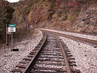
Amigo is an unincorporated community in Raleigh County, West Virginia, United States. The community is located on West Virginia Route 16 at the confluence of the Guyandotte River and Winding Gulf. The Amigo Post Office closed on 10/22/2011, it was established in 1915 The community most likely derives its name from the Amigo Coal Company.

Pocatalico is an unincorporated community in Kanawha County, West Virginia, United States. Pocatalico is located along Interstate 77 south of and near Sissonville.

Grassy Meadows is an unincorporated community in Greenbrier County, West Virginia, United States. Grassy Meadows is 7 miles (11 km) east-southeast of Meadow Bridge. Grassy Meadows had a post office, which opened on June 15, 1858, and closed on June 25, 2011.

Terry is an unincorporated community in Raleigh County, West Virginia, United States. Terry is located on the New River 4 miles (6.4 km) southeast of Mount Hope.

Riverside is an unincorporated community in Kanawha County, West Virginia, United States. Riverside is located on the north bank of the Kanawha River and U.S. Route 60 1 mile (1.6 km) southeast of Glasgow.

Sewell is an unincorporated community in Fayette County, West Virginia, United States. Sewell is located on the New River 6 miles (9.7 km) southeast of Fayetteville. Sewell was the sight of a major coking operation with 193 beehive coke ovens operating in the late nineteenth century and early to mid twentieth century. The operation was serviced by the Mann's Creek Railroad between 1886 and 1955.

Boomer is a census-designated place (CDP) in Fayette County, West Virginia, United States. Boomer is located on the north bank of the Kanawha River 2 miles (3.2 km) southeast of Smithers. Boomer has a post office with ZIP code 25031. As of the 2010 census, its population was 615.

Corton is an unincorporated community in Kanawha County, West Virginia, United States. Corton is located on the Elk River and West Virginia Route 4 4 miles (6.4 km) east of Clendenin.

Landville is an unincorporated community in Logan County, West Virginia, United States. Landville is located on the Guyandotte River and West Virginia Route 80 2 miles (3.2 km) south-southeast of Man. Landville had a post office, which closed on July 9, 1988.

Quinnimont is an unincorporated community in Fayette County, West Virginia, United States. Quinnimont is located on West Virginia Route 41 near the New River, 7.1 miles (11.4 km) east-southeast of Mount Hope. Quinnimont had a post office, which opened on February 23, 1874, and closed on February 1, 1997.

Muses Bottom is an unincorporated community in Jackson County, West Virginia, United States. Muses Bottom is located on the Ohio River and West Virginia Route 68 6.5 miles (10.5 km) north of Ravenswood. Muses Bottom once had a post office, which is now closed.

River Bend is an unincorporated community in the Upper Falls census-designated place in Kanawha County, in West Virginia, in the United States.


