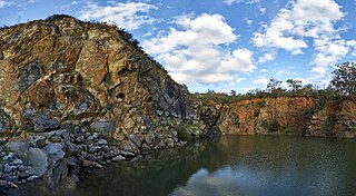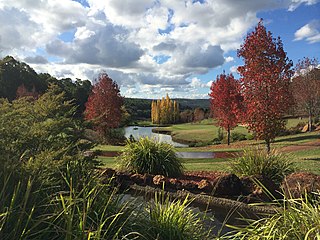
Great Eastern Highway is a 590-kilometre-long (370 mi) road that links the Western Australian capital of Perth with the city of Kalgoorlie. A key route for road vehicles accessing the eastern Wheatbelt and the Goldfields, it is the western portion of the main road link between Perth and the eastern states of Australia. The highway forms the majority of National Highway 94, although the alignment through the Perth suburbs of Guildford and Midland, and the eastern section between Coolgardie and Kalgoorlie are not included. Various segments form parts of other road routes, including National Route 1, Alternative National Route 94, and State Route 51.

Laura is a rural town and locality in the Shire of Cook, Queensland, Australia. In the 2021 census, the locality of Laura had a population of 133 people.

Esk is a rural town and locality in the Somerset Region in South East Queensland, Australia. In the 2021 census, the locality of Esk had a population of 1,641 people.

The Eastern Railway is the main railway route between Fremantle and Northam in Western Australia. It opened in stages between 1881 and 1893. The line continues east to Kalgoorlie as the Eastern Goldfields Railway.

The Railway Reserves Heritage Trail – also on some maps as Rail Reserve Heritage Trail or Rail Reserves Historical Trail, and frequently referred to locally as the Bridle Trail or Bridle Track – is within the Shire of Mundaring in Western Australia.

Chidlow is a small community in the Shire of Mundaring approximately 45 kilometres east of Perth, Western Australia.
Wooroloo is a town on the outer fringe of the Perth metropolitan region, located off Great Eastern Highway in the eastern part of the Shire of Mundaring. At the 2021 census, Wooroloo had a population of 2,613.

Swan Hills is an electoral district of the Legislative Assembly in the Australian state of Western Australia.

The Shire of Mundaring is a local government area in eastern metropolitan Perth, the capital of Western Australia. The Shire covers an area of 645 square kilometres (249 sq mi) and had a population of approximately 38,000 as at the 2016 Census.

Woombye is a rural town and locality in the Sunshine Coast Region, Queensland, Australia. In the 2021 census, the locality of Woombye had a population of 3,944 people.

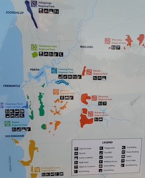
Beeliar Regional Park is a conservation park approximately 19 kilometres (12 mi) south of the central business district in Perth, Western Australia, located within the Citys of Cockburn, Kwinana and Melville. The regional park is named after the indigenous Beeliar people of the area.

Degilbo is a rural town and locality in the North Burnett Region, Queensland, Australia. In the 2021 census, the locality of Degilbo had a population of 182 people.

Kewarra Beach is a coastal suburb of Cairns in the Cairns Region, Queensland, Australia. In the 2021 census, Kewarra Beach had a population of 6,133 people.

Nandi is a rural locality in the Western Downs Region, Queensland, Australia. In the 2021 census, Nandi had a population of 105 people.

Rockingham Lakes Regional Park is a conservation park approximately 40 kilometres (25 mi) south of Perth, Western Australia, located within the City of Rockingham. The park, established in 1997, covers a non-continuous area of 4,270 hectares and occupies approximately 16 percent of the area of the City of Rockingham.

Jandakot Regional Park is a conservation park approximately 20 kilometres (12 mi) south of Perth, Western Australia, located within the Cities of Armadale, Canning, Cockburn, Gosnells and Kwinana as well as the Shire of Serpentine-Jarrahdale. The park, established in 1997 as the Jandakot Botanic Park, covers a non-continuous area of 2,362 hectares and is managed by the Cities of Armadale, Cockburn and Kwinana. It stretches from the southern end of Jandakot Airport to south of Casuarina Prison.

Banyowla Regional Park, formerly Kelmscott-Martin Regional Park, is a conservation park in the Perth Hills, 20 kilometres south-east of Perth, Western Australia, located within the Cities of Gosnells and Armadale. The regional park was re-named in 2008 after Banyowla, who was a Noongar elder at the time of European settlement.

Regional parks in Western Australia are conservation areas with the purpose of serving as urban havens to preserve and restore cultural heritage and valuable ecosystems as well as to encourage sustainable nature-based recreation activities.

Wungong Regional Park is a conservation park near Bedfordale in the Perth Hills, 20 kilometres south-east of Perth, Western Australia, located within the City of Armadale.
The 2021 Beechina bushfire was a bushfire that began on 26 December 2021 in Beechina, 46 kilometres east-north-east of the Perth central business district, in the Shire of Mundaring, Western Australia. The bushfire began less than five kilometres from the 2021 Wooroloo bushfire, and coincided with a COVID-19 outbreak and associated public health measures in the Perth metropolitan region. One house was destroyed as a result of the fire, along with six outbuildings and a number of vehicles.


