Yangmingshan National Park | |
---|---|
Location | Taiwan |
Nearest city | Taipei (majority of park within city limits) |
Coordinates | 25°10′39″N121°32′51″E / 25.17750°N 121.54750°E |
Area | 113.38 km2 (43.78 sq mi) [1] |
Established | September 16, 1985 |
Yangmingshan | |||||||||||
---|---|---|---|---|---|---|---|---|---|---|---|
Traditional Chinese | 陽明山國家公園 | ||||||||||
Simplified Chinese | 阳明山国家公园 | ||||||||||
|
Yangmingshan National Park is one of the nine national parks in Taiwan,located in both Taipei and New Taipei City. The districts that are partially in the park include Taipei's Beitou and Shilin Districts;and New Taipei's Wanli,Jinshan,Sanzhi and Tamsui Districts. The national park is known for its cherry blossoms,hot springs,sulfur deposits,fumaroles,venomous snakes,and hiking trails,including Taiwan's tallest dormant volcano,Qixing (Seven Star) Mountain rising to 1,120 m (3,675 ft).
This mountain range was originally called "Grass Mountain" (Chinese :草山; Pe̍h-ōe-jī :Chháu-soaⁿ) during the Qing Dynasty,in reference to the Datun Mountain ( 大屯山 ;Tōa-tūn-soaⁿ). [2] Officials during this period were worried about thieves stealing sulfur from the rich sulfur deposits in the area,so they would regularly set fire to the mountain. Thus,only grass and no trees could be seen.
Daiton National Park ,Taiwan's first national park,was established on 27 December 1937. [3] It was one of three national parks designated by Governor-General of Taiwan SeizōKobayashi during Japanese rule.
In 1950,President Chiang Kai-shek renamed Grass Mountain to Yangmingshan to commemorate the Ming Dynasty scholar Wang Yangming. [2] [4] In 1962,the then Taiwan Provincial Bureau of Public Works began to plan the Yangmingshan National Park. The initial planning area was 28,400 hectares,including Mount Kwan-in and the Tatun Volcanic Group.
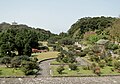
Unlike most other national parks,the Yangmingshan National Park has a lower elevation. Although the park's elevation ranges from only 200–1120 meters,beautiful landscapes such as ridges,valleys,lakes,waterfalls,and basins are abundant. Andesite rocks make up most of the area's geology. [5]
Xiaoyoukeng (Chinese :小油坑) is a post-volcanic geological landscape area located in the north of Taiwan in Yangmingshan National Park [6] [7] at the northwestern foot of Seven Star Mountain. [8] It is approximately 805 meters above sea level and is famed for the fumaroles,sulfur crystals,hot springs and spectacular 'landslide terrain' formed by post-volcanic activity. [9]
Hiking trails to Seven Star Mountain are accessible from the Xiaoyoukeng parking lot. The top of the trail is 1,120 meters above sea level,which is the highest peak of Taipei City. The Xiaoyoukeng trail can connect to Qixing Park,Menghuan Pond,and Lengshuikeng. The trail also connects to the visitor center,Yangmingshan Second Parking Lot,and the Yangmingshan Bus Station.< [6]
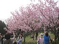
Due to the effects of post-volcanic activity and precipitation,soil in the region is highly acidic. With the influence of the northeast monsoon and the area's microclimates,winter temperatures are much lower than in the surrounding areas. [10] The above factors cause the vegetation to differ from those in other regions at the same latitude. Some medium and high-altitude plants can be found here such as bird-lime tree and hairy Japanese maple. Vegetation groups can be divided into subtropical monsoon rainforests,temperate evergreen broadleaf forests,and mountain ridge grasslands. There are 1360 species of vascular bundle plants in the region. [11] Some of the common ones are red nanmu,large-leaved machilus,Formosan sweet gum,Taiwan cherry,Mori cleyera and dark spotted cherry. The most famous is Taiwan isoetes in Menghuan pond,an aquatic fern only found in Taiwan. Mt. Datun is one of the most well-known places to see some of the 168 species of butterflies in northern Taiwan,With them being most frequently seen from May to August. The most common ones are from the families Papilionidae,Danainae,and Nymphalidae. There are also 122 species of birds in the region. [12] Semi-feral cattle are one of the notable attractions in the area. [13]
Yangmingshan has a humid subtropical climate (Köppen:Cfa). Summers are warm,humid,and accompanied by torrential rainstorms;while winters are cool,very wet,and very foggy due to the northeasterly winds from the vast Siberian High being intensified by the pooling of this cooler air in the Taipei Basin. Due to Taiwan's location in the Pacific Ocean,it is affected by the Pacific typhoon season,which occurs between June and October.
The following climate data is for the Anbu weather station. Other places in the national park may have different temperatures.
Climate data for Anbu,Yangmingshan National Park (1991-2020 normals,extremes 1943-present) | |||||||||||||
---|---|---|---|---|---|---|---|---|---|---|---|---|---|
Month | Jan | Feb | Mar | Apr | May | Jun | Jul | Aug | Sep | Oct | Nov | Dec | Year |
Record high °C (°F) | 24.5 (76.1) | 27.0 (80.6) | 27.7 (81.9) | 28.8 (83.8) | 29.9 (85.8) | 31.0 (87.8) | 31.9 (89.4) | 32.0 (89.6) | 31.4 (88.5) | 30.7 (87.3) | 27.5 (81.5) | 25.7 (78.3) | 32.0 (89.6) |
Mean daily maximum °C (°F) | 13.3 (55.9) | 14.6 (58.3) | 17.1 (62.8) | 20.5 (68.9) | 23.2 (73.8) | 25.6 (78.1) | 27.4 (81.3) | 26.8 (80.2) | 24.3 (75.7) | 20.5 (68.9) | 18.1 (64.6) | 14.6 (58.3) | 20.5 (68.9) |
Daily mean °C (°F) | 10.3 (50.5) | 11.2 (52.2) | 13.2 (55.8) | 16.6 (61.9) | 19.6 (67.3) | 22.2 (72.0) | 23.4 (74.1) | 23.0 (73.4) | 21.1 (70.0) | 17.9 (64.2) | 15.4 (59.7) | 11.8 (53.2) | 17.1 (62.9) |
Mean daily minimum °C (°F) | 8.1 (46.6) | 8.7 (47.7) | 10.3 (50.5) | 13.7 (56.7) | 17.2 (63.0) | 19.9 (67.8) | 20.9 (69.6) | 20.7 (69.3) | 19.1 (66.4) | 16.3 (61.3) | 13.5 (56.3) | 9.8 (49.6) | 14.9 (58.7) |
Record low °C (°F) | −3.7 (25.3) | −2.4 (27.7) | −2.0 (28.4) | 1.0 (33.8) | 8.1 (46.6) | 11.4 (52.5) | 16.6 (61.9) | 15.5 (59.9) | 12.6 (54.7) | 6.0 (42.8) | 1.1 (34.0) | −1.6 (29.1) | −3.7 (25.3) |
Average precipitation mm (inches) | 296.7 (11.68) | 291.3 (11.47) | 246.7 (9.71) | 222.3 (8.75) | 334.0 (13.15) | 341.1 (13.43) | 230.9 (9.09) | 400.8 (15.78) | 724.6 (28.53) | 683.6 (26.91) | 502.5 (19.78) | 422.6 (16.64) | 4,697.1 (184.92) |
Average precipitation days (≥0.1 mm) | 21.2 | 18.3 | 18.3 | 15.8 | 15.6 | 14.3 | 9.7 | 13.1 | 16.3 | 20.1 | 20.9 | 21.4 | 205.0 |
Average relative humidity (%) | 92.1 | 91.5 | 89.8 | 88.4 | 87.5 | 87.8 | 85.8 | 87.5 | 89.0 | 91.0 | 92.0 | 92.2 | 89.6 |
Mean monthly sunshine hours | 59.0 | 58.7 | 78.1 | 77.2 | 79.6 | 85.2 | 138.4 | 124.7 | 96.0 | 61.5 | 51.4 | 46.6 | 956.4 |
Source:Central Weather Bureau [14] [15] [16] [17] [18] |
Hsinchu,formerly known as Tek-chhàm,or Shinchiku during Japanese rule,is a city located in northwestern Taiwan. It is the most populous city in Taiwan that is not a special municipality,with estimated 450,655 inhabitants. Hsinchu is a coastal city bordering the Taiwan Strait to the west,Hsinchu County to the north and east,and Miaoli County to the south. Nicknamed the Windy City for its strong northeastern monsoon during the autumn and winter seasons.
Taichung,officially Taichung City,is a special municipality located in central Taiwan. Taichung has approximately 2.85 million residents and is the second largest city of Taiwan,as well as the most populous city in Central Taiwan. It serves as the core of the Taichung–Changhua metropolitan area,the second largest metropolitan area in Taiwan.
Keelung,Chilung or Jilong,officially known as Keelung City,is a major port city situated in the northeastern part of Taiwan. With 361,082 inhabitants,the city forms a part of the Taipei–Keelung metropolitan area with its neighboring New Taipei City and Taipei.
Taoyuan is a special municipality located in northwestern Taiwan,neighboring New Taipei City to the north-east,Yilan County to the south-east,and Hsinchu County to the south-west. Taoyuan District is the seat of the municipal government and which,along with Zhongli District,forms a large metropolitan area. Taoyuan developed from a satellite city of Taipei metropolitan area to become the fourth-largest metropolitan area,and fifth-largest populated city in Taiwan. "Taoyuan" literally means "peach garden" in Chinese,since the area used to have many peach trees. Formerly a county,Taoyuan became the latest new founding special municipality in 2014.
Chiayi,officially known as Chiayi City,is a city located in Chianan Plain in southwestern Taiwan,surrounded by Chiayi County with a population of 263,188 inhabitants as of January 2023.
Yu Shan or Yushan,also known as Mount Jade,Jade Mountain,or Mount Yu,and known as Mount Niitaka during Japanese rule,is the highest mountain in Taiwan at 3,952 m (12,966 ft) above sea level,giving Taiwan the 4th-highest maximum elevation of any island in the world. It is the highest point in the western Pacific region outside of the Kamchatka Peninsula. Yushan and its surrounding mountains belong to the Yushan Range. The area was once in the ocean;it rose to its current height because of the Eurasian Plate's movement over the Philippine Sea Plate. Yushan is ranked 40th by topographic isolation.
Yilan City is a county-administered city and the county seat of Yilan County,Taiwan. The city lies on the north side of the Lanyang River.
Taitung City is a county-administered city and the county seat of Taitung County,Taiwan. It lies on the southeast coast of Taiwan facing the Pacific Ocean. Taitung City is the most populous subdivision of Taitung County and it is one of the major cities on the east coast of the island.
Suao Township (Chinese:蘇澳鎭;pinyin:Sū'ào Zhèn;Wade–Giles:Su1-ao4 Chen4;Pe̍h-ōe-jī:So͘-ò),alternately romanized as Su-ao or Su'ao,is located in southern Yilan County,Taiwan,is an urban township that is famous for its seafood restaurants and cold springs. It is a terminus of National Highway No. 5,the Suao-Hualien Express Way,and the North-Link Line of the Taiwan Railway Administration. It also has two large harbors:Suao Port,a multi-function seaport that also houses a naval base;and Nanfang-ao Port,a major fishing port of Taiwan.
Sun Moon Lake is a lake in Yuchi Township,Nantou County,Taiwan. It is the largest body of water in Taiwan. The area around the lake is home to the Thao tribe,one of Taiwan's aboriginal tribes. Sun Moon Lake surrounds a tiny island called Lalu. The east side of the lake resembles a sun while the west side resembles a moon,hence the name.
Orchid Island,also known by other names,is a 45 km2 (17 sq mi) volcanic island off the southeastern coast of Taiwan,which Orchid Island is part of. It is separated from the Batanes of the Philippines by the Bashi Channel of the Luzon Strait. The island and the nearby Lesser Orchid Island are governed as Lanyu Township in Taitung County,which is one of the county's two insular townships.
Hengchun Township is a township located on the southern tip of the Hengchun Peninsula in Pingtung County,Taiwan. It is the southernmost township in Taiwan. Hengchun is also the only urban township in the southern part of Pingtung County. Hengchun has a land area of 136.76 km2 (52.80 sq mi) and has a population of 29,790 as of October 2023.
Chenggong Township or Chengkung Township is an urban township in Taitung County,Taiwan. It is a coastal town facing the Pacific Ocean. Chenggong Fish Harbor is just west of downtown.
Dawu Township (Chinese:大武鄉;pinyin:DàwǔXiāng;Wade–Giles:Ta4-wu3 Hsiang1) is a rural township in Taitung County,Taiwan.
Wuqi District is a coastal suburban district in southern Taichung,Taiwan. The Port of Taichung is in Wuqi District.
Tamsui District is a seaside district in New Taipei City,Taiwan adjacent to the Tamsui River and overlooking the Taiwan Strait. The name of the district means "fresh water" in Chinese. Although modest in size,Tamsui plays a significant role in Taiwanese history and culture.
Hualien City is a county-administered city and the county seat of Hualien County,Taiwan. It is located on the east coast of Taiwan on the Pacific Ocean,and has a population of 99,458 inhabitants.
Pengjia Islet,also known as P'eng-chia Hsü,Hōka-sho,Agincourt,Dashihshan Islet,Chaolai Islet,P'eng-chia Yü or Pengchia Islet,is an islet north of Taiwan and is administered under Zhongzheng District,Keelung City. It is under Taiwanese military control and cannot be visited by ordinary citizens.
Alishan Township is a mountain indigenous township in Chiayi County,Taiwan. The Alishan National Scenic Area covers most,but not all,of the township and also parts of neighboring townships.
Dongji Island / Dongji Islet / Tungchi Island is an island in Dongji Village,Wangan Township,Penghu County,Taiwan. Dongji Island has also been known as Nandongyu (南東嶼).
{{cite web}}
: CS1 maint: archived copy as title (link)