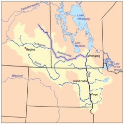
Yorkton Creek

Last updated

Yorkton Creek
Assiniboinerivermap.png
Red River drainage basin, with the Assiniboine River highlighted
Canada relief map 2.svg
Red pog.svg
Location of the mouth in Saskatchewan
Canada Saskatchewan relief location map.jpg
Red pog.svg
Yorkton Creek (Saskatchewan)
Location
CountryFlag of Canada (Pantone).svg  Canada
Provinces Flag of Saskatchewan.svg  Saskatchewan
Physical characteristics
SourceLeech Lake
  location RM of Cana No. 214
  coordinates 51°05′11″N102°27′21″W / 51.0863°N 102.4559°W / 51.0863; -102.4559
  elevation506 m (1,660 ft)
Mouth Whitesand River
  location
RM of Good Lake No. 274
  coordinates
51°24′02″N102°32′58″W / 51.4006°N 102.5494°W / 51.4006; -102.5494 Coordinates: 51°24′02″N102°32′58″W / 51.4006°N 102.5494°W / 51.4006; -102.5494
  elevation
477 m (1,565 ft)
Basin features
River system Assiniboine River drainage basin
Tributaries 
  leftCussed Creek
  right Crescent Creek

Yorkton Creek, [1] formally known as Little Whitesand River, is a river in the south-east region of the Canadian province of Saskatchewan. The river begins at Leech Lake, south of Yorkton, and flows north into the Whitesand River. The Whitesand River flows east into the Assiniboine River, which is a major tributary of the Red River. While Yorkton Creek begins at Leech Lake, [2] its main tributary, Crescent Creek, [3] has its headwaters in the Beaver Hills [4] to the west. [5]

Contents

History

York City plaque YorktonPlaque.JPG
York City plaque

Plains Cree and Saulteaux First Nations inhabited both the Whitesand River and Yorkton Creek watersheds before the arrival of Europeans as archaeological evidence shows signs of encampment sites and hunting activity. With the signing of Treaty 4 at Fort Qu'Appelle in 1874, the land was opened up for settlement from Eastern Canada. [6]

In 1882, a group of investors and settlers from York County in Ontario arrived in the area and set up York Colony on the banks of Little Whitesand River. Four men stayed that winter while the rest of the settlers returned to Eastern Canada. When the settlers returned in 1883, they named the community York City. Since there already was a York City in Ontario, when the post office opened on 1 January 1884, it was renamed Yorkton. A few years later, the Manitoba & North Western Railway was extending westward and the route was going to miss Yorkton. In 1888, the residents agreed to move the community to meet the railway. In 1890, the hamlet of Yorkton left the banks of the Little Whitesand River and moved south 4.6 km (2.9 mi) to its present location. The original townsite was located at 13-26-4 W2. [7] [8]

In the year 2000, Little Whitesand River was renamed Yorkton Creek.

Description

Yorkton Creek begins at the eastern end of Leech Lake in the RM of Cana No. 214. From there, the river crosses Highway 9 and heads north towards Yorkton. On its way, it crosses Highway 16, is met by a tributary that comes from York Lake, and crosses Highway 10 before skirting the eastern edge of Yorkton and continuing north. Yorkton Creek follows Highway 9 northward before crossing the highway south of Ebenezer where it heads north-west towards the Whitesand River. Just before it meets the Whitesand River, it is joined by Cussed Creek in the RM of Good Lake No. 274. Besides the aforementioned rural munucipalies, the river also passes through RMs of Saltcoats No. 213, Wallace 243, and Orkney 244. [9] [10]

Tibutaries

Crescent Creek [11] begins in the Beaver Hills in the RM of Garry No. 245 and heads south-east towards Melville. In 1921, a dam was built along the course of Crescent Creek by the Canadian National Railway that created Crescent Creek Reservoir. Melville purchased the reservoir in 1958 for its drinking water supply. [12] [13] From the dam, Crescent Creek continues eastward and empties into Crescent Lake, [14] which is connected to Leech Lake. [15]

Willow Brook, [16] like Crescent Creek, begins in the RM of Garry No. 245 and the Beaver Hills. It travels in an easterly direction into Rousay Lake, which flows into York Lake. [17] A short river connects York Lake to Yorkton Creek.

Cussed Creek [18] begins in the Beaver Hills in the RM of Foam Lake No. 276 and flows east and meets Yorkton Creek just before it empties into the Whitesand River. Cussed Creek crosses two major highways, 16 and 47. Sorefoot Creek, which also begins in the Beaver Hills, is a tributary of Cussed Creek and meets it near the Highway 47 crossing.

See also

Related Research Articles

<span class="mw-page-title-main">Saskatchewan Highway 9</span> Highway in Saskatchewan, Canada

Highway 9 is a paved, undivided provincial highway in the Canadian province of Saskatchewan. It runs from North Dakota Highway 8 at the US border near Port of Northgate until it transitions into Provincial Road 283 at the Manitoba provincial boundary.

The Saskota Flyway is known as the International Road to Adventure, because it takes you from Hudson Bay, Saskatchewan, all the way south to Bismarck, North Dakota.

<span class="mw-page-title-main">Rama, Saskatchewan</span> Village in Saskatchewan, Canada

Rama is a village in the Canadian province of Saskatchewan within the Rural Municipality of Invermay No. 305 and Census Division No. 9. It is located 44 km west of Canora and 60 km east of Wadena at the intersection of Highway 5 and Highway 754.

The Beaver Hills are a range of hills located in the Canadian province of Saskatchewan.

<span class="mw-page-title-main">Sturgeon River (Saskatchewan)</span> River in Saskatchewan, Canada

Sturgeon River is a river in the Hudson Bay drainage basin in the central part of the Canadian province of Saskatchewan. It flows from its source in the Waskesiu Hills in Prince Albert National Park to the North Saskatchewan River, just west of the city of Prince Albert.

<span class="mw-page-title-main">Waterhen River (Saskatchewan)</span> River in Saskatchewan

Waterhen River is an east-flowing river in the north-west area of the Canadian province of Saskatchewan in the drainage basin of the Beaver River. It is north of and parallel to the east-flowing part of the Beaver River and joins the north-flowing part of that river. Most of the river and its drainage basin is at the southern edge of the boreal forest belt. While the river's source is Lac des Îles, its drainage basin reaches north into the Mostoos Hills and west well into the neighbouring province of Alberta.

<span class="mw-page-title-main">Whitesand River (Saskatchewan)</span> River in Saskatchewan, Canada

The Whitesand River is a tributary of the Assiniboine River and finds its headwaters at Whitesand Lake near Invermay in east-central Saskatchewan. Its mouth can be found at its confluence with the Assiniboine River near Kamsack.

<span class="mw-page-title-main">Spirit Creek</span> River in Saskatchewan, Canada

Spirit Creek is a river located in the Assiniboine River watershed in the Canadian province of Saskatchewan. It begins east of Rama and flows south-east into the north end of Good Spirit Lake. Along its route, it crosses Highway 5 and the CN Railway 3 kilometres (2 mi) west of Buchanan. Just over 3 kilometres (2 mi) south of Buchanan, it crosses Highway 47 and flows into Patterson Lake. From Patterson Lake, it empties into the north end of Good Spirit Lake.

Woody River is a river in the Canadian provinces of Manitoba and Saskatchewan. The river's source is in the Porcupine Hills and Porcupine Provincial Forest of eastern Saskatchewan. From there it flows south through boreal forest and then east through Boreal Plains in the Parkland Region of Manitoba en route to Swan Lake. The river parallels the Swan River for much of its route as it travels through Swan River Valley between Duck Mountain and Porcupine Hills of the Manitoba Escarpment. Bowsman is the only notable community along the course of Woody River. Several highways cross it, including Saskatchewan's Highway 980, Manitoba's Roads 588, 587, 366, 268, and Manitoba's Highway 10.

Smallfish Lake is a lake in the Canadian province of Saskatchewan. It is located in the east-central part of the province right alongside the border with Manitoba in the Porcupine Hills and Porcupine Provincial Forest. The lake is part of the Woody River Block of Porcupine Hills Provincial Park and is situated in boreal forest surrounded by hills, other small lakes, and muskeg. Access to the lake is on the western side from Highway 980.

Good Spirit Lake is a lake on the eastern side of the Canadian province of Saskatchewan. It is a shallow lake notable for its naturally sandy beaches, parks, and sand dunes. One of Saskatchewan's six founding provincial parks, Good Spirit Lake Provincial Park, surrounds the western and southern shores of the lake. The lake is in the RM of Good Lake No. 274 and Yorkton, 48 km (30 mi) to the south, is the nearest city. The hamlets of Burgis Beach and Canora Beach–the only two communities on the lake–are located on the eastern shore. The southern shore of the lake is accessed from Highway 229 and the northern shore is accessed from Highway 651. Highway 47 runs north to south west of the lake and Good Spirit Provincial Park.

Theodore Reservoir is a man-made reservoir along the Whitesand River in the Canadian province of Saskatchewan. The lake was formed with the building of Theodore Dam in 1964. The reservoir and dam were named after the nearby community of Theodore. Whitesand River is the primary inflow and outflow for the reservoir. Lawrie Creek, which begins in the Beaver Hills, flows into the lake on the western side near the dam.

<span class="mw-page-title-main">Crescent Creek (Saskatchewan)</span> River in Saskatchewan, Canada

Crescent Creek is a river in the south-east region of the Canadian province of Saskatchewan. The river begins in the Beaver Hills and flows in an easterly direction into Crescent Lake. Crescent Creek is a tributary of Yorkton Creek, which flows north into the Whitesand River–a tributary of the Assiniboine River.

York Lake, formally known as Pebble Lake, is a lake in the south-east region of the Canadian province of Saskatchewan. It is a shallow, narrow lake located about 5 km (3.1 mi) south of the city of Yorkton in the Prairie Pothole Region of North America, which extends throughout three Canadian provinces and five U.S. states, and within Palliser's Triangle and the Great Plains ecoregion of Canada.

<span class="mw-page-title-main">Big River (Saskatchewan)</span> River in Saskatchewan, Canada

Big River is a river in the west-central part of the Canadian province of Saskatchewan in the boreal forest ecozone of Canada. The river begins at Witchekan Lake in the RM of Spiritwood No. 496 and heads in a north-easterly direction before emptying into Cowan Lake at the town of Big River. Cowan Lake is the source for Cowan River, which is a major tributary of Beaver River. Beaver River then flows into Lac Île-à-la-Crosse and the Churchill River.

<span class="mw-page-title-main">Bow River (Saskatchewan)</span> River in Saskatchewan, Canada

Bow River is a river in the Northern Administration District of the Canadian province of Saskatchewan. The river begins at Ridge Lake of Bow River chain lakes in Clarence-Steepbank Lakes Provincial Park and flows in a northerly direction into Lac la Ronge and Lac La Ronge Provincial Park. Rapid River connects Lac la Ronge to the Churchill River. There are no communities nor settlements along the river's course.

<span class="mw-page-title-main">Spruce River (Saskatchewan)</span> River in Saskatchewan, Canada

Spruce River, also called Little Red River, is a river in the north-central region of the Canadian province of Saskatchewan. It begins in the Waskesiu Hills in Prince Albert National Park and flows generally in a southward direction through boreal forests, glacier carved hills and valleys, muskeg, and prairie en route to the North Saskatchewan River at the east end of the city of Prince Albert.

<span class="mw-page-title-main">Shell River (Saskatchewan)</span> River in Saskatchewan, Canada

Shell River, formerly Shell Brook, is a river in the north-central region of the Canadian province of Saskatchewan. The river begins at Big Shell Lake and travels in an easterly direction and flows into the Sturgeon River north of the city of Prince Albert. The upper reaches of its watershed are as far west as the Thickwood Hills.

Big Shell Lake is a lake in the Canadian province of Saskatchewan. Officially known as Shell Lake, it is commonly called Big Shell Lake to differentiate it from Little Shell Lake, which is about 4.5 km (2.8 mi) downstream. Big Shell Lake is in the RM of Spiritwood No. 496 and the resort villages of Big Shell and Echo Bay are on the south-eastern and eastern shore. Access to the lake and the villages is from Highway 12.

<span class="mw-page-title-main">Makwa River</span> River in Saskatchewan, Canada

Makwa River is a river in the Canadian province of Saskatchewan in the transition zone between parkland and boreal forest. Makwa is Cree for Loon. The upper reaches of the Makwa River's watershed reach just across the border into Alberta and includes lakes such as Hewett, Ministikwan, Makwa, and Jumbo.

References

  1. "Yorkton Creek". Canadian Geographical Names Database. Government of Canada. Retrieved 26 May 2022.
  2. "Leech Lake". Canadian Geographical Names Database. Government of Canada. Retrieved 26 May 2022.
  3. "Crescent Creek". Canadian Geographical Names Database. Government of Canada. Retrieved 26 May 2022.
  4. "Beaver Hills". Canadian Geographical Names Database. Government of Canada. Retrieved 26 May 2022.
  5. "Yorkton Creek, Saskatchewan Map". Geodata.us. Geodata.us. Retrieved 26 May 2022.
  6. Rasmussen, Mark. "Yorkton". The Canadian Encyclopedia. The Canadian Encyclopedia. Retrieved 26 May 2022.
  7. "Our Histories". City of Yorkton. City of Yorkton. Retrieved 26 May 2022.
  8. Baird, Craig. "The History of Yorkton". Canadian History Ehx. Meks. Retrieved 26 May 2022.
  9. "Yorkton Creek". Geoview.info. Geoview.info. Retrieved 26 May 2022.
  10. Barr, Debbie (9 May 2012). "A river ran through it". SaskToday. Glacier Media Group. Retrieved 26 May 2022.
  11. "Crescent Creek". Geoview.info. Geoview.info. Retrieved 26 May 2022.
  12. "Melville Town Reservoir Fishing Map". GPS Nautical Charts. Bist LLC. Retrieved 26 May 2022.
  13. "Water Treatment Plant". City of Melville. City of Melville. Retrieved 26 May 2022.
  14. "Crescent Lake". Canadian Geographical Names Database. Government of Canada. Retrieved 26 May 2022.
  15. "Yorkton Creek". Research Gate. ResearchGate GmbH. Retrieved 26 May 2022.
  16. "Willow Brook". Canadian Geographical Names Database. Government of Canada. Retrieved 26 May 2022.
  17. "York Lake Fishing Map". GPS Nautical Charts. Bist LLC. Retrieved 26 May 2022.
  18. "Cussed Creek". Canadian Geographical Names Database. Government of Canada. Retrieved 26 May 2022.